Heat and humidity continue with a chance for isolated strong storms


The heat and humidity from the July 4th Weekend will continue into July 5th. Both Saturday and Sunday saw highs in the low 90s. The humidity was a little more present on Sunday with dew points in the upper 60s. Monday will be another hot day with highs once again expected to reach or at least get close to 90* making it our third day in a row.

Tuesday continues to trend warmer and could be our fourth day in a row in the 90s which is exactly what we did almost a month ago at the beginning of June. Some comfy weather will return around 70* Wednesday and Thursday with 70s hanging around through the upcoming weekend.
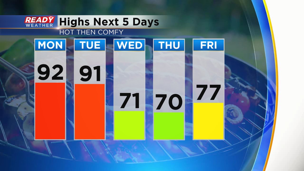
In addition to the heat, it will be fairly humid. Dew points on Monday will reach 70* which is even more humid than Sunday and Tuesday is expected to be tropical with dew points in the low 70s. The humidity drops Wednesday but you might still notice some mugginess in the morning.

Some differences to Monday's heat compared to the weekend will be the presence of wind gusting to about 30 mph throughout the day making the heat a bit more tolerable. We also have the chance for isolated showers and storms in the late afternoon and evening. The better chance for storms is along and north of I-94. Most will likely stay dry but a few downpours are possible.
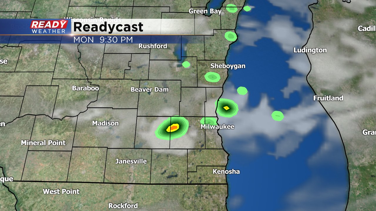
Because of all the heat, any storms that do fire could be stronger with some hail and gusty wind. Another storm chance exists on Tuesday, mainly in the evening, where storms could once again be a bit strong especially to our north.

Download the CBS 58 Ready Weather app to see how hot it gets where you live and track storms as they move in.