Heavy rain to slushy snow expected Wednesday night through Thursday


Our next winter storm is almost here. This one comes with the chance for both rain and snow. Most of Wednesday is nice, warm and mostly sunny but clouds increase Wednesday night with rain and a little snow arriving just after midnight. By the Thursday morning commute the Waukesha/Milwaukee area mostly sees steady, heavy rain but our northern and western counties already see steady snow falling.
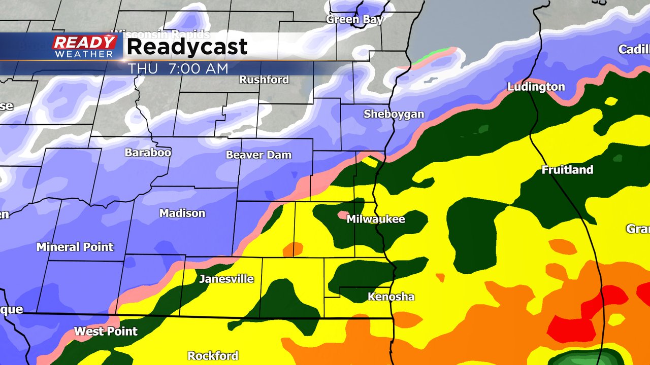
By 10 AM on Wednesday almost everyone has switched over to just snow with heavy, wet, steady snow expected through the rest of the morning into the early afternoon. Snowfall rates could approach an inch per hour during this time. The accumulating snow will end before the Thursday evening commute with just flurries or a lingering snow shower expected Thursday night and Friday.

As this storm starts as rain we will see a good soaker across most of southeast Wisconsin. Anywhere from a half to full inch of rain is expected - impressive for February standards.

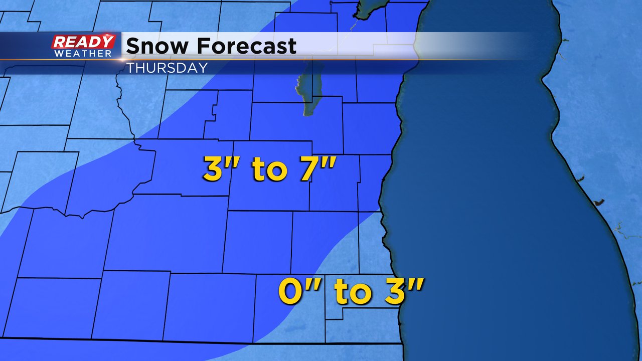
Once the rain switches to snow we will get a decent amount. The storm track has overall shifted a little to the southeast increasing our chance for at least some slushy snow for all of southeast Wisconsin. Milwaukee, Racine and Kenosha and eastern parts of Waukesha and Walworth Counties could see just rain or maybe a few slushy inches. Our western and northern counties have the better chances to see over 3" of snow and maybe as much as 7" in spots.
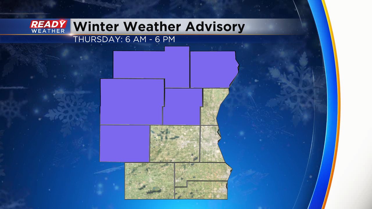
A winter weather advisory has already been issued for Thursday from 6 AM to 6 PM for the counties that have the best chance for over 3" of snow. I wouldn't be surprised if another tier of counties to the southeast was added to this advisory.
Download the CBS 58 Ready Weather app to track the rain switching to snow Wednesday night into Thursday with the interactive radar.