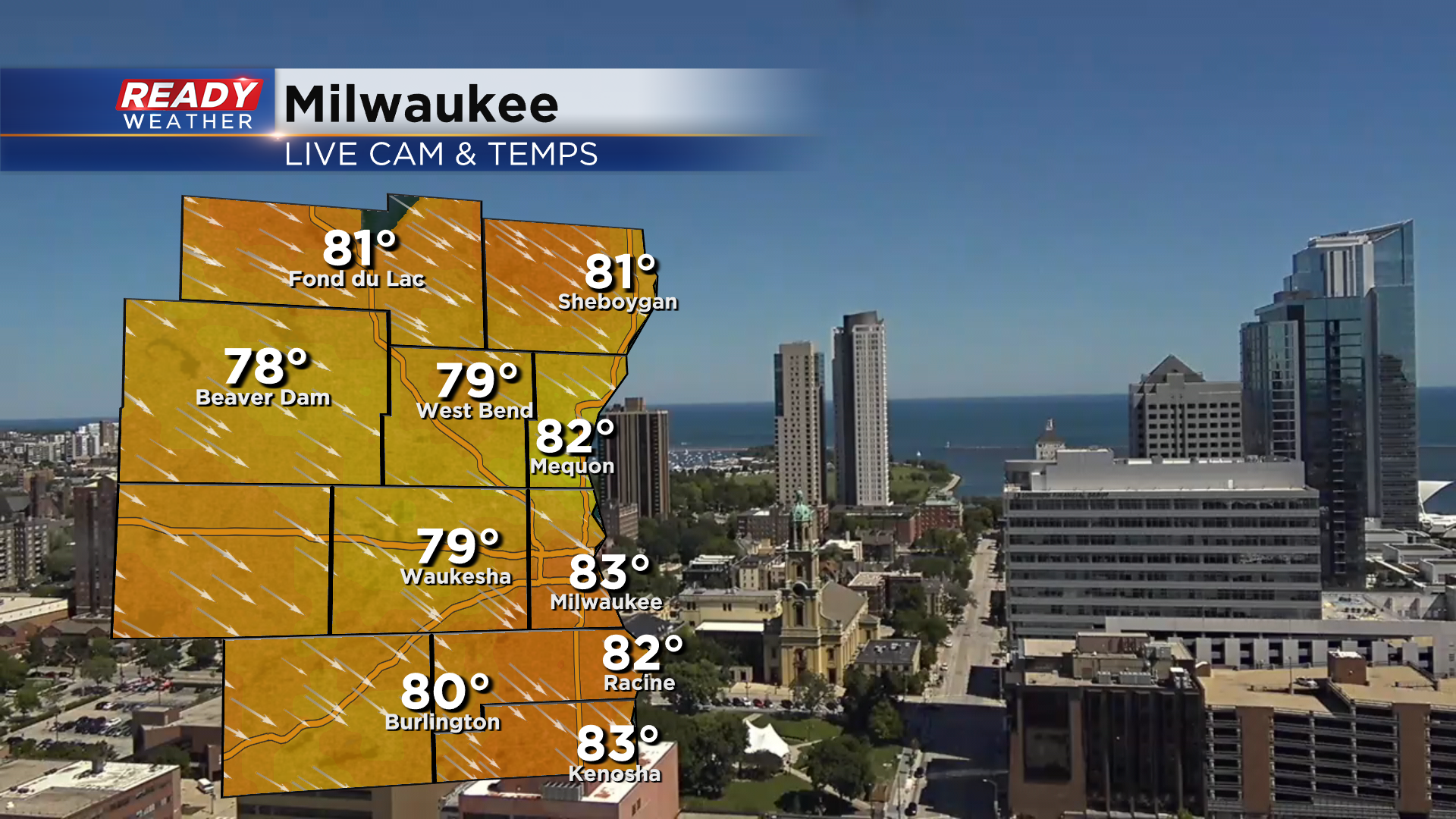
How is it already the last day of August?! It's been a picture perfect day so far with abundant sunshine, a nice breeze, and temps in the upper 70s to low 80s.
It being the last day of August means it's also the last day of meteorological summer! Coming off our 2nd hottest summer on record in 2021, this summer has felt super nice. That being said, summer 2022 has been the 13th warmest on record going into today and will likely end up 11th or 12th.
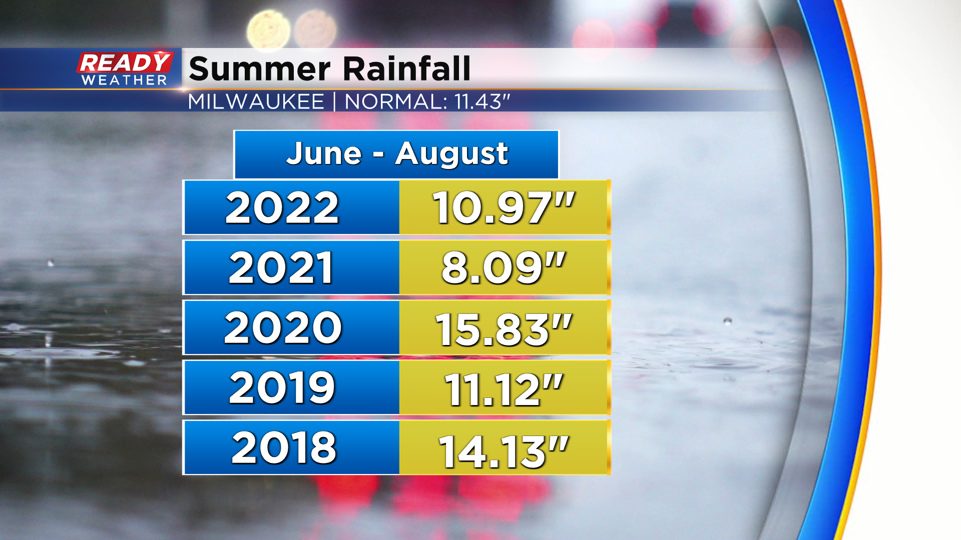
With no chance of rain today, we'll end the summer with just under 11" of rain, which is about a half inch below normal. We'll take it after our drought last summer!
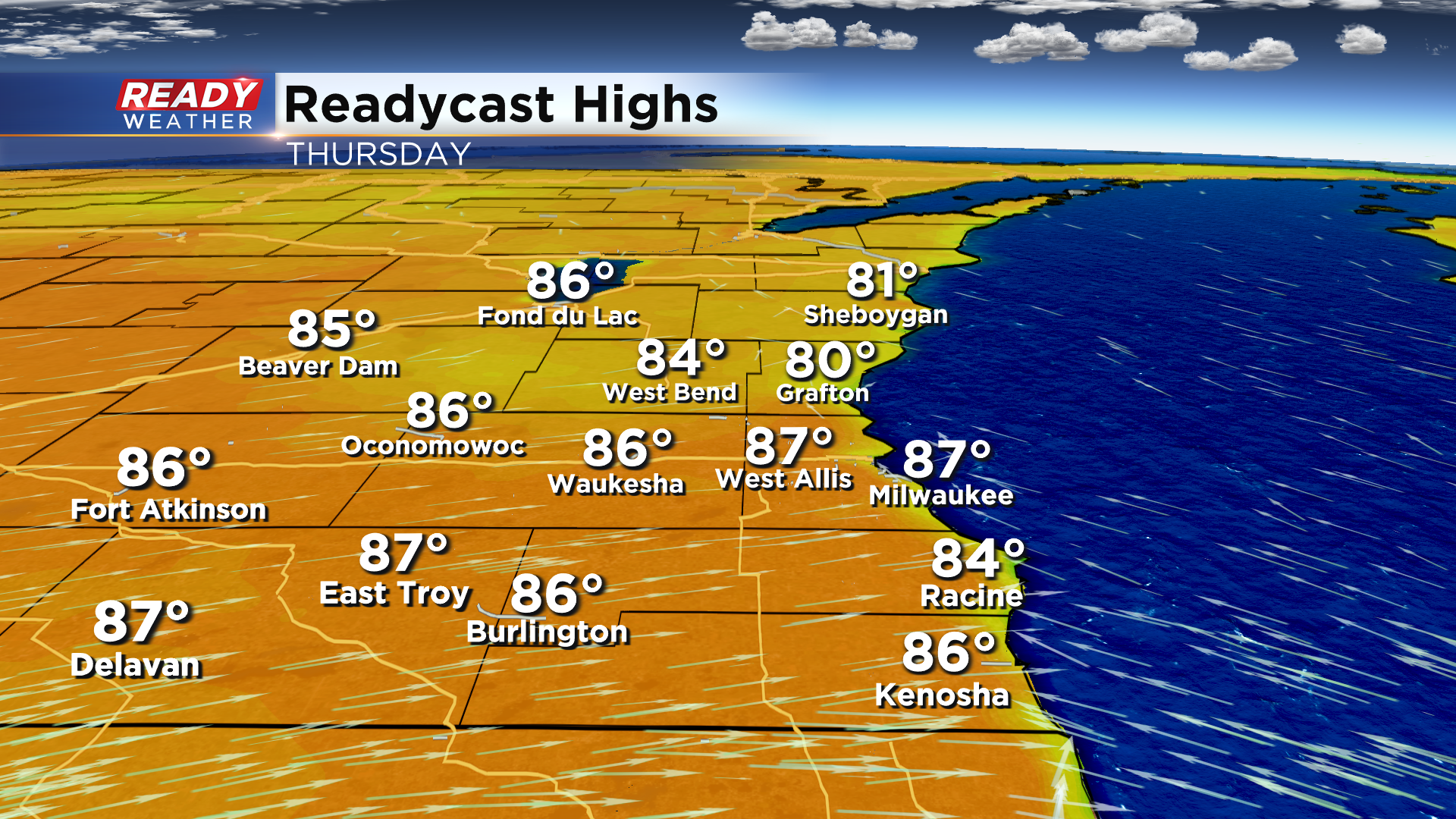
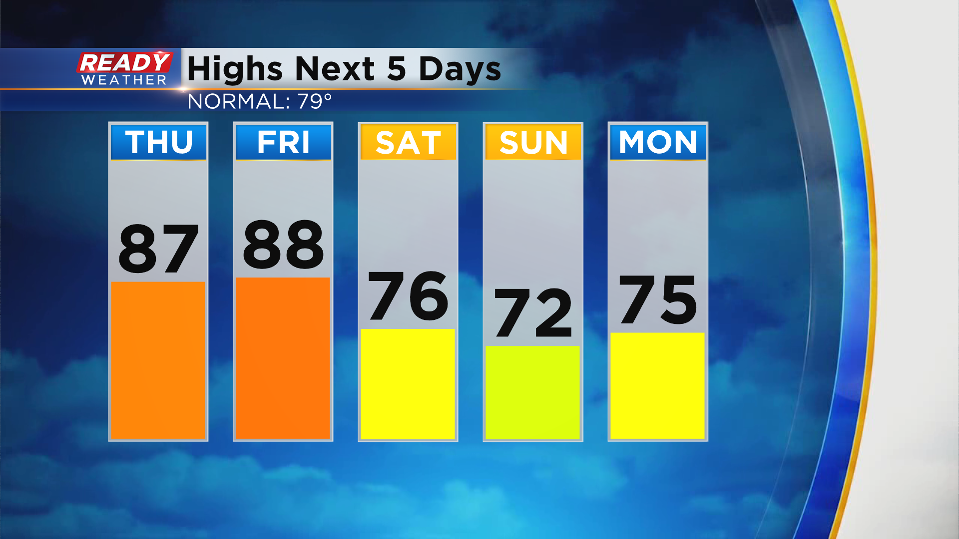
Even though we flip the calendar to September tomorrow, it will still feel like summer as temps warm into the mid to upper 80s across most of SE WI with the exception being the lakeshore where winds will turn SE.
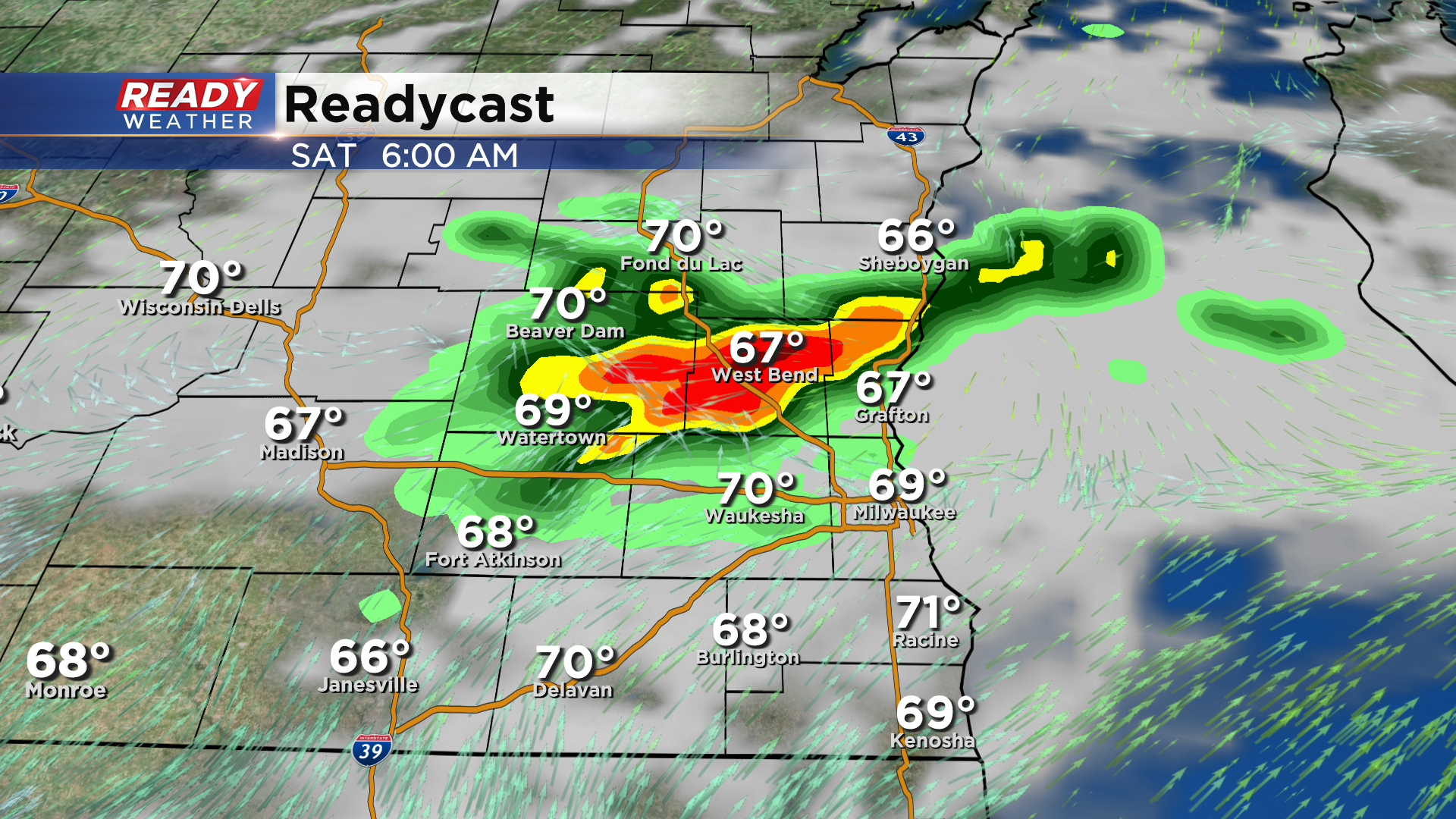
You'll also notice the humidity creep in as well by the end of the week. It'll still be quite warm on Friday, but a cold front will be approaching the area during the day and pass through on Saturday. This will bring an isolated chance of showers and storms back to the area later Friday into Saturday.
Behind this front temps drop back into the 70s throughout Labor Day weekend.
Download the CBS 58 Ready Weather app to see the full 7 day forecast and to get video forecast updates sent to your phone.
