Hottest air of the season
The bubble of hot temperatures and high humidity are showing signs of reaching Wisconsin already. The humidity is the first thing you will notice with the increase of moist air by this afternoon. Dew points will jump into the 60s, while temperatures from Milwaukee, and near the lakeshore, will stay in the low 80s. Inland locations could already hit 90 today.
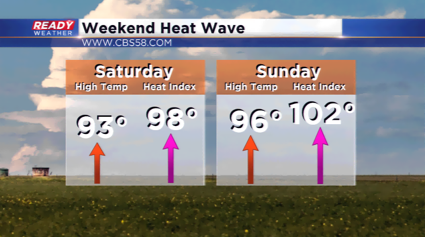
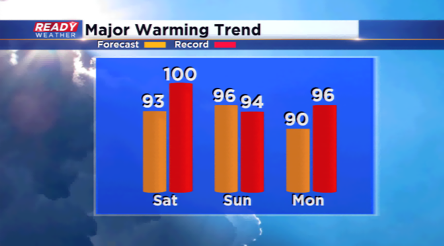
All eyes will be on the thermometer tomorrow and Sunday to see how hot those temps get. Most locations will soar into the low and mid 90s both days, with Sunday being the hottest and stickiest. The record high in Milwaukee on Sunday is 94 set in 1994, which will likely be broken. Heat indices, or what it feels like outside with the temps and humidity, will skyrocket near 100. These are high levels; please take the precautions to keep you and your family safe from the heat.
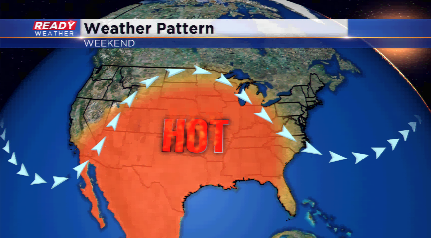
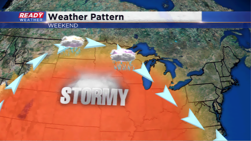
The central and northern part of the state will be in the middle of an active weather pattern called the “ring of fire”. This is where the placement of the jet stream sits in summer and fires showers and storms, some strong to severe. Southeastern Wisconsin should be out of the way of most of these storms, but a few could clip the northern parts of our area, and we cannot rule out a scattered shower or storm today, or this weekend.