Evening Update: Hottest temps of the year bring a threat for strong storms


Early Evening Update: We did it! The first 90 of the year achieved today in Milwaukee.
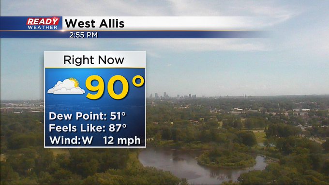

The hottest temps of the year are here! High temperatures Wednesday and Thursday likely reach the upper 80s and 90 degrees is not out of the question. Thursday's date, June 13, is actually the average date for the first 90 degree day of the year in Milwaukee so this heat is right on time! We get some brief relief Friday and Saturday in the 70s then more 80s for Father's Day and the start to next week.
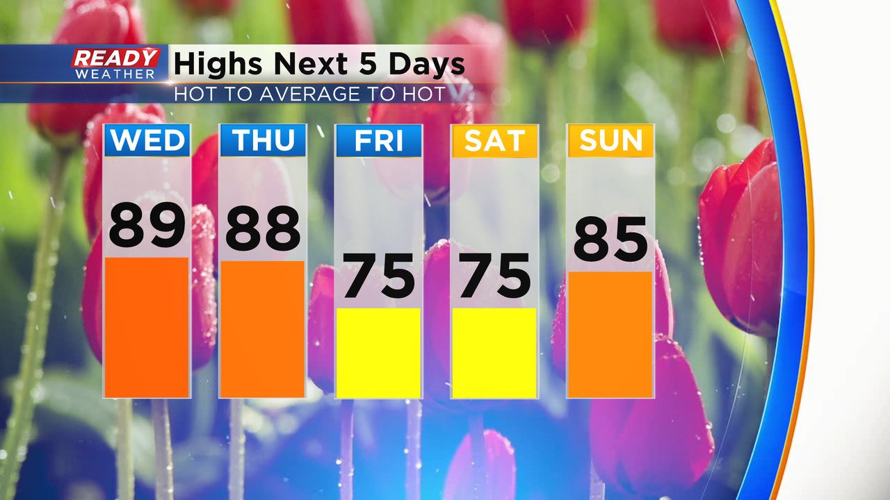
Along the heat building, the humidity will return as well. Dew points are terrible on Wednesday hovering around 60 but you will notice it. A lot more sticky and humid on Thursday with dew points reaching the upper 60s. As temperatures drop for the start of the weekend the humidity will take a break as well.

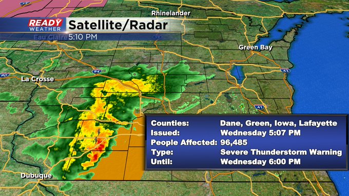
All of the heat and humidity will also bring in some storm chances. Wednesday morning we are watching some storms in central Minnesota that could survive and roll into central Wisconsin during the afternoon. There's a slim chance some of those could reach our western and northern counties locally in the late afternoon and dinner time hours. The better chance for a few storms will be in the late evening and overnight tonight.
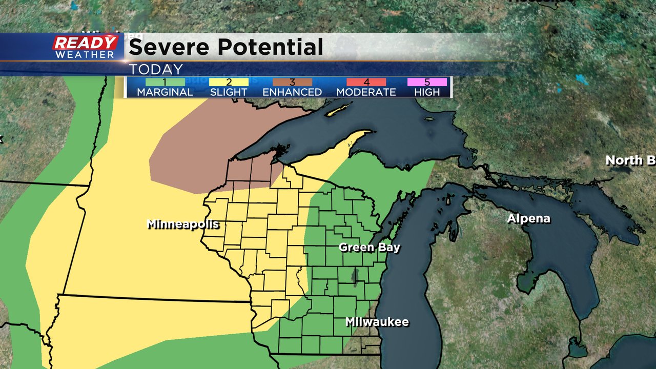
Any storms that do form over the next 36 hours could be on the stronger side. The best chance for severe weather Wednesday is in Minnesota and especially northern Minnesota but parts of southeast Wisconsin are under the Level 1 Marginal Risk for severe storms mainly for anything that arrives in the afternoon and dinnertime hours.
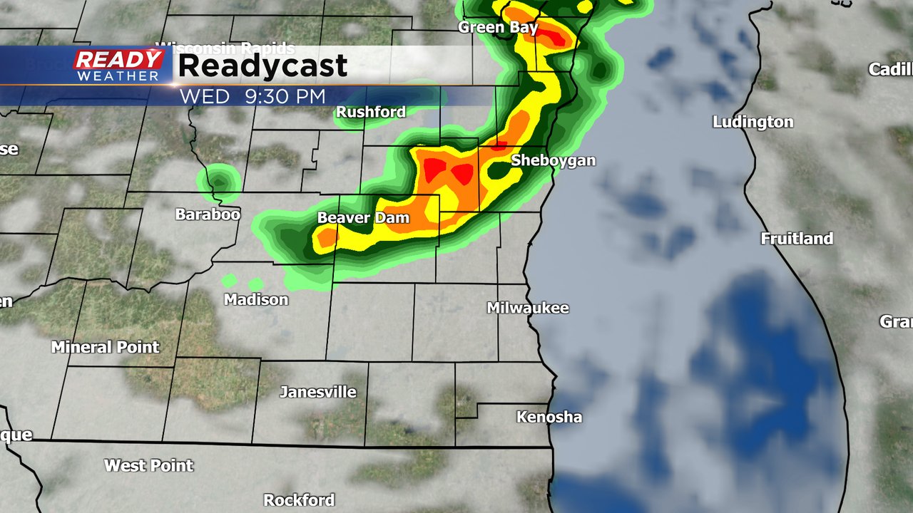
Most of Thursday morning is dry but another chance for storms is possible Thursday afternoon and evening. These storms will be best along the cold front which looks to set up close to the IL border or in northern Illinois but a few showers or storms could pop in southern counties near the border.

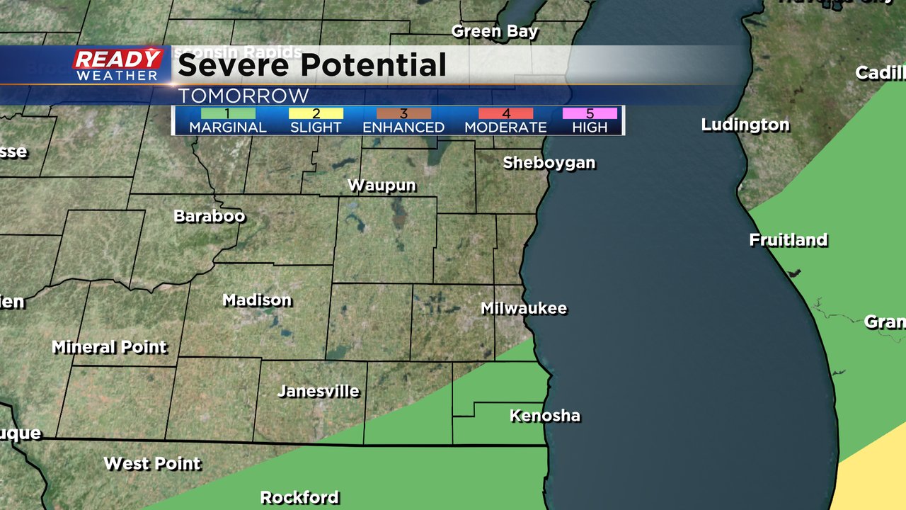
If storms do pop in our southern counties there's another chance they could be on the stronger side. Parts of Milwaukee, Racine, Kenosha and Walworth Counties are under the Level 1 Marginal Risk.
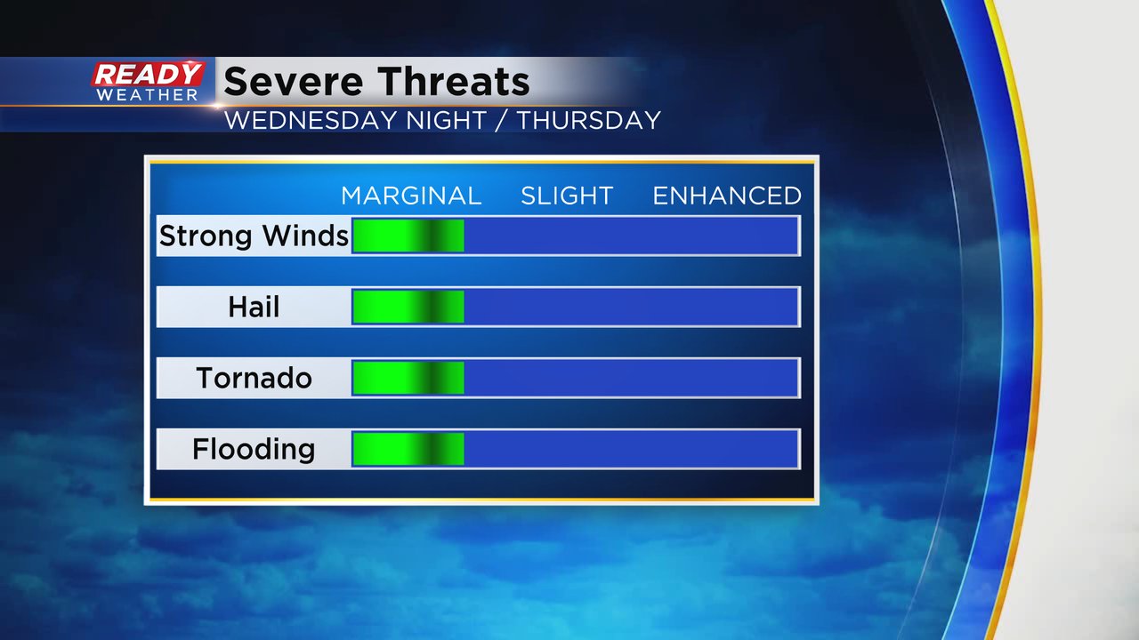
With any strong to severe storms that do form in southeast Wisconsin Wednesday or Thursday some gusty wind and small hail will be the main threats but as with most of our severe events this year an isolated tornado can't be ruled out or some brief flooding.
Download the CBS 58 Ready Weather app to track the heat, humidity and storms the next two days.