Isolated showers possible Wednesday with a round of soaking rain and storms Thursday


After a few nice dry and sunny days we will see rain chances return to southeast Wisconsin. It starts off with a fairly light chance on Wednesday mostly during the afternoon and evening with best chances in our southern counties although a shower in northern counties can't be ruled out.
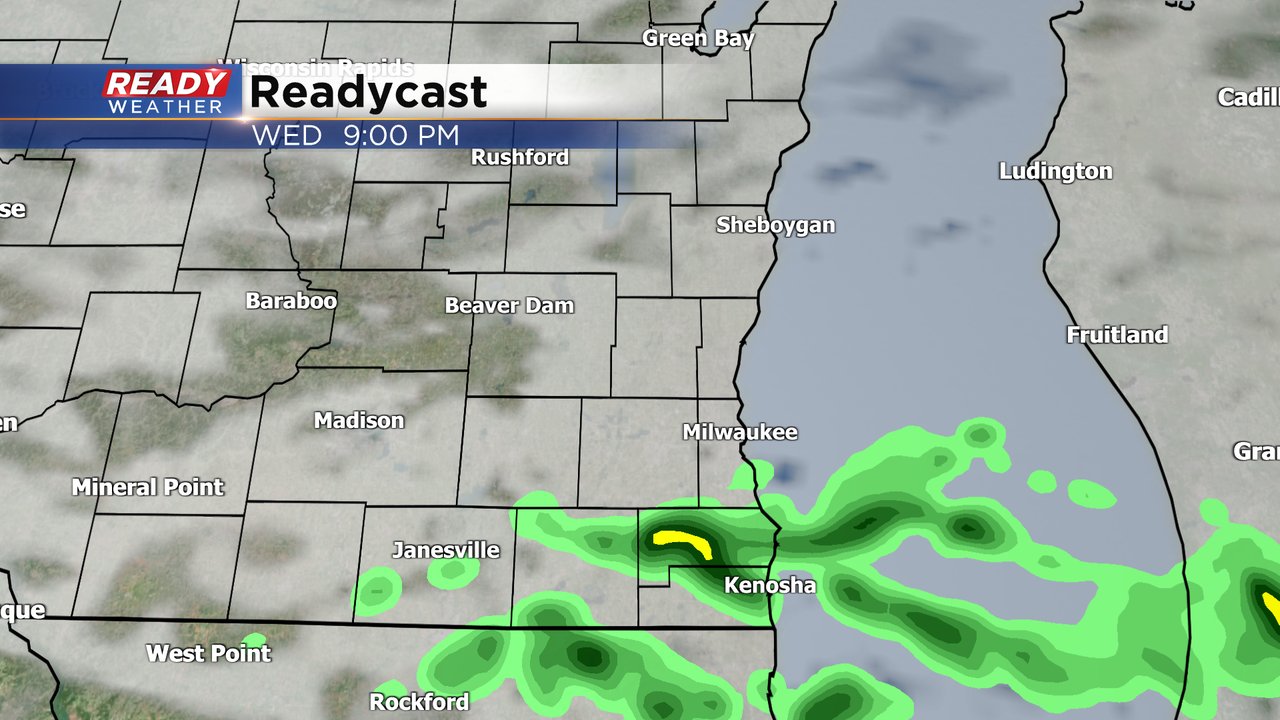
A few isolated showers might be possible Wednesday night but the better area of steady rain arrives Thursday morning. At least scattered showers and some storms are possible throughout the day on Thursday but a few hours of steady rain will be likely as well.

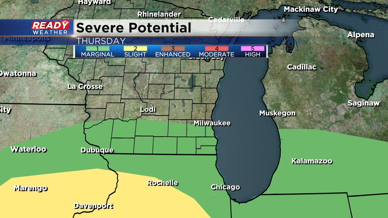
The threat for severe weather doesn't look great especially with cooler temps in the 40s on Thursday, but areas along and south of I-94 are currently included in the Level 1 Marginal Risk for severe weather. A warm front will stay in northern Illinois but a few strong to severe storms that form along that front in IL could move north and keep their strength north of front as they roll into Wisconsin. If strong storms do form, small hail would be the main threat.
With or without thunderstorms this does look like a good soaking rain. Over a half inch of rain will be likely for most of southeast Wisconsin with some totals around or over 1". A few northern counties might not reach that half inch mark.

Download the CBS 58 Ready Weather app to track the next round of rain and the possibility of storms.