Large temperature spread Monday followed by soggy weather for the middle of the week


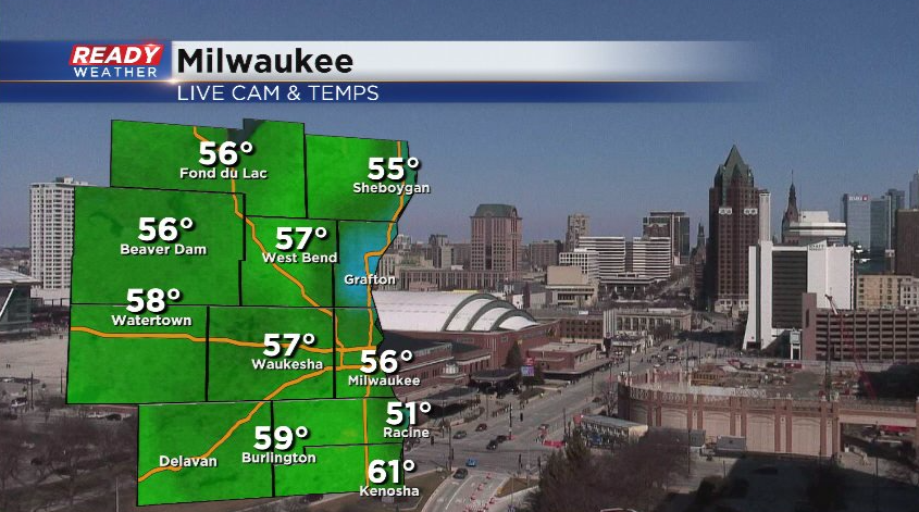
It's been a fantastic first day of spring across southeast Wisconsin with abundant sunshine and temps in the 50s!
Get outside and enjoy it while it's here because it'll turn cooler and very soggy by the middle of the week. Monday won't be too bad with only a few isolated showers north of Milwaukee early in the morning ahead of a warm front.
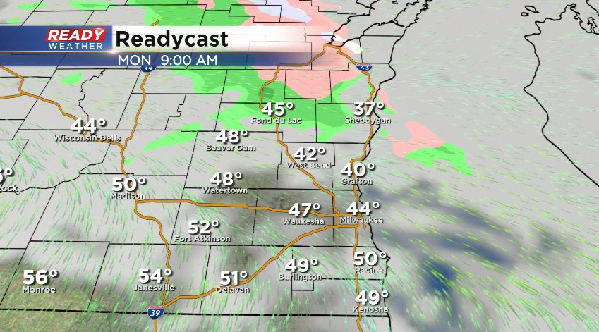
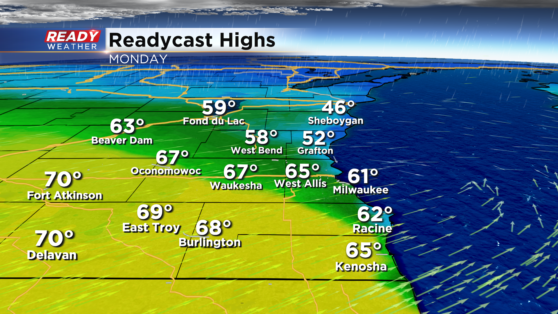
That warm front will lift into southern Wisconsin on Monday, but chilly breeze off of Lake Michigan will prevent the warm front from lifting through the whole area. This will create a wide range of high temperatures on Monday with mid 40s near Sheboygan, near 60° in Milwaukee, and 70° near Janesville.
After a mix of sun and clouds on Monday, our weather will really go downhill Tuesday as widespread rain moves into the state.
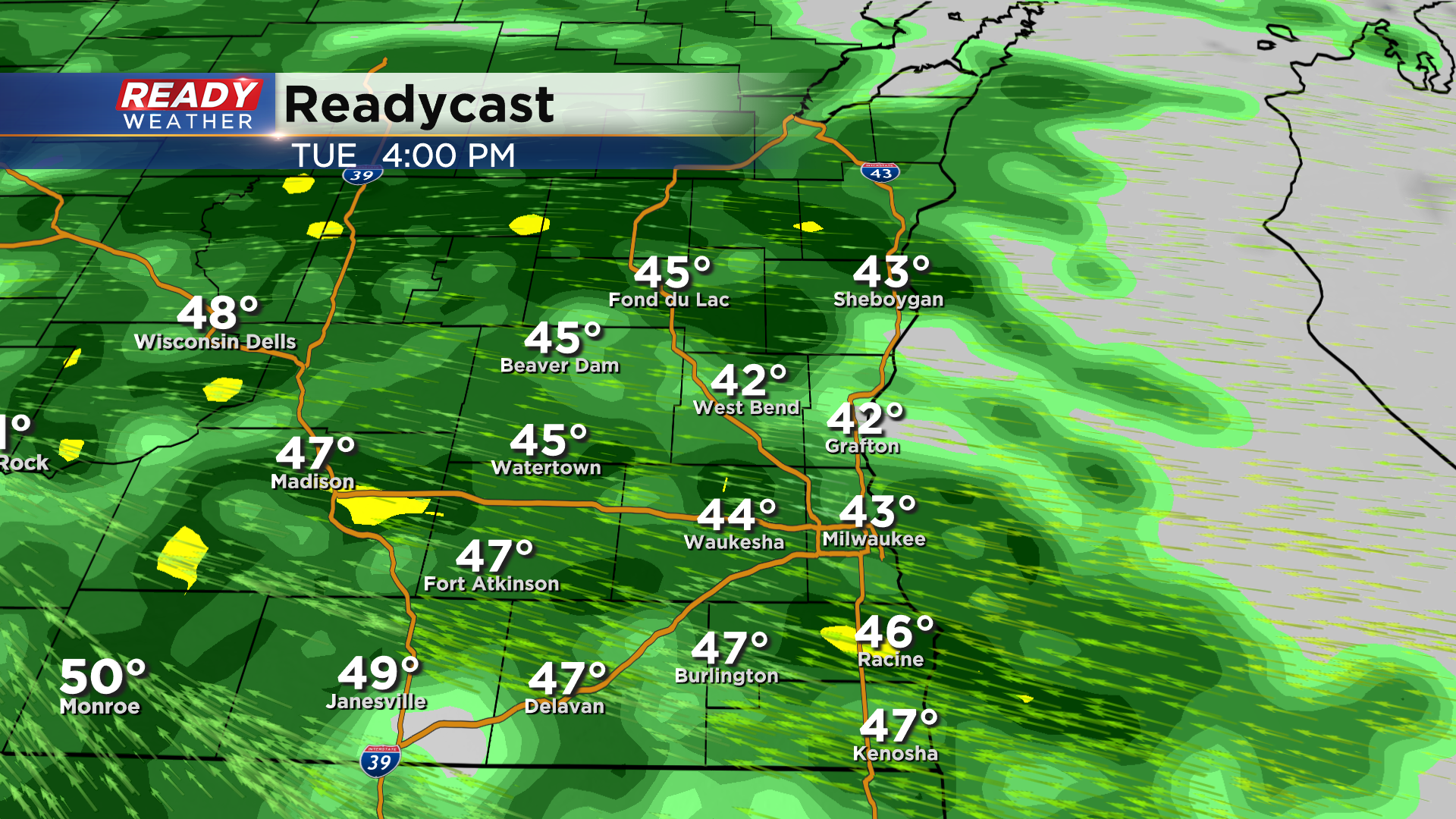
Rain will pick up in intensity Tuesday night into Wednesday morning with showers continuing throughout the day Wednesday. The rain begins to mix with sleet and light, wet snow Wednesday night into Thursday before finally ending. Currently between 1 and 1.5" of rain is expected from Tuesday through Thursday.

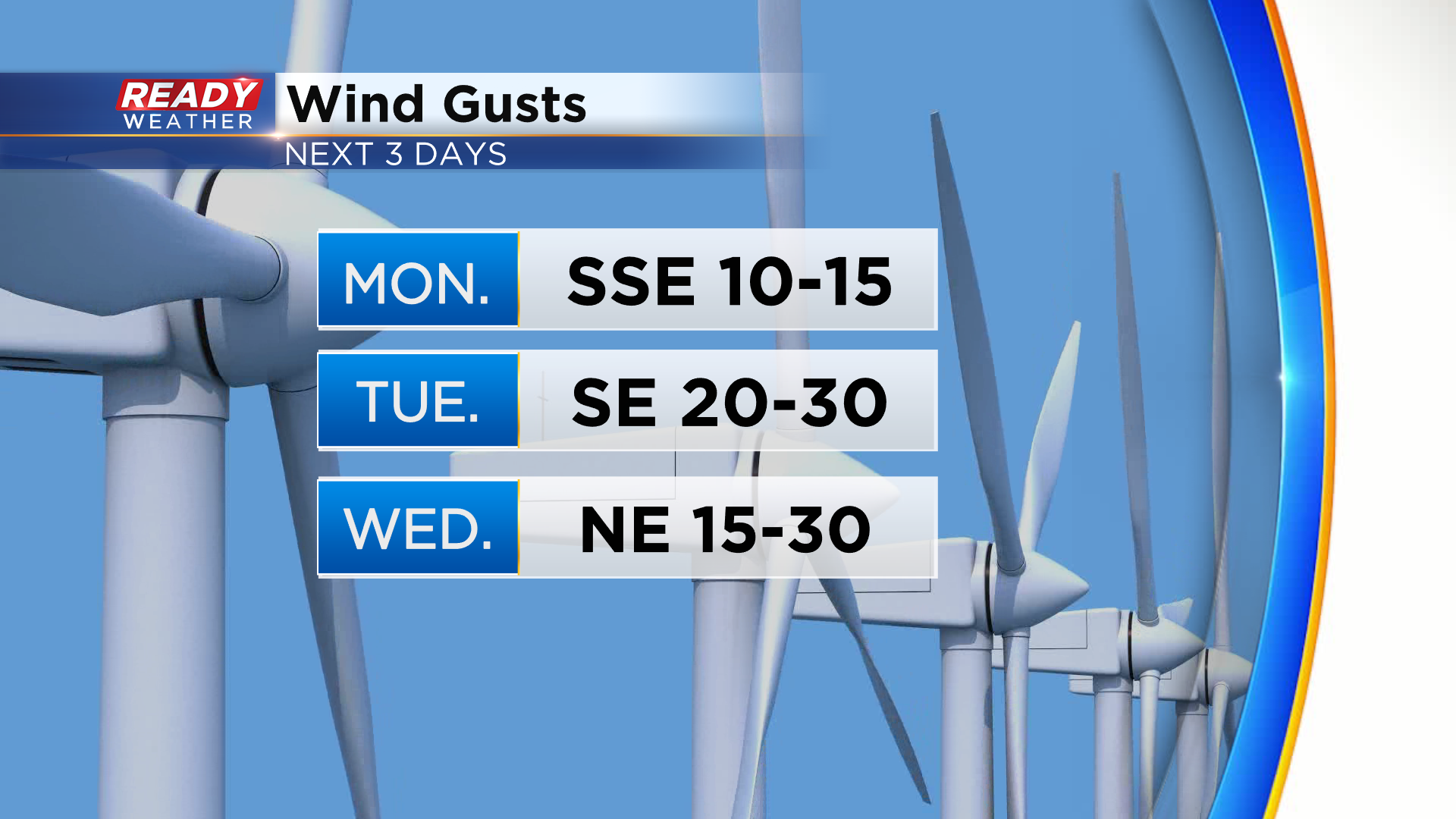
In addition to the rain, we'll have a blustery easterly wind Tuesday and Wednesday with frequent gusts of 25-30 mph.
Download the CBS 58 Ready Weather App to track the soggy work week weather.