Latest winter storm is history but still plenty of wintry weather in this forecast

-
0:42

Kids learned the importance of protecting our lakes at annual...
-
2:46

Milwaukee church offers unique museum tour for Black History...
-
5:01

Surviving member of the ’Mader’s Entertainers’ returns...
-
4:15

Milwaukee Admirals, community groups celebrate Pride Night
-
1:12

Tendick Nature Park
-
4:28

Hartford native, All-Pro NFL player Quinn Meinerz surprises athletes...
-
3:42

Couples renew their vows after decades of marriage
-
5:55

Call Me Old Fashioned at the Racine Zoo!
-
3:58

Inside a Downtown Space Where Beauty, Wellness, and Entrepreneurship...
-
5:15

Reviews of ’Crime 101’ and ’Good Luck, Have Fun, Don’t...
-
3:58

Exploring Innovations in Film & Media
-
4:40

Girls on the Run Builds Confidence, Community, and Connection

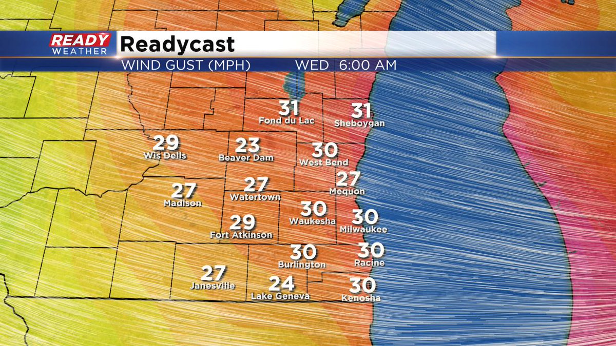
Milwaukee (CBS 58)--After record snowfall in Milwaukee of more than 8 inches Tuesday, we get a little break today. Although blowing and drifting will be a concern with the gusty west winds into the afternoon, especially on rural roads in outlying areas. Highs staying in the 20s, but the wind will make it feel more like the single digits and teens.
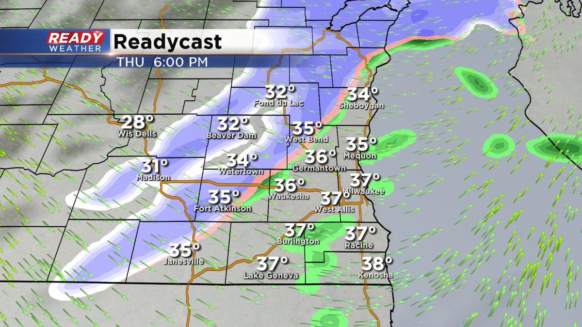
On Valentine's Day, we get a nice warmup with highs near 40. But it doesn't last long. Another front will move through into Thursday night. This will change and light rain into snow again. Nothing major but watch the roads.
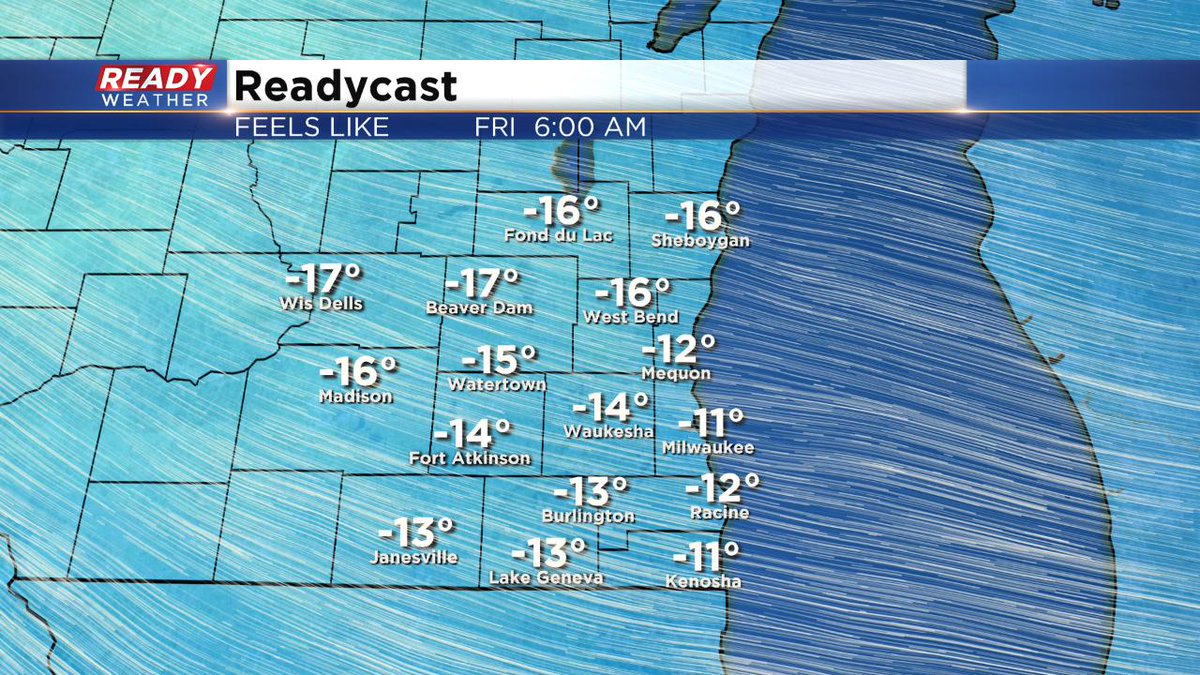
Temperatures for highs will stay in the 20s starting Friday and going into much of next week.
We do have another snow chance on Sunday. Stay tuned for more on this event.