
-
0:23

State volleyball great Simone Lee greets Lakeland Volleyball...
-
2:20

Kenosha veteran attacked and carjacked by 2 teenagers while Ubering
-
1:56

Cream City Skatepark races to find new home as closure looms
-
1:40

MCSO, MPD searching for 3 suspects after attempted traffic stop...
-
5:28

Von Maur talks Brewers merch ahead of Opening Day
-
1:13

CBS 58 highlights hometown doctor to kick off National Physicians...
-
0:50

Brewers fan creates ’Fly the Barrel’ flag to wave on winning...
-
0:40

Milwaukee Mayor Cavalier Johnson votes early in spring election
-
0:59

Milwaukee County Executive Crowley announces series of projects...
-
1:10

’I wear it for everybody’: Milwaukee VA hosts meet-and-greet...
-
8:15

Bat manufacturer breaks down what goes into supplying MLB players...
-
1:07

Local boutiques bring private shopping experience to Milwaukee...

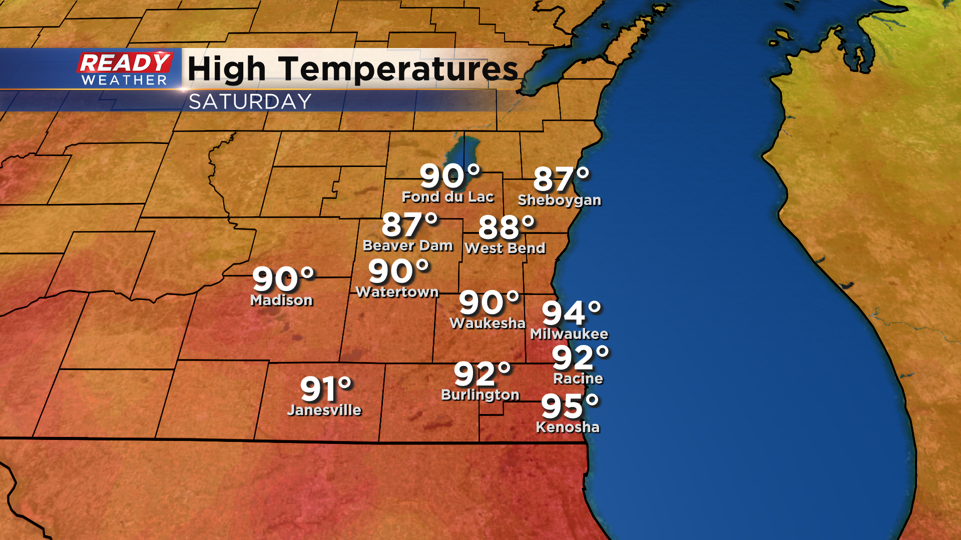
It was a very hot and humid day across southeast Wisconsin on Saturday with highs topping out in the upper 80s to mid 90s.
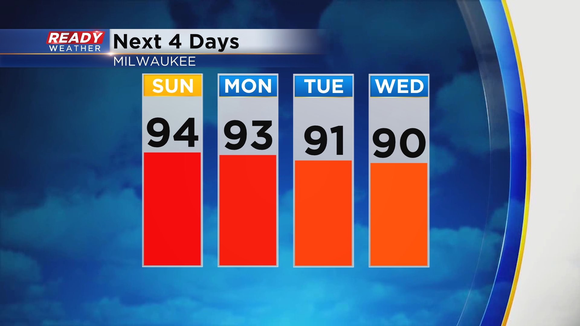
It was already our 11th day in the 90s this year, and it won't be our last. Temps will climb well into the 90s again Sunday and Monday and will make a run at 90° Tuesday and Wednesday.
Although the heat will continue into the beginning of the week, we'll have a break from the humidity on Sunday, and it won't be too bad on Monday.
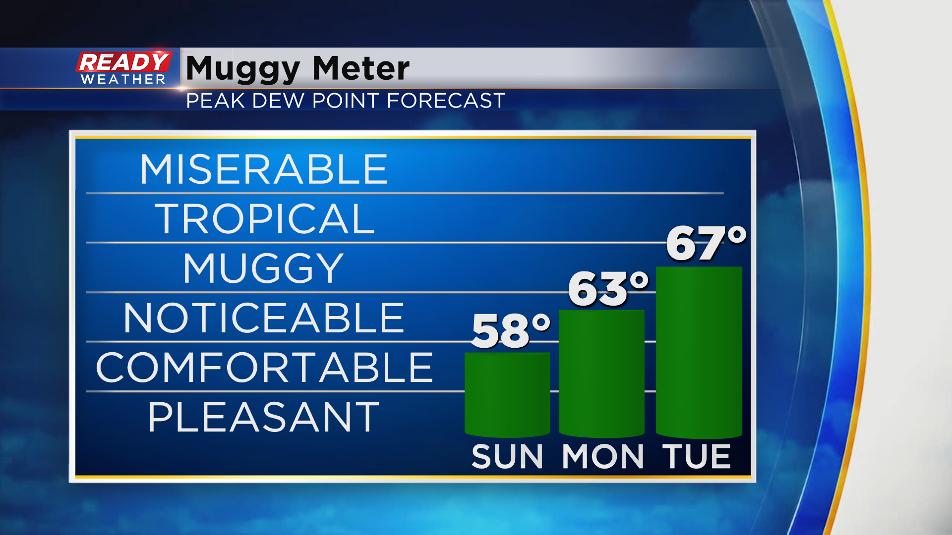
Unfortunately, the muggy air moves back in Tuesday and Wednesday, along with storm chances. Chance will be isolated on Tuesday and confined to areas north of 94, but everyone will likely see rain and storms later Wednesday into Thursday morning as the cold front moves through. Download the CBS 58 Ready Weather App to see how fall temps will fall behind the cold front.