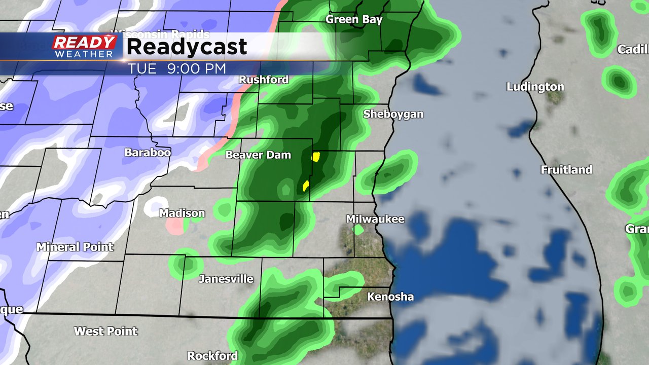
Light rain and snow arrives Tuesday evening

-
2:25

Cold weather advisory issued for Saturday and Sunday as the coldest...
-
2:00

Meet CBS 58’s Pet of the Week: Eddie
-
3:28

Amilinda to serve Hanukkah dinner inspired by chef’s heritage
-
2:18

Firefighters respond to structure fire at Bass Bay Brewhouse...
-
5:04

’It’s really overwhelming’: Drone pilot works to find lost...
-
0:48

Man accused of stabbing Madison man back in 2019 pleads guilty...
-
0:53

Woman accused of hitting man and leaving him in coma makes first...
-
0:48

Congrats graduates! MATC students walk stage for their high school...
-
1:07

Protesters gather outside courthouse to show support for Judge...
-
2:18

‘Flooded with calls’: SE Wisconsin roofing company working...
-
5:09

Upcoming events happening at the Marcus Performing Arts Center...
-
4:39

’Overdose Death Initiative’: DOJ’s new approach investigating...
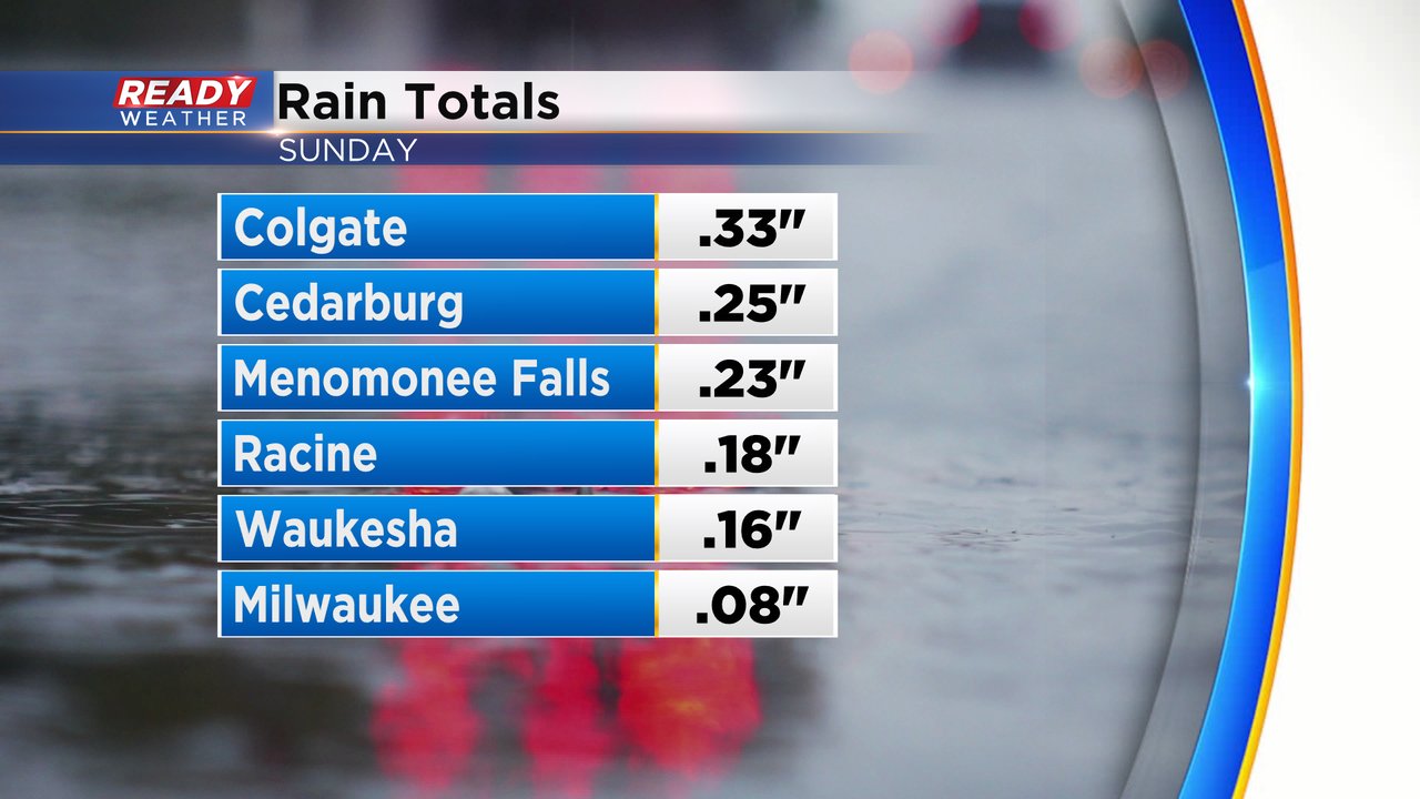
The long holiday weekend is over and it ended with some light steady rain on Sunday. That rain was heaviest in Washington and Ozaukee Counties where locations picked up around a quarter inch of rain but the rest of southeast Wisconsin saw less.

After a sunny and dry Monday we see the clouds increase Monday night. Our next rain chance arrives on Tuesday but for most of us it isn't until the evening. Tuesday night into early Wednesday morning could see a bit of light snow mix in but that should all be wrapped up before the Wednesday morning commute.

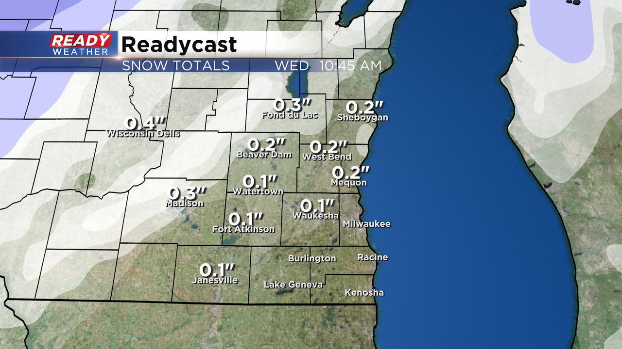
Any snow that does fall Tuesday night won't amount to more than a dusting or a few tenths of an inch. Hometowns west and north of the Milwaukee metro area have the best chance of seeing up to a half inch of snow.

Download the CBS 58 Ready Weather app to track the next round of rain and snow.

