Tornado Warning issued for Jefferson, western Waukesha Co. until 1:45 a.m.
Updated: 1:09 a.m. on Thursday, July 29
A Tornado Warning has been issued for both Dodge and Jefferson counties until 1:15 a.m. and for western Waukesha County until 1:45 a.m.
Watch live as the CBS 58 Ready Weather Team provides updates on the severe weather in our area:
Updated: 10:10 pm Wednesday, July 28th:
Line of severe storms with embedded spin ups is congealing and starting to track SSE. Wind reports closing in on 80 mph have been reported in parts of central Wisconsin with these storms.
Main part of the line we're concerned with at this point is near Waupaca, where a severe thunderstorm warning and tornado warning are currently in effect.
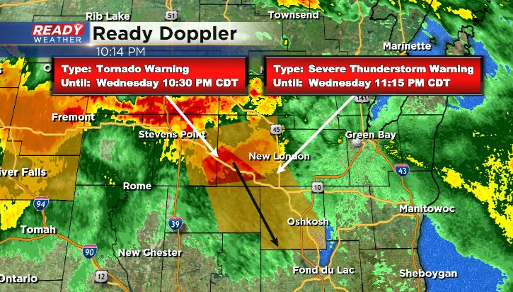
This cell has a history of wind damage in parts of the Wausau area. At the current speed and path, it would reach Fond du Lac around 11 pm.
----------------------------------------------------------------------------------------
Updated: 7:30 pm Wednesday July 28th:
A Particularly Dangerous Situation Severe Thunderstorm Watch has been issued for all of southeast Wisconsin through 2 am. This is a rare and more serious type of Severe Thunderstorm Watch that's issued when significant severe weather is likely.
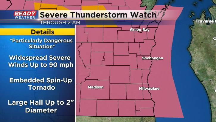
Widespread damaging severe wind gusts up to 90 mph are likely as the storms race across our area between 11pm - 2am. We'll be watching for any embedded spin-ups within the squall line as well. Storms are just starting to fire in NW WI.
These are the storms that will congeal into a line and track into SE WI. Download the CBS 58 Ready Weather App to get any warnings sent to your phone.
-------------------------------------------------------------------------------
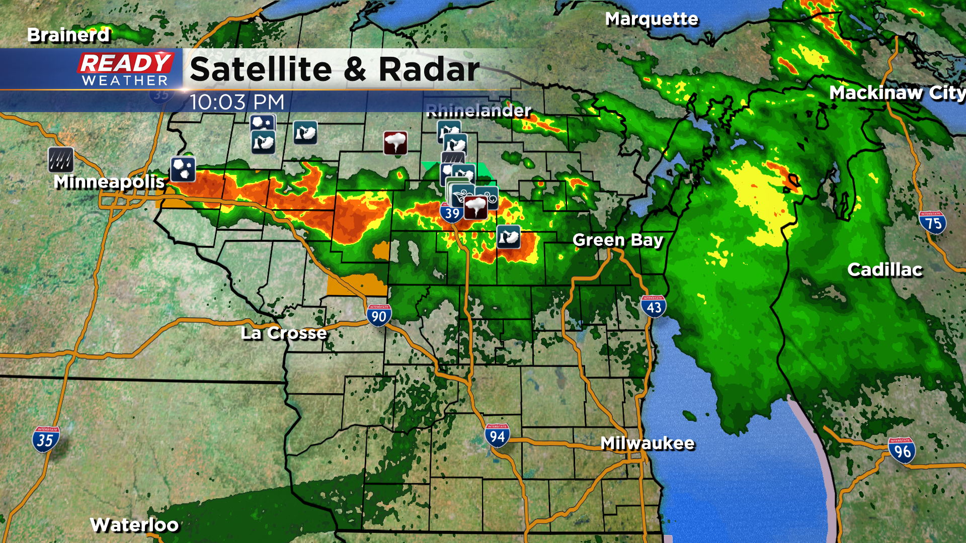
All is quiet, hot, and muggy across southeast Wisconsin this afternoon with a few showers ongoing in central Wisconsin. Unfortunately these showers and clouds won't have much, if any, impact on our severe weather threat late this evening and overnight.
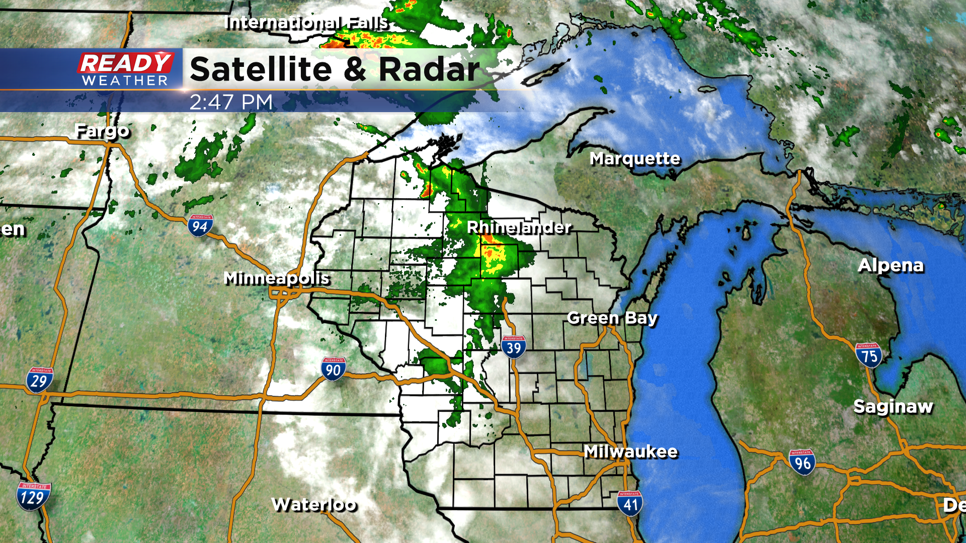
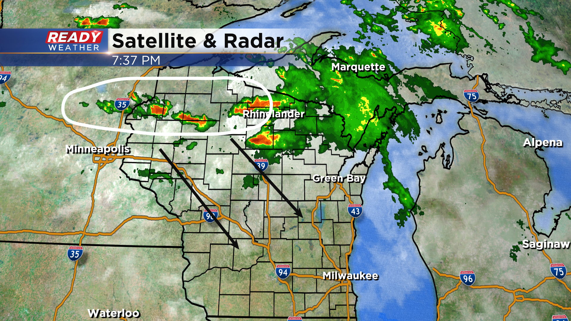
Supercell thunderstorm look to fire in northwest Wisconsin between 6-8 pm.
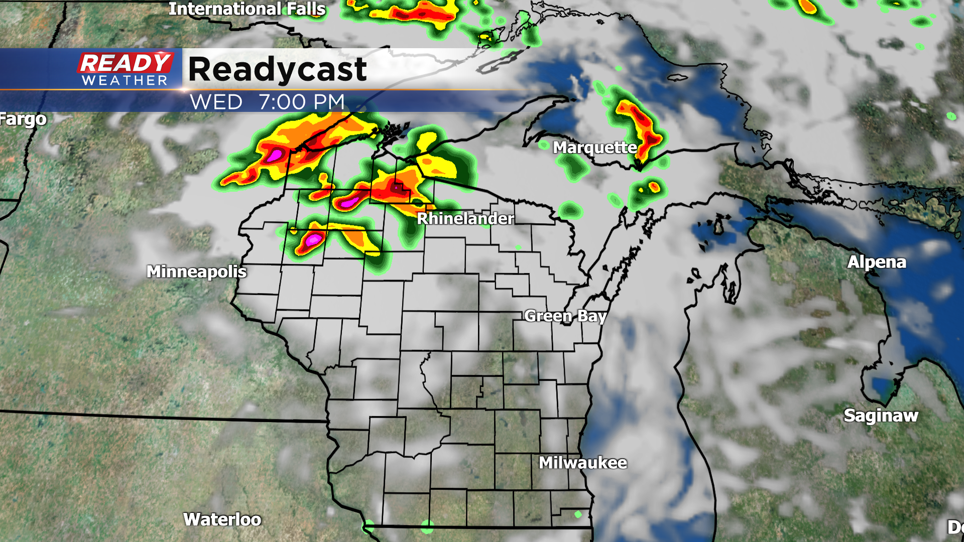
These storms will have a tornado and large hail threat initially before congealing into a line and tracking southeast across the state through the evening hours.
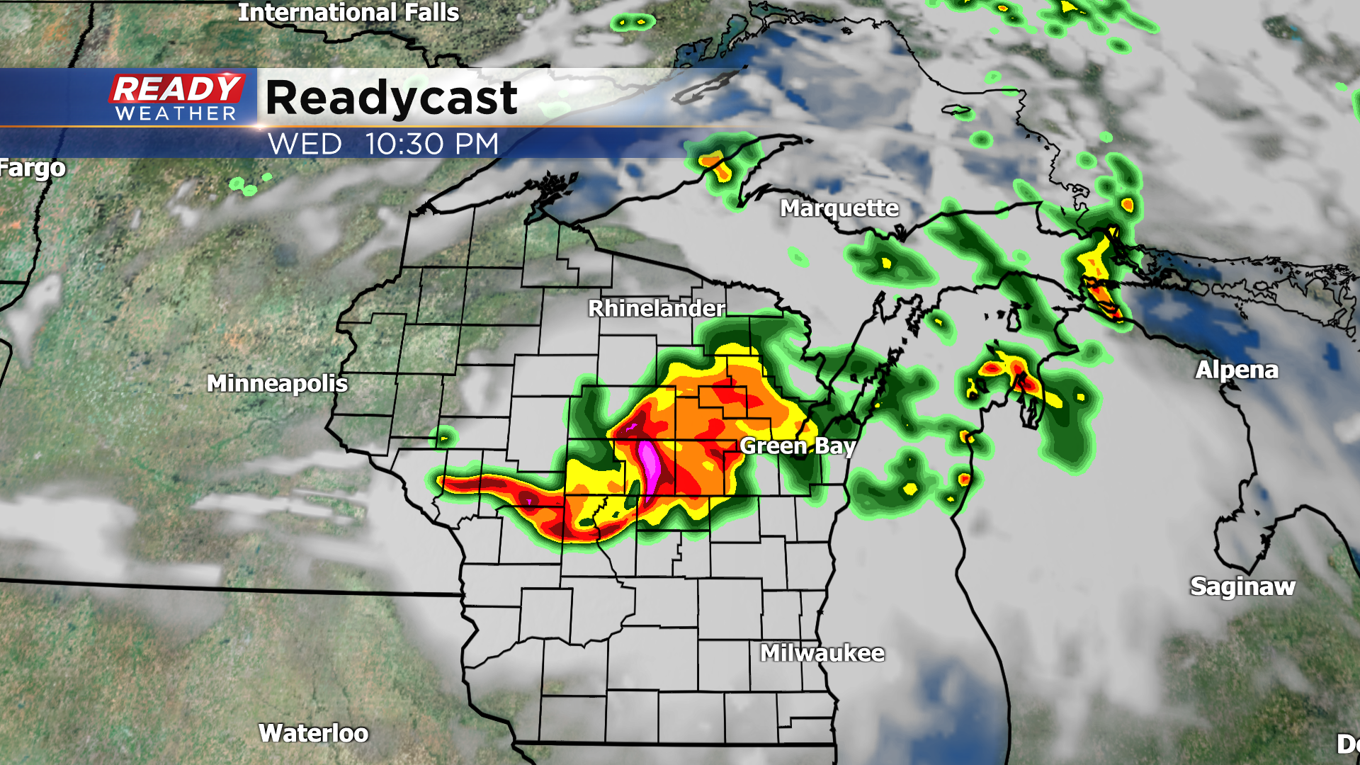
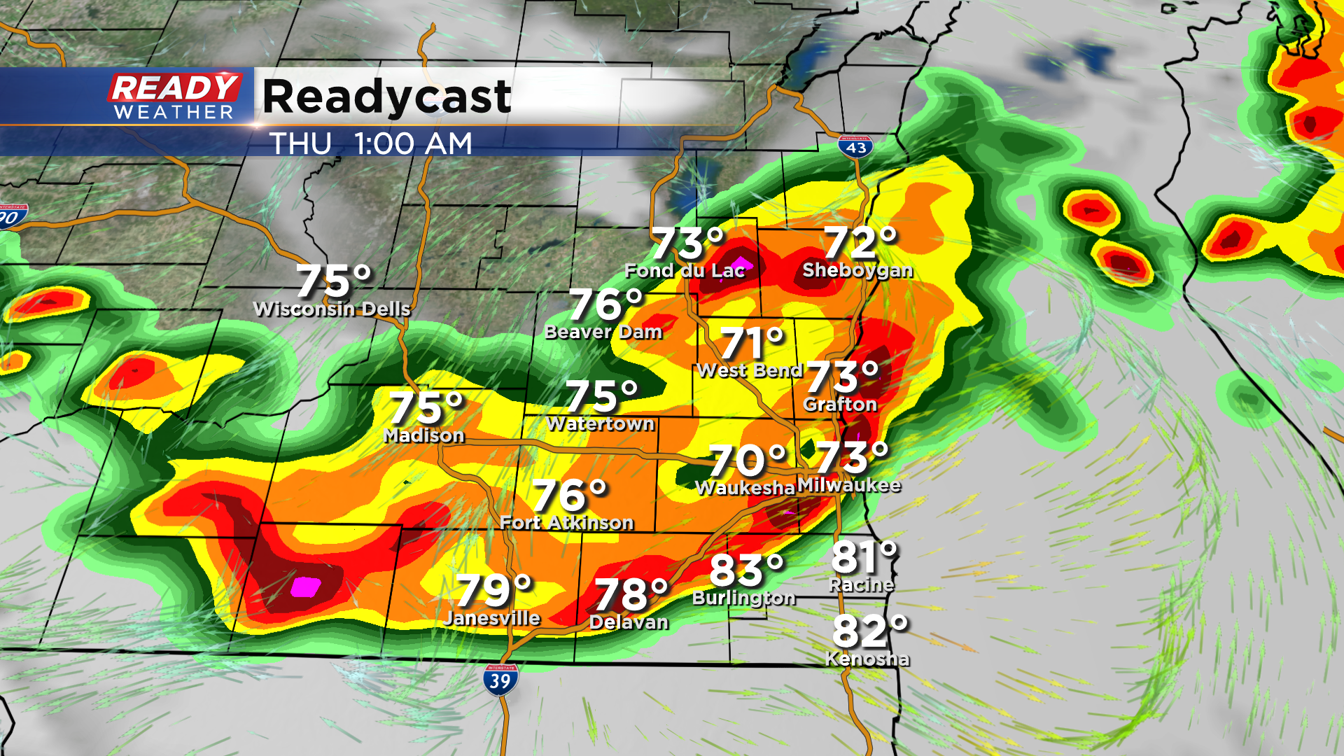
We expect this line to reach Fond du Lac, Dodge, and Sheboygan counties between 10pm-12am, exiting Kenosha county between 2-3 am.
Once the storms congeal into a line, they'll pose more of a damaging straight-line wind risk with the potential for 70-80 mph winds or greater. Additionally, we'll have to watch out for embedded spin-ups within the squall line (QLCS tornadoes).
![]()
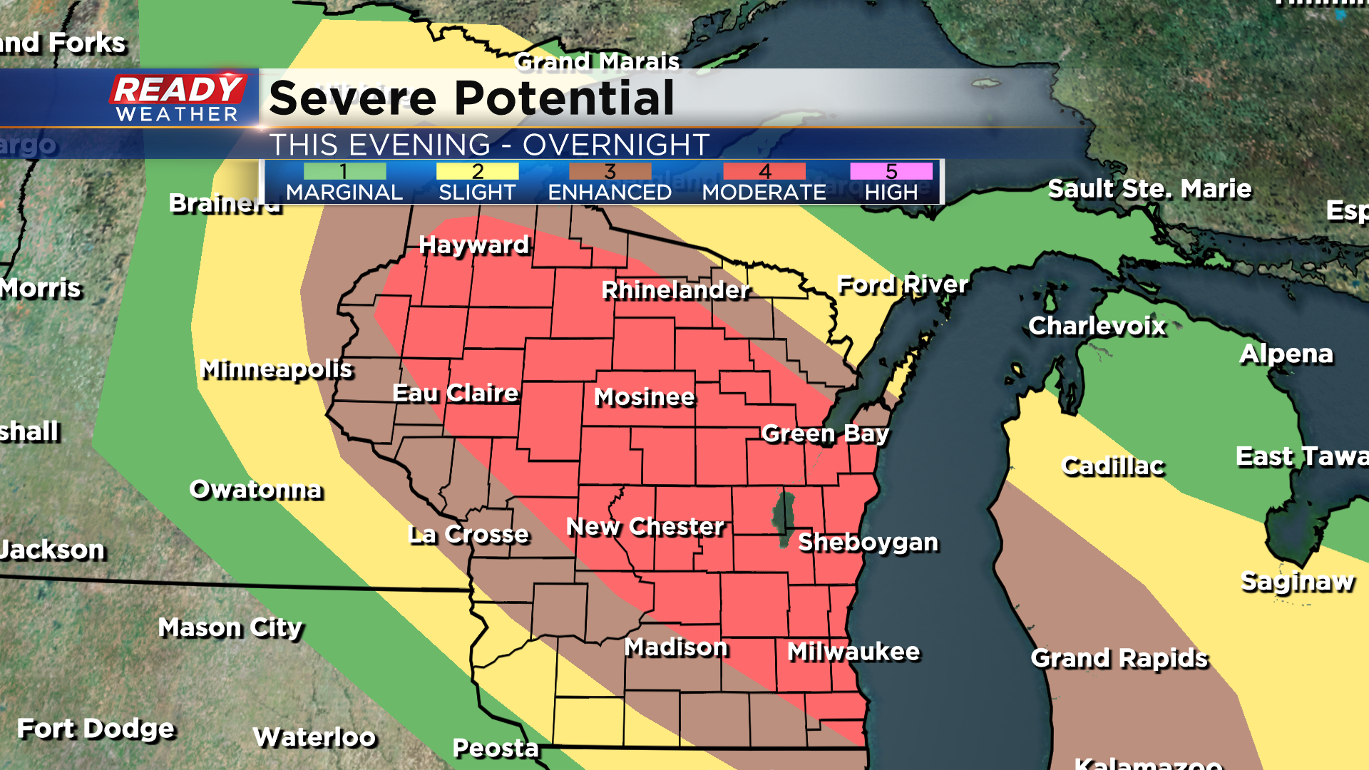
As of 3 pm, a large majority of the state is under a level 4 of 5, Moderate Risk, for severe storms tonight. This includes most of southeast Wisconsin.
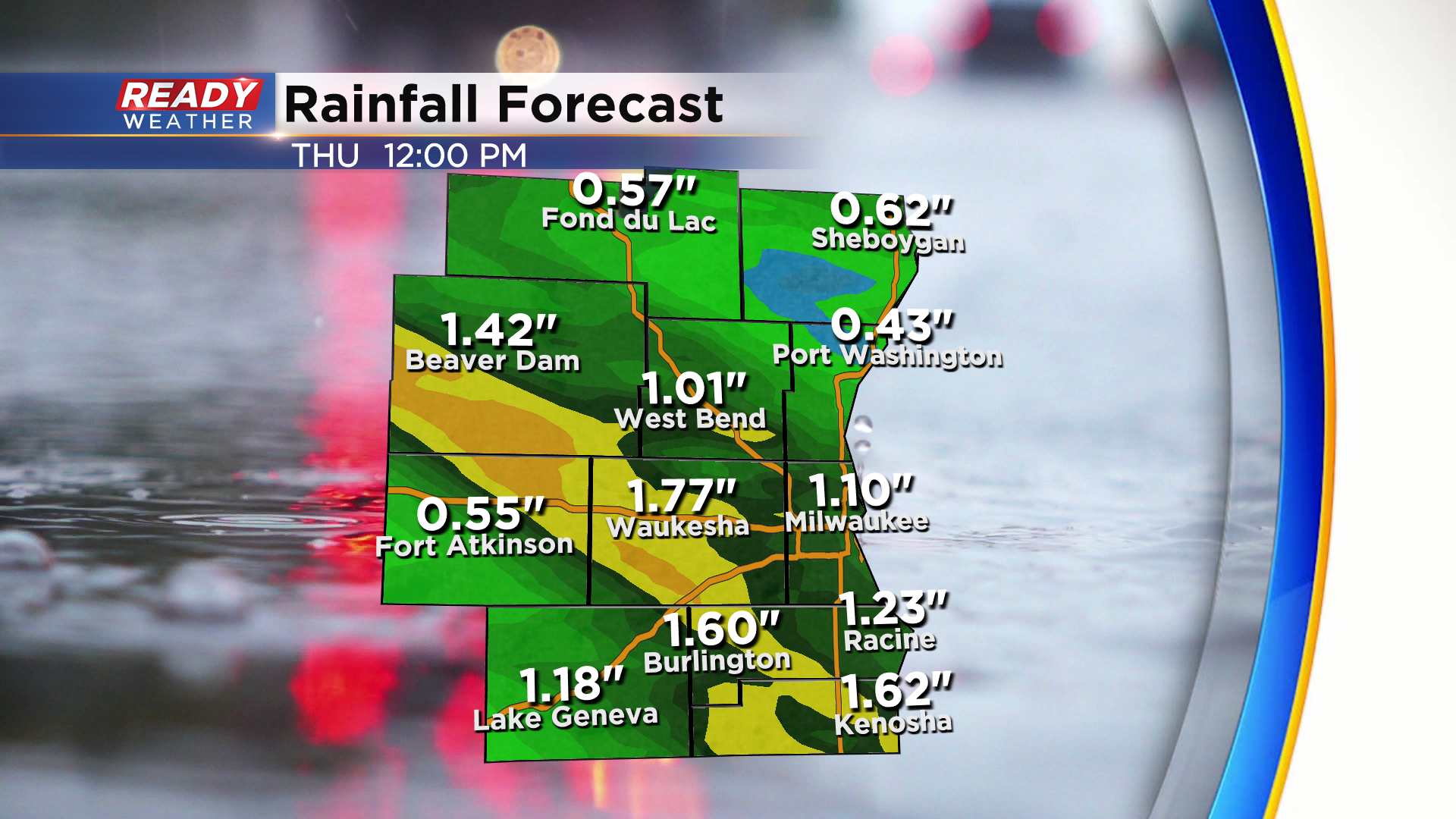
In addition to the severe weather, heavy rain is also expected with these storms. Most spots will pick up between .50-1.50" of rain, but locally higher amounts over 2" are possible.
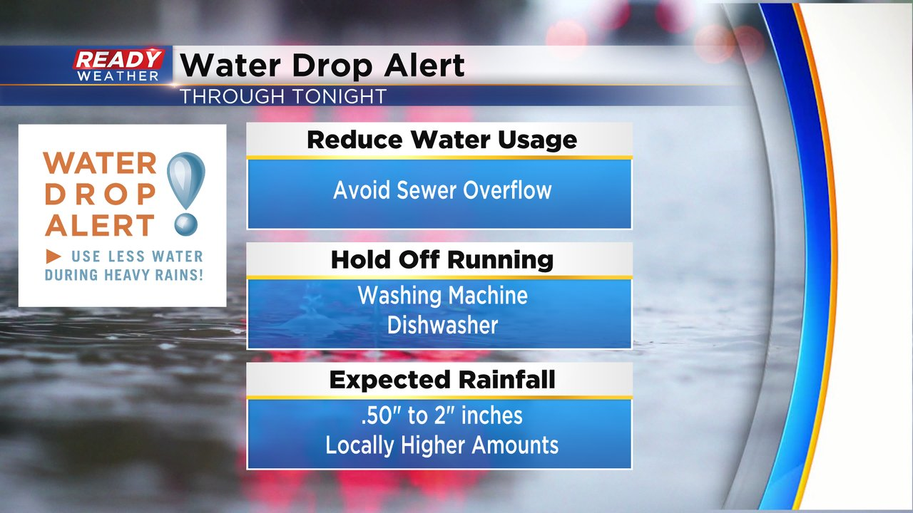
With the potential for heavy rain with tonight's storms, MMSD has issued a Water Drop Alert for the Milwaukee metro. Please conserve water and help reduce the risk of basement backups and sewer overflows. Take a short shower, hold off on washes dishes/clothes etc.
You'll NEED a way to receive severe warnings overnight tonight, so download the CBS 58 Ready Weather App to get any warnings sent to your phone. A weather radio would also be ideal for tonight. Remember, tornado sirens are not meant to be heard indoors and definitely not meant to wake you up.
