


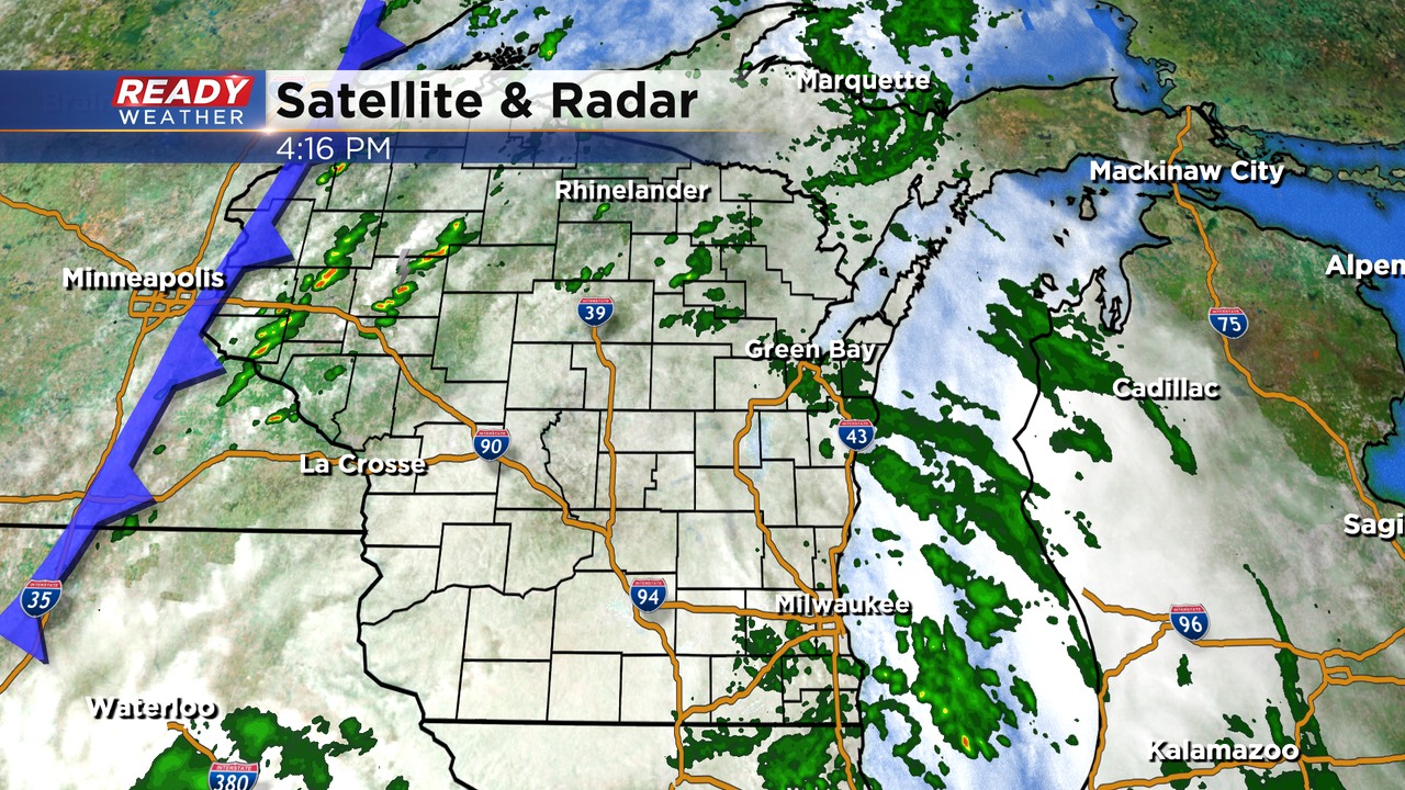
It's been a humid and gloomy Saturday across southeast Wisconsin with off and on showers and drizzle throughout much of the day. The showers have been rather light with only a Tr. - .15" across the area. The lingering cloud cover to our west will limit additional shower and storm development along the cold front late this evening, but there could still be some patchy drizzle until the front moves through around midnight.
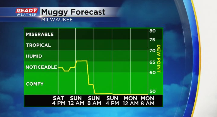
Behind the cold front will be a very welcomed drop in humidity! Dew points will hover around 50 degrees both Sunday and Monday.
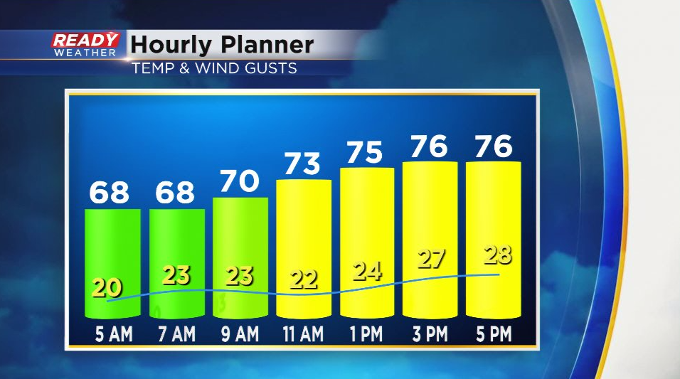
Not only will you notice the lower humidity on Sunday, but there will be a gusty northwest wind around 20-30 mph. With sunny to partly cloudy skies, temps will top out in the mid to upper 70s to end the weekend.
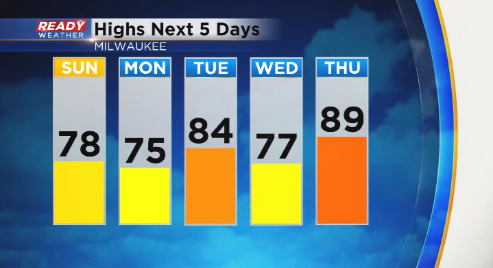
Temps remain comfortable on Monday with highs in the 70s and abundant sunshine, but winds turn back to the southwest Tuesday, boosting temps into the mid 80s ahead of a cold front. That front will trigger a few isolated storms Tuesday evening and briefly drop temps on Wednesday, but temps will jump to near 90 degrees on Thursday.
Download the CBS 58 Ready Weather App to see if there is any solid rain on the way next week.