Mild and windy most of this week with another big storm system


Over the weekend we had a pretty dynamic storm system bring severe storms throughout southeast Wisconsin Friday night then we stayed mostly dry Saturday before the backside of the low pressure brought a good area of snowfall Sunday morning. Snow totals across the Milwaukee metro and surrounding area reached over 6" in some spots.

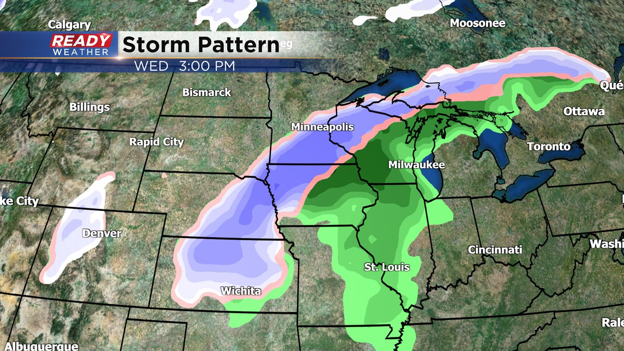
St. Patrick's Day Monday should remain all dry and most of Tuesday looks dry as well. But by Wednesday things start to change. Only a few showers are expected Wednesday morning but the rain picks up in intensity Wednesday afternoon and evening. A few stronger storms are possible Wednesday afternoon before the rain switches to snow Wednesday evening into early Thursday.
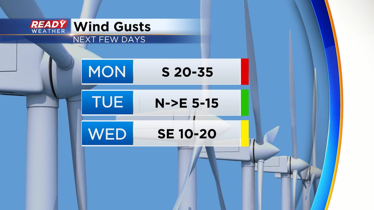
The wind Monday morning is light but the wind will pick up Monday afternoon and evening with gusts to 35 mph. On Tuesday the wind is light but shifts to the east bringing back in a lake breeze so temps will be warmer inland on Tuesday. By Wednesday the lake breeze stays breezy but it won't have much effect on the temps with clouds and rain keeping temps steady for most in the 50s.
Download the CBS 58 Ready Weather app to track the changes with our midweek storm system.