Mild for all but cooler by the lake again Thursday; strong to severe storms possible Friday night


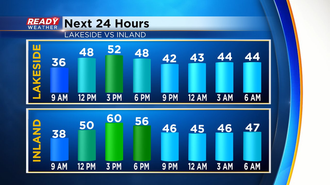
Our weather focus in southeast Wisconsin will quickly shift from cooler by the Lake conditions to a chance for strong to severe storms Friday evening and night. Thursday is another nice, sunny days with highs reaching around 50 lakeside and closer to 60 inland with a Lake breeze. Everyone stays mild Thursday night with lows only dropping into the 40s.
The wind is a lake breeze Thursday out of the SE but light from 5-15 mph. That southeast wind really ramps up Friday afternoon and evening with gusts from 20-35 mph. The wind Saturday will shift to the southwest after a warm front rolls through Friday night. Wind gusts Saturday will be even strong from 25-45 mph leading to a possible wind advisory.

As the warm front rolls through Friday night it will bring with it the chance for storms. Storms are expected to be severe as they roll through Illinois and move northeast. They should be weakening as they move into southeast Wisconsin but some strong to severe storms are still possible. The best timing for any storms locally will be from 10 PM late Friday evening to 3 AM Saturday morning.

The severe risk in place for Friday and Friday night across the Midwest is unusually high for this early in the severe weather season. A rare Level 4 Moderate Risk has been put in place for parts of Missouri and Illinois centered around St. Louis with a Level 3 Enhanced Risk surrounding it. All of southeast Wisconsin remains under a Level 2 Slight risk in yellow or a Level 1 Marginal risk in green. The biggest severe weather threat will be damaging wind gusts over 60 mph but some hail and isolated tornadoes will also be possible.

Make sure to download the CBS 58 Ready Weather app and enable alerts so you can get notified if severe thunderstorm warnings or tornado warnings are issued while you're sleeping Friday night.