Monday morning frost leads to Monday evening rain showers


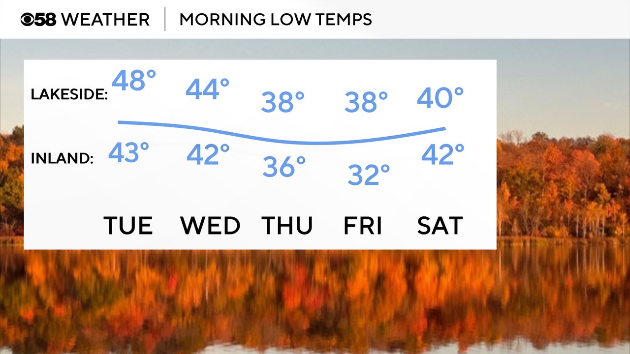
The first frost advisory of the season, locally, was in effect Monday morning until 8 AM. Widespread frost was likely, especially away from the lakefront, with lows dropping into the mid 30s. Milwaukee stayed around 40 so we are still looking for our first low in the 30s in Milwaukee this season.

Low temperatures will be a bit milder Tuesday and Wednesday mornings in the 40s because of some clouds and rain chances. Our next chance for frost will be Thursday morning and Friday morning could see a freeze, especially inland.
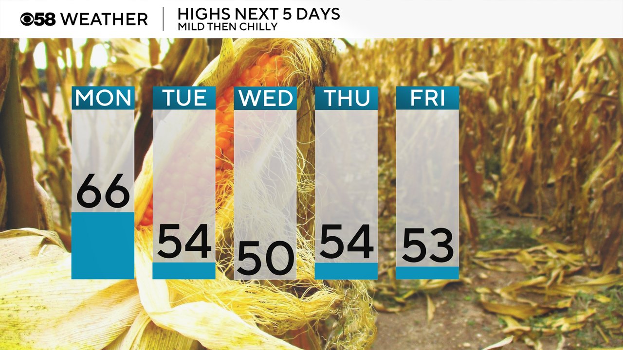
Despite the cold start Monday, with some good sunshine most of the morning through early afternoon we should see temperatures warm fast. Highs Monday likely reach the mid 60s before a cold front rolls in Monday night dropping highs into the 50s the rest of the week. Wednesday might even struggle to hit 50!
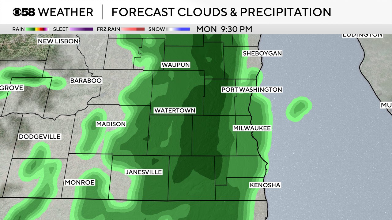
The cold front that rolls through Monday night will give us our next chance for showers. After morning sunshine Monday the clouds will increase by late afternoon and showers are possible from 8 PM Monday evening through 3 AM early Tuesday.
The rest of Tuesday morning looks pretty dry until around midday when more showers are possible that last through Tuesday afternoon and evening and potentially into Wednesday.
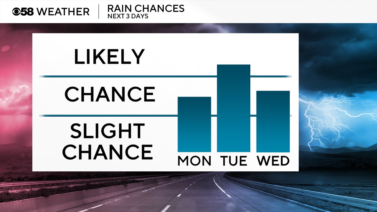
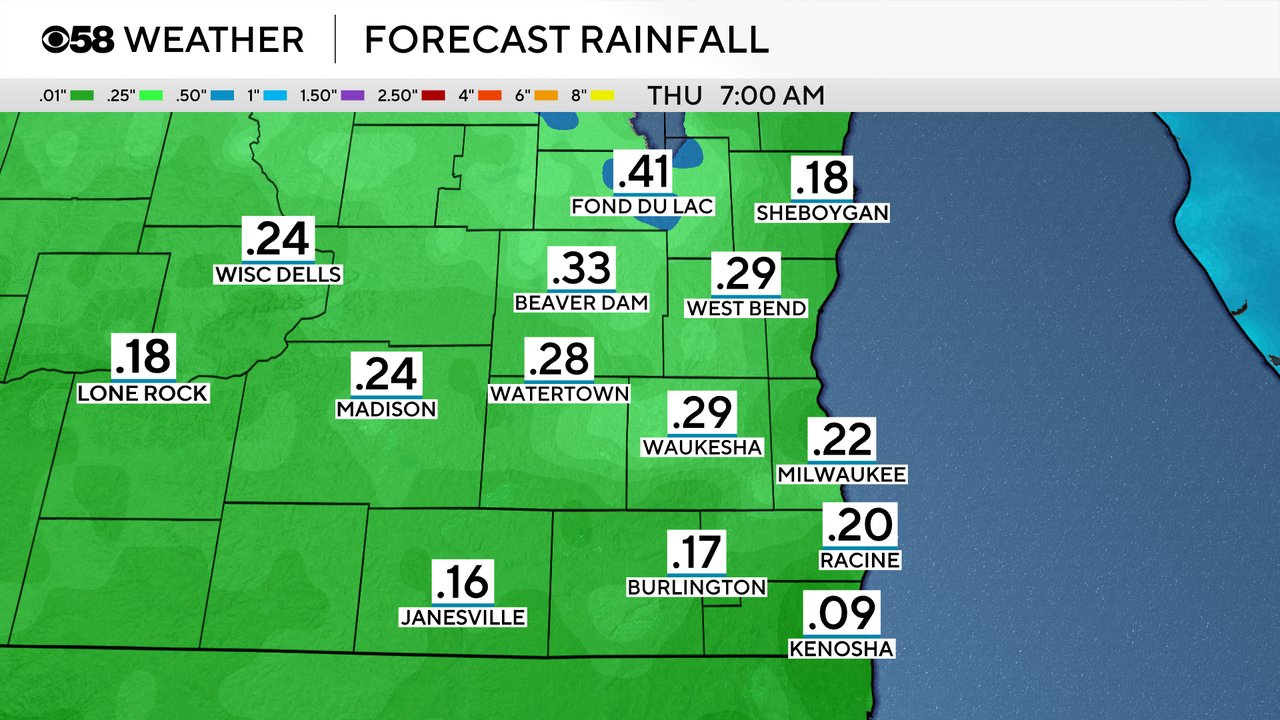
Despite a few rain chances over the next few days, rain totals will stay mostly light. Around a tenth of rain is possible with the first round Monday evening into Tuesday morning then up to a quarter inch is possible Tuesday afternoon through Wednesday. By Thursday morning totals could range from 0.10"-0.40".
Download the CBS 58 Weather app to track the rain chances with the interactive radar and our next chance for frost with the 10-day forecast.