


It's been a bit of a backwards day in the temperature department across parts of southeast Wisconsin today. Temperatures overnight were in the 70s before a cold front moved through this morning. Then a lake breeze developed around midday and pushed inland this afternoon, dropping temps back into the upper 50s to low 60s.
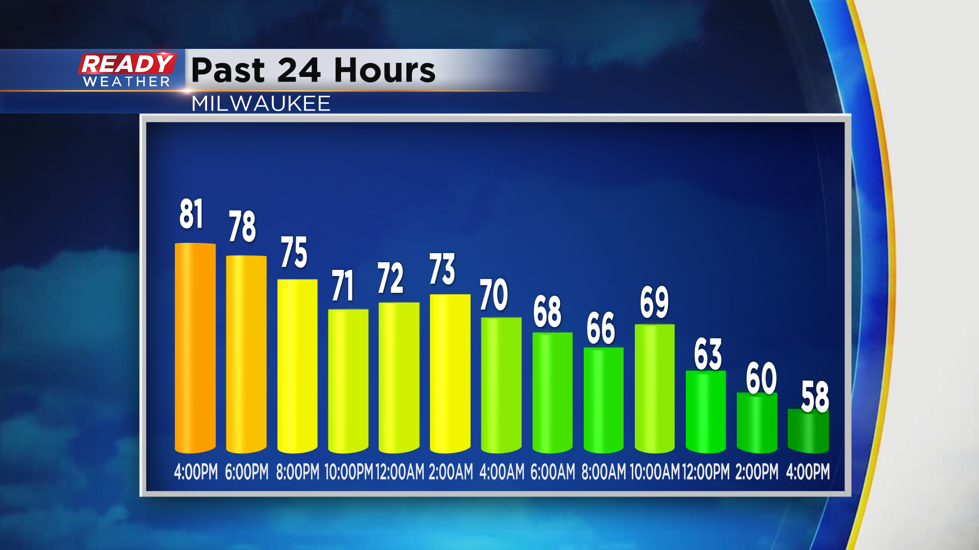
Temps will drop back into the low 50s this evening and stay there overnight as winds remain around 10-15 mph from the ESE. While skies will be mainly clear overnight, the southeast winds will pull clouds into the area around sunrise. Any sunshine early Sunday morning will be replaced by clouds as the day progresses. Clouds combined with a SE breeze at 10-15 mph will hold temps in the low 60s.

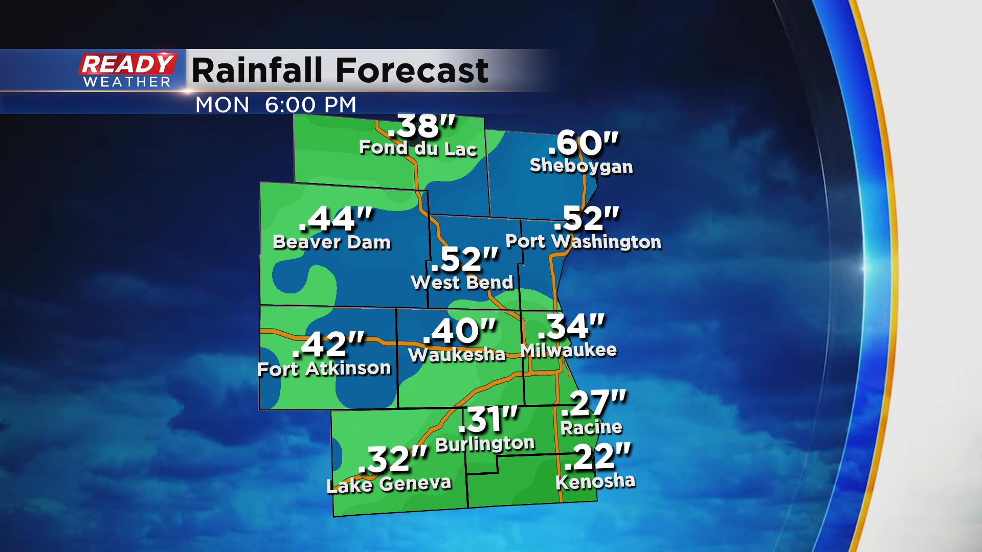
After a dry Sunday and Sunday night, rain and storms will return to the region Monday morning along a cold front. The line of showers and storms could move into western spots as early as 7 am.
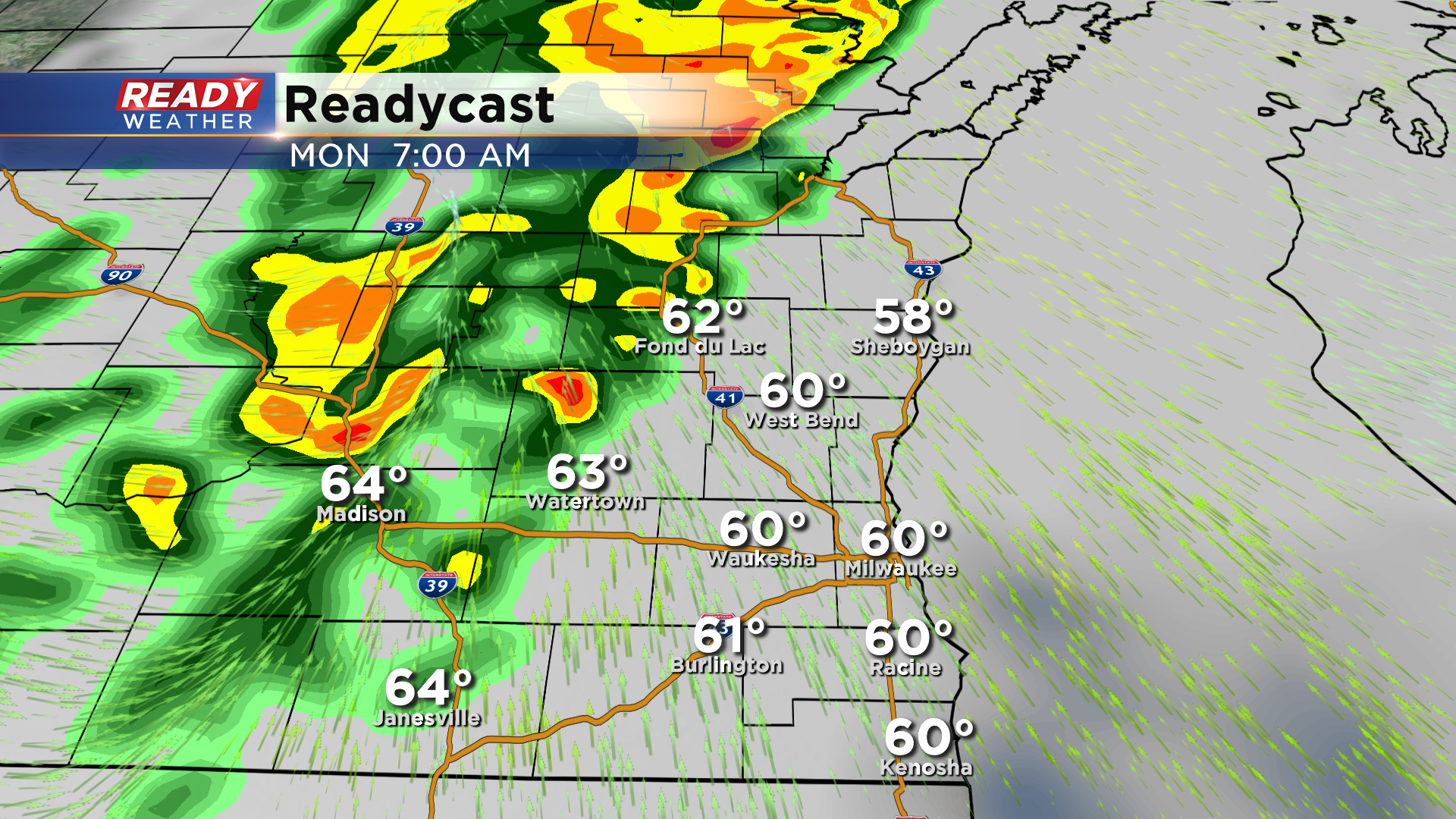
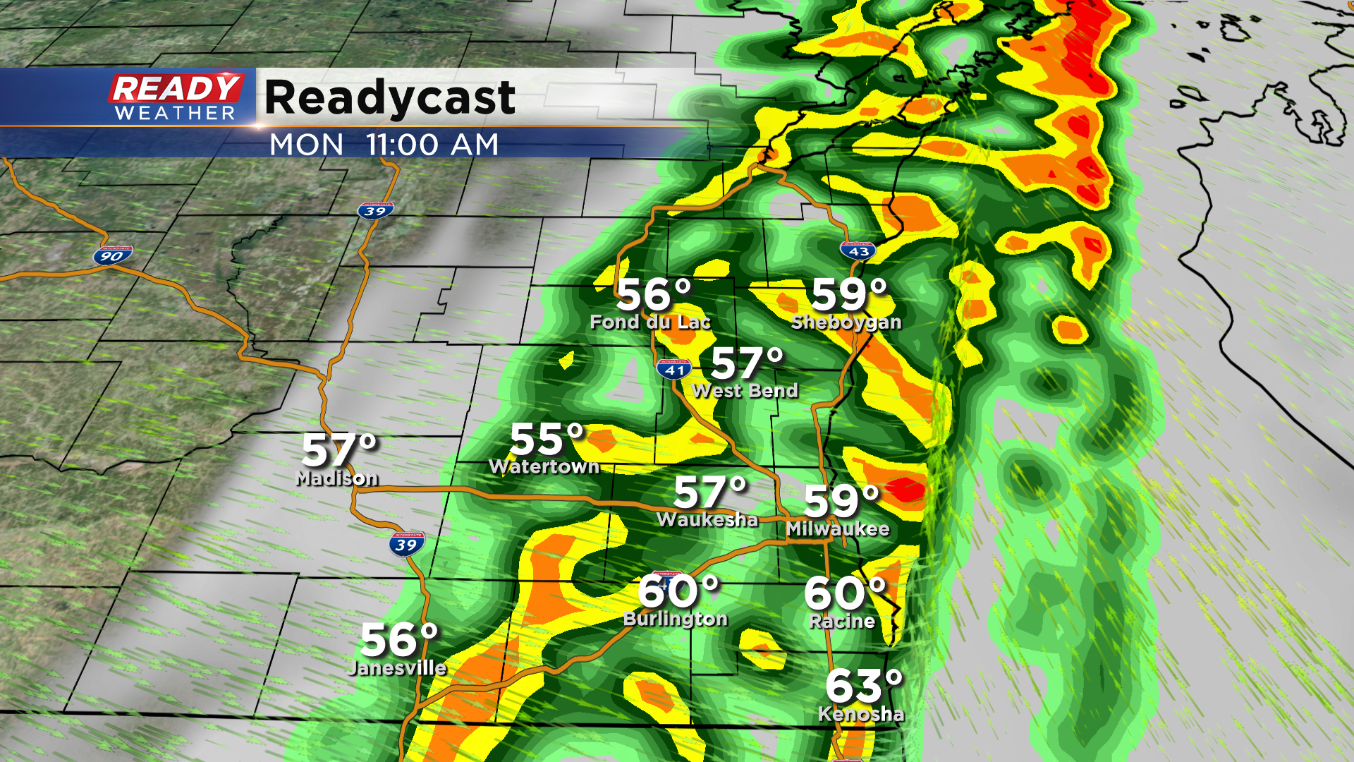
Scattered rain and storms will continue through the morning, exiting the area by early afternoon. Clouds will quickly decrease behind this front, but windy conditions are expected.
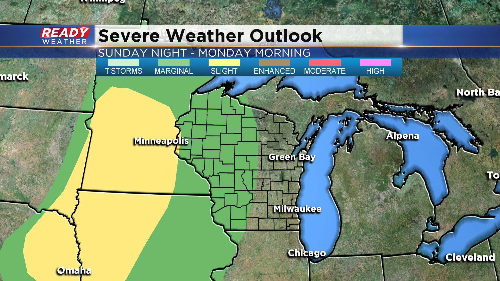
The risk for severe weather remains to our west with this line of storms, but we can't rule out a few stronger cells that may produce small hail or gusty winds.
Between .25-.50" of rain is expected on Monday, which will be a welcomed sight as most of the region hasn't had any rain in over a week.
Temps won't cool much behind Monday's cold front, but a stronger cold front is expected Wednesday night that'll really make it feel like fall for the second half of the week. See how cool temps will be by downloading the CBS 58 Ready Weather App.