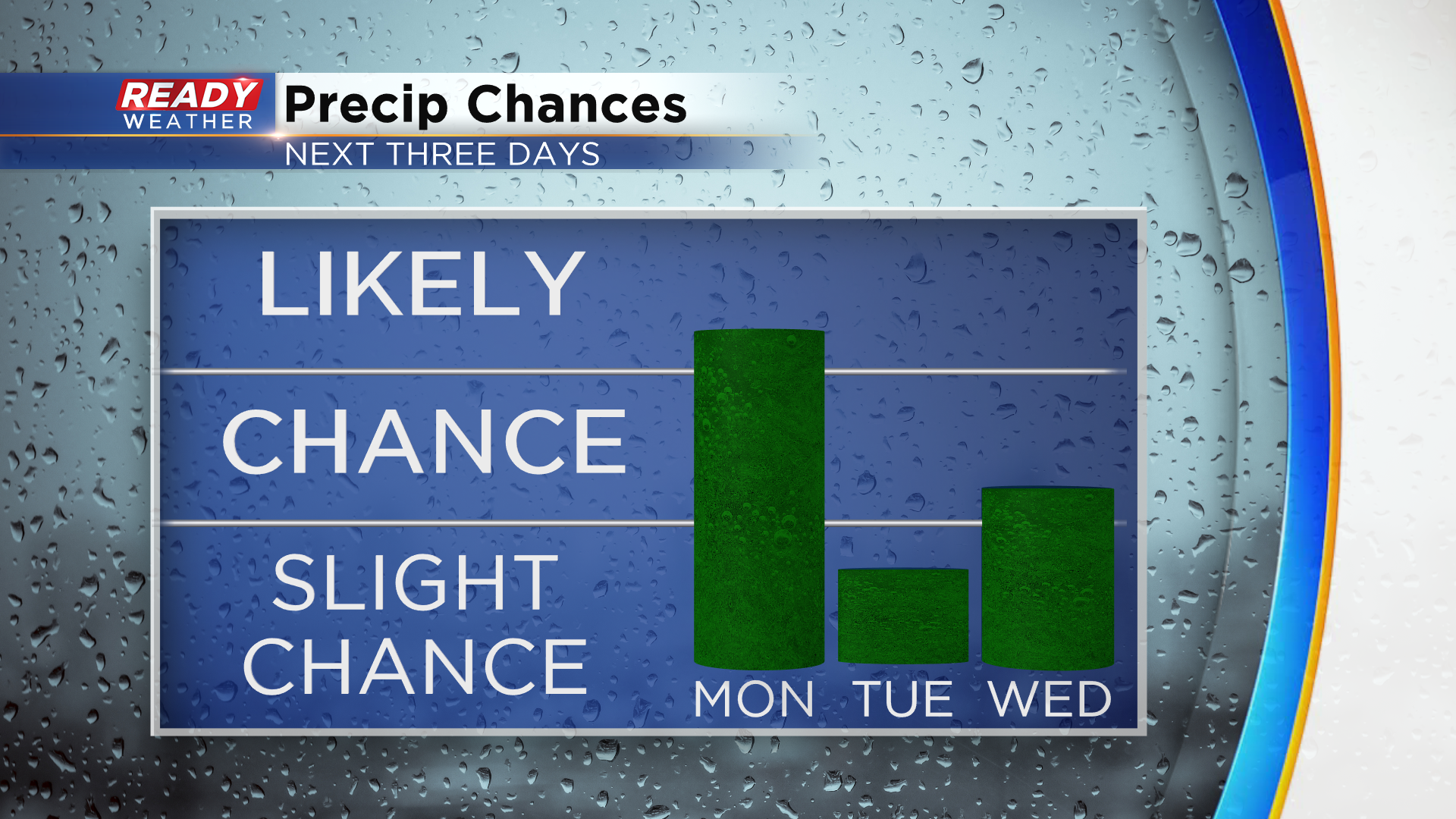
Multiple chances for pop up storms this week with plenty of heat and humidity


10:25 pm update:
Scattered storms are ongoing in northwestern Wisconsin, and a few more are now beginning to develop in southern Minnesota.
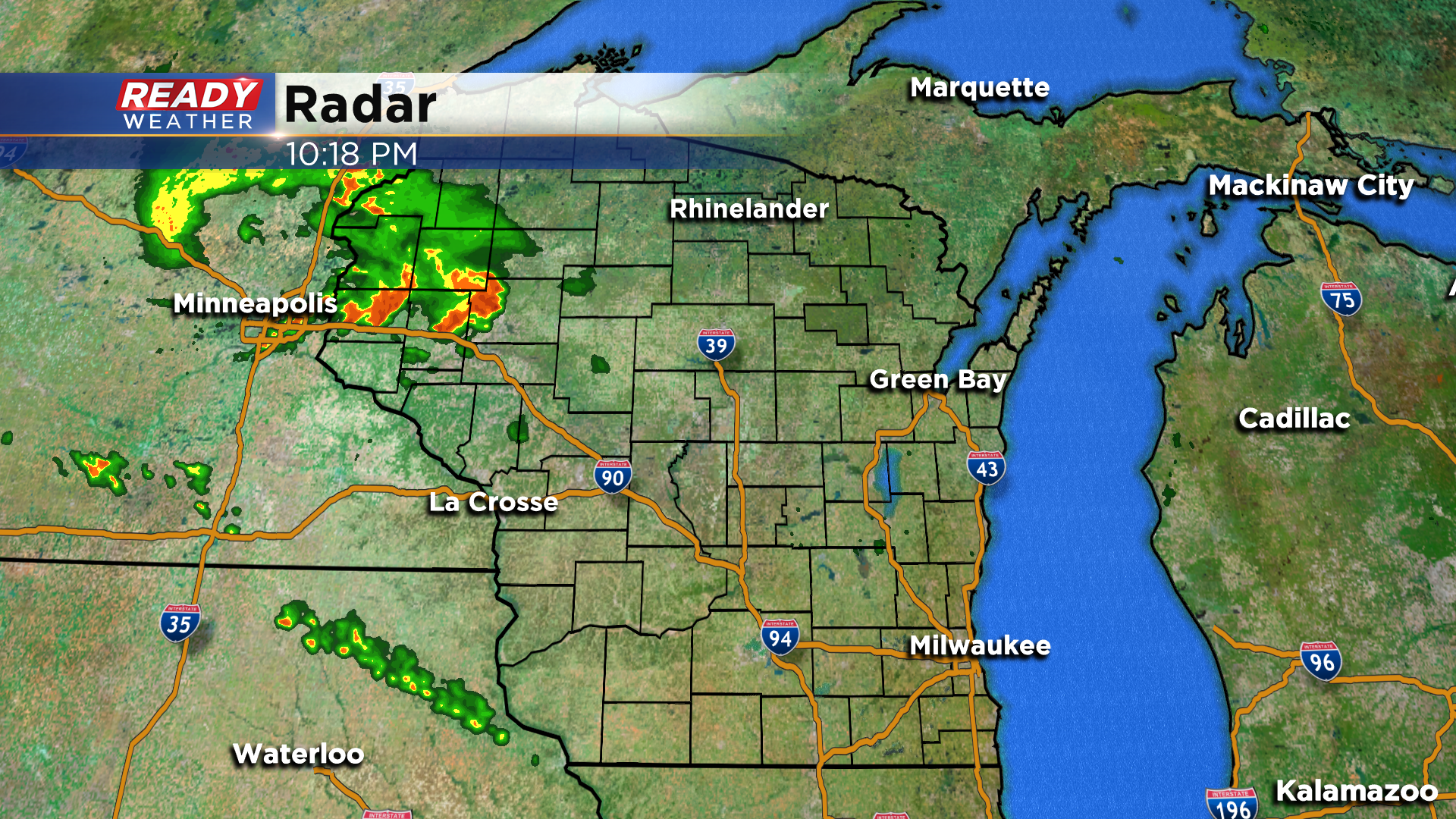
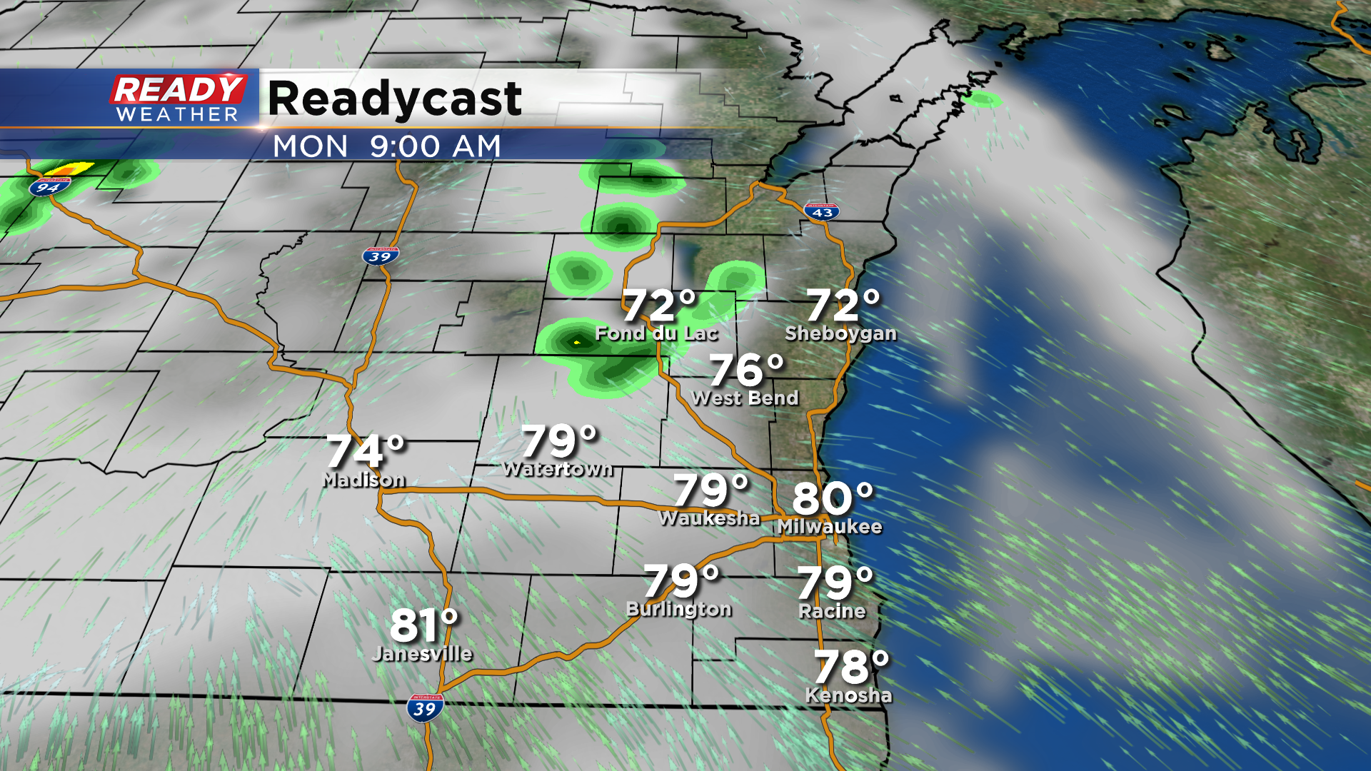
These storms are expected to continue to develop in Minnesota overnight, with a line of storms working into western/northern Wisconsin Monday morning. It looks like most of SE Wisconsin should stay dry through much of the morning, with scattered storm chances returning around midday into the early evening.
----------------------------------------------------------------------------------------------------------
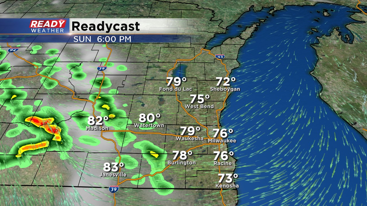
It's been another pleasant day across SE Wisconsin with sunny to partly cloudy skies and a nice ESE breeze. Some of us have gotten a break from the humidity this afternoon, but places south and west of Milwaukee are still quite humid.

Due to this, we can't rule out a shower or storm popping up before 8pm, mainly west of a line from Lake Geneva to Johnson Creek, but most of the area will be dry.
Late this evening our attention will turn to northern Iowa/southern Minnesota where strong to severe thunderstorms are expected to develop.
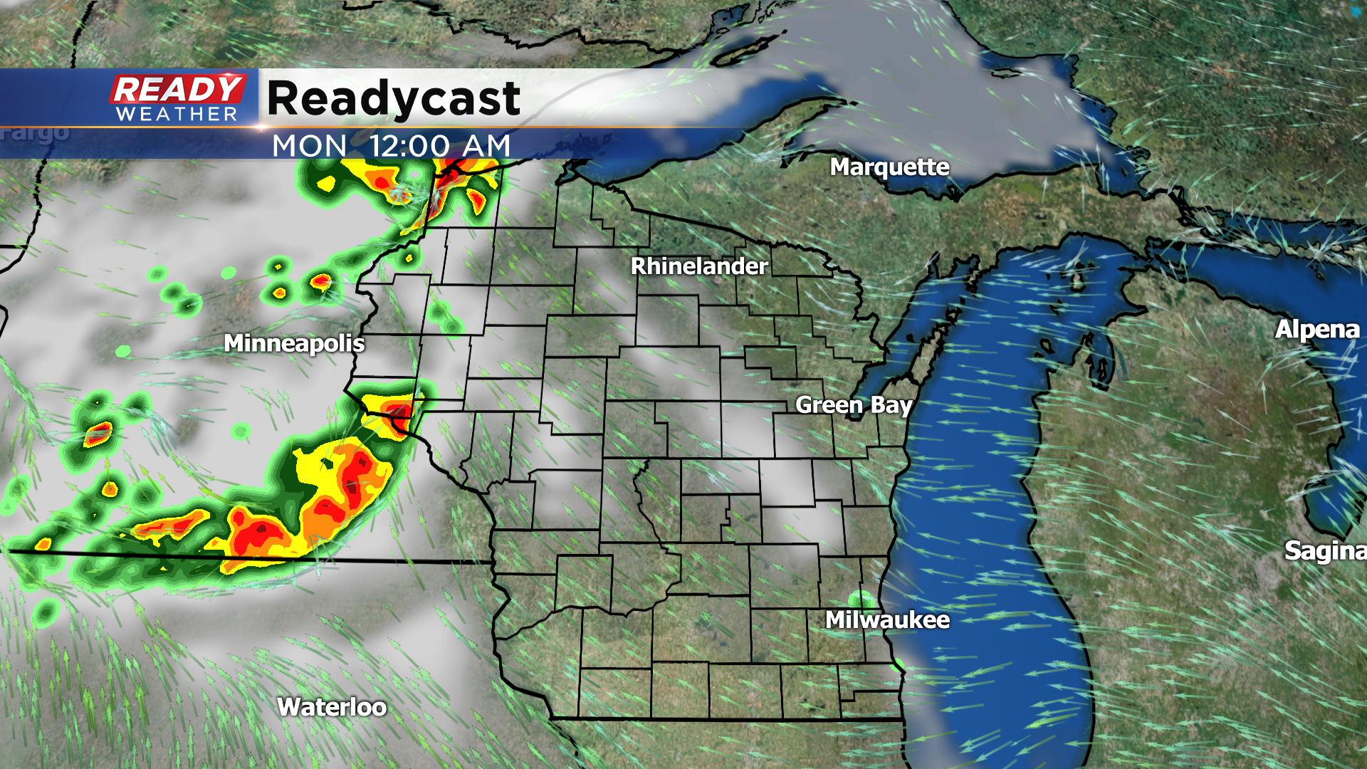
There's still a bit of uncertainty as to exactly where these storms will fire. If they fire farther to the north, closer to the Twin Cities, a complex of storms will track across the northern half of the state after midnight into Monday morning before dissipating. If they do fire right along the MN/IA border, they'll track into western Wisconsin after 4am, but will be weakening as they progress across the state.
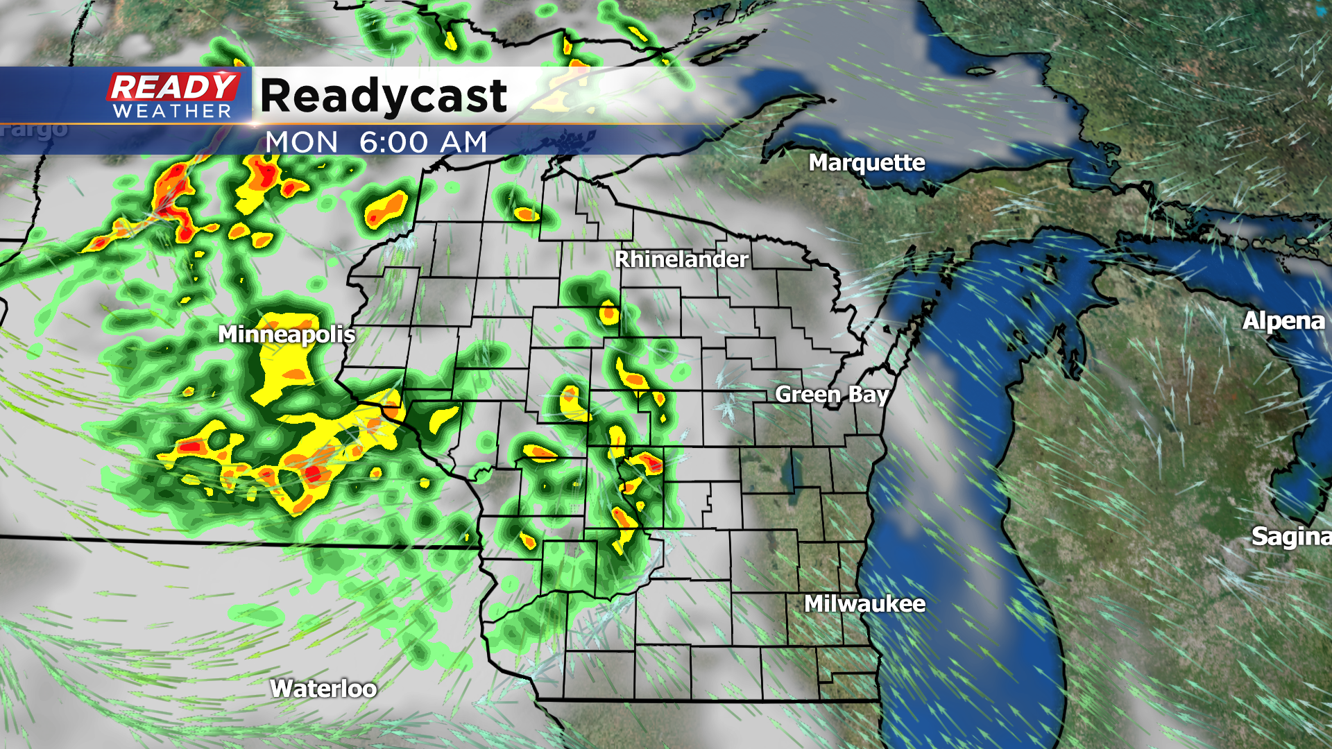
We're expecting most of the showers and storms to fall apart before it reaching SE Wisconsin Monday morning, but if any showers or storms are able to hold together they'd move through the area between 8-11am.
Where these storms ultimately fizzle out will be the focus for more pop up storms Monday afternoon into the evening. Any storms that develop will likely produce very heavy downpours.
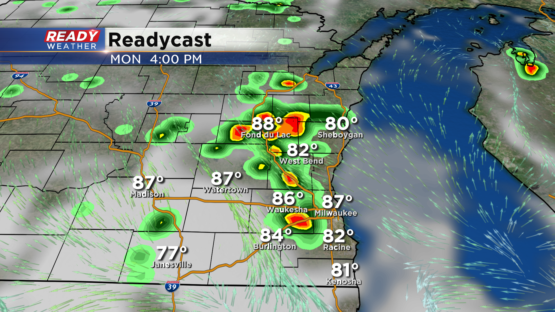
Scattered pop up storms will be possible at times this week, primarily with peak heating of the day in the afternoon as we'll have plenty of heat and humidity around the area.
Highs will range from 80-84° lakeside and 85-90° inland every day this week with muggy conditions making it feel even hotter.

Download the CBS 58 Ready Weather App to track any storms that pop up on radar, and check back for additional updates regarding the Monday morning storm chances.