Multiple rounds of storms, some strong, are possible Thursday and Friday


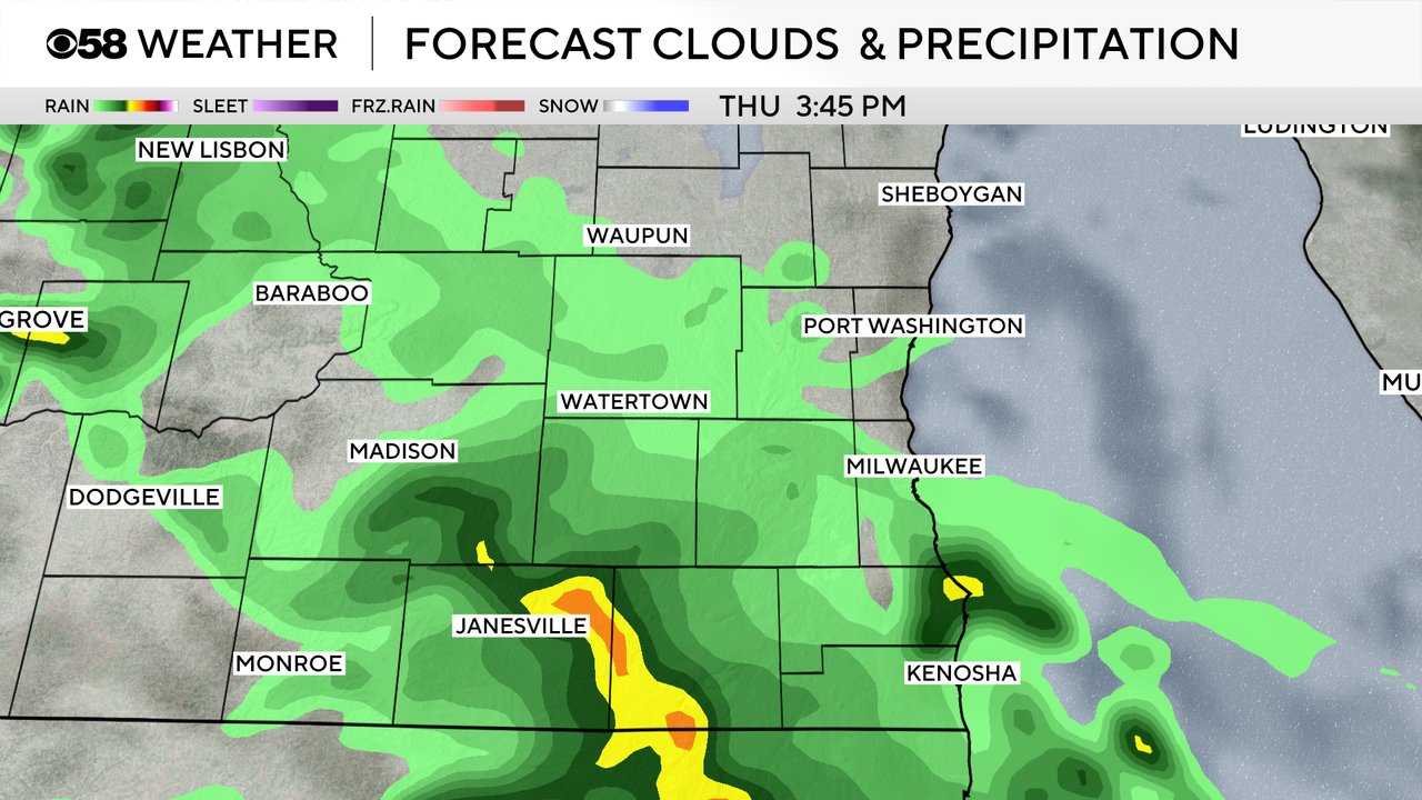
Thursday morning starts off dry with some sunshine but the end of the day could be much different. A few rounds of storms will be possible both Thursday and Friday. The best chance for storms to start will be in the mid to late afternoon hours of Thursday. Most of these storms won't be strong but could include some small hail and downpours.
One question mark in the forecast is whether or not we see a cluster of storms late Thursday night into early Friday morning. A few weather models show this cluster rolling through southeast Wisconsin between 2-5 AM. If that cluster does form they could be loud storms with lots of lightning, heavy downpours, strong wind and hail.
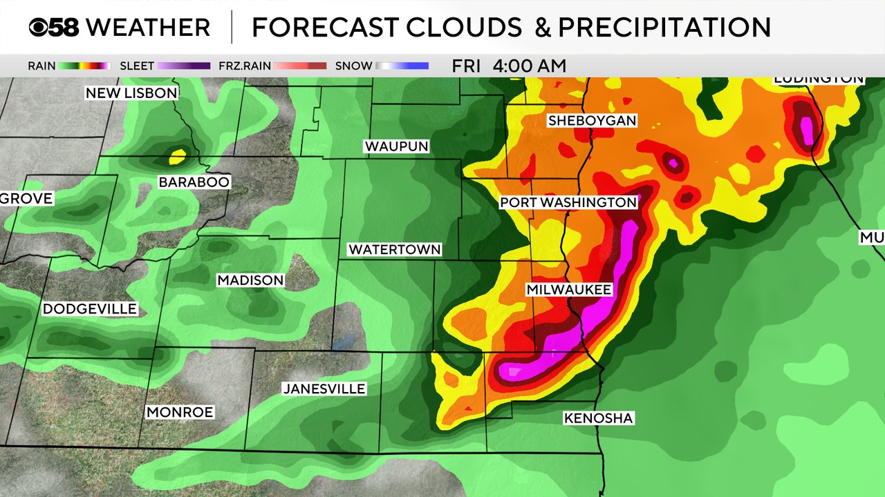
If the early morning cluster of storms Friday does happen it may decrease our chances for any additional storms Friday afternoon and evening. But if the storms never form then a round of storms Friday afternoon/evening would be more likely.
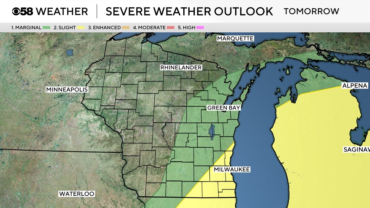
For Thursday there is a Level 1 Marginal Risk for severe weather in western Wisconsin but the better severe risk for southeast Wisconsin will be on Friday when most of our southern and lakeside counties are included in a Level 2 Slight Risk and our northern and western counties are in the level 1 Marginal Risk.
For any storms that do become strong to severe on Friday gusty wind and hail will be the primary threats but an isolated tornado cannot be completely ruled out especially for any storms Friday afternoon/evening.
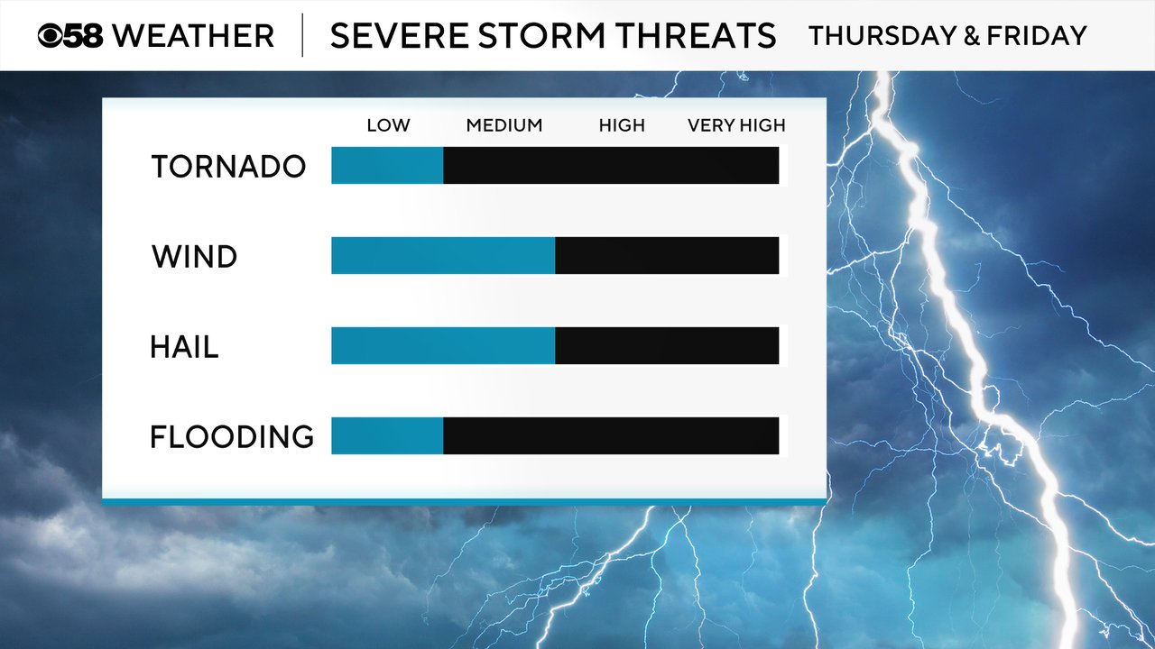
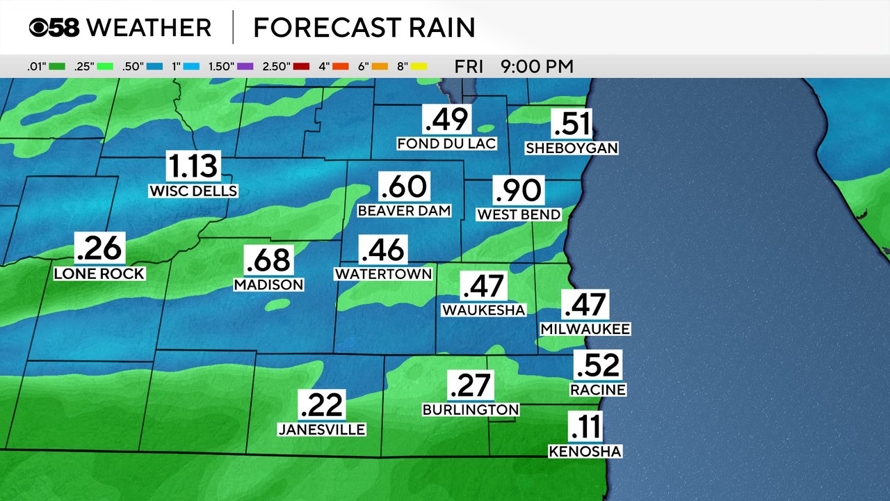
Flooding is not a big concern with the storms Thursday and Friday as rain totals mainly stay between 0.25-0.50" for most of southeast Wisconsin. But areas that see big storms could get as much as an inch.
Download the CBS 58 Weather app to track the storms with the interactive radar.