Near record lows Friday morning with another chance at records Monday and Tuesday


We are in the middle of our second cold blast of air in just over a week. Lows Friday morning reached the single digits in some spots with our first sub-zero wind chills of the season. The record low for Friday in Milwaukee is 12° set back in 1991. As of 7 a.m. the low so far in Milwaukee is 15°, just 3° away from the record.
So far this November, every day has been below-average and according to the National Weather Service, it is the 7th coldest start to a November on record. Temperatures will warm up slightly over the weekend with highs on either side of 40°. The "warmth" is still about 10° below-average and doesn't last long. By Monday and Tuesday our third cold blast arrives with the coldest temps of the season.
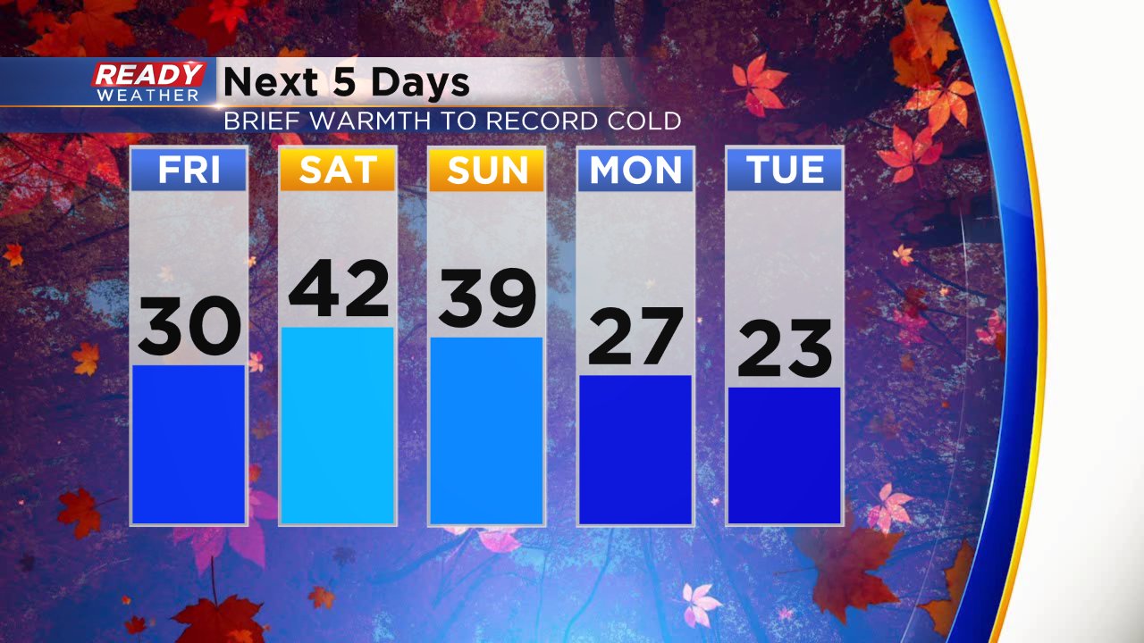
We are back on record watch to start the work week for the low temps and record cold high temps. With the current forecast, the forecast lows for Monday and Tuesday look about 5° above the records set back in 1986. The cold high temps are where records could fall. The current record coldest high for Monday is 26° set in 1986 and the forecast is 27°. Tuesday has an even better shot with a record cold high of 23° set in 1940 which is exactly the forecast.

After the cold blast Monday and Tuesday we warm back into the 30s the rest of the week. There are starting to be signs that this deep cold plunge we've been in for weeks will break just before Thanksgiving. The latest temperature trend from the Climate Prediction Center gives Wisconsin a 70-80% chance of below-average temps. That's better than the 90% chance it was showing the past two days.

Download the CBS 58 Ready Weather app to keep checking the 10-day to see when some more seasonable air might return.