


Wednesday could be the warmest day of the year so far. Currently that belongs to Saturday, March 5th when we got into the middle 60s. 60s look pretty good for everyone today with even a chance at the upper 60s.
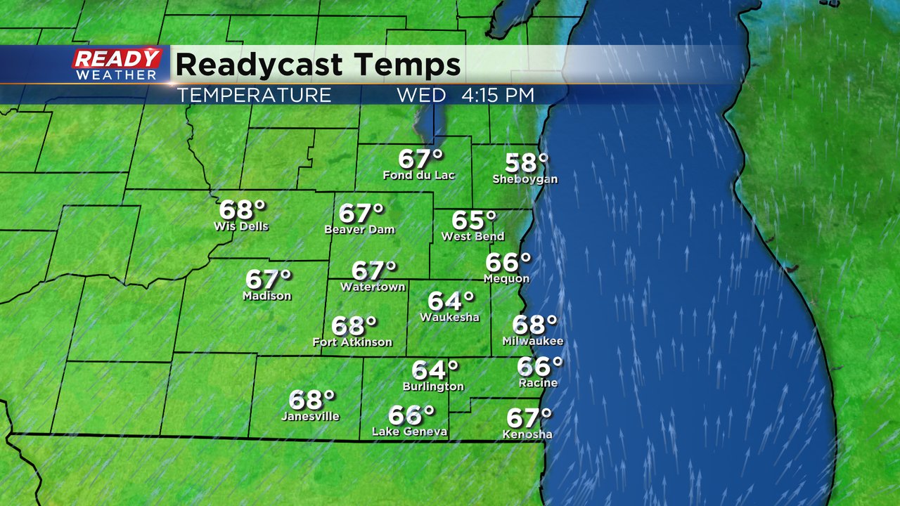
Upper 60s would get close to records. The current record is 71* set back in 1930 and 2015.

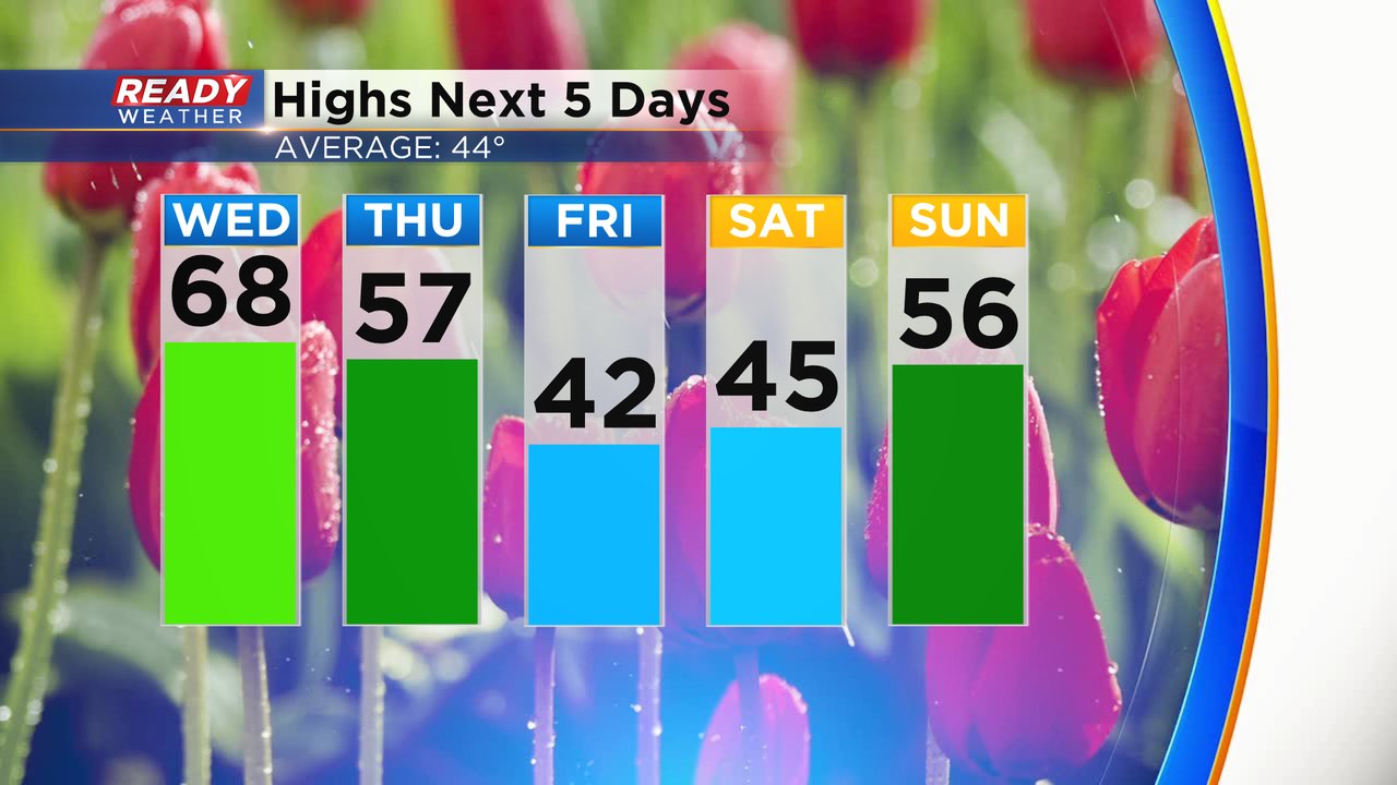
Even after a very warm day on Wednesday, Thursday is also going to be mild with highs in the 50s. The end of the week will drop into the low to the middle 40s, closer to the average high of 44*. Both of those days could see a lake breeze return. Sunshine returns for Sunday for the start of Spring with highs back into the middle 50s.
Enjoy the sunshine and warm weather on Wednesday because the weather turns a lot more active for the end of the week. A few rain showers are possible in the afternoon/evening of St. Patrick's Day. Those showers will switch or mix with snow on Friday and Saturday. The chance for accumulating snow is increasing for at least part of our viewing area.

Download the CBS 58 Ready Weather app to see how warm it will be where you live and track the latest trends with the end of week storm.