Off and on showers and isolated storms continue through Monday


A few light showers have been passing through southeast Wisconsin from time to time today with a more widespread area of light rain moving in late this afternoon.
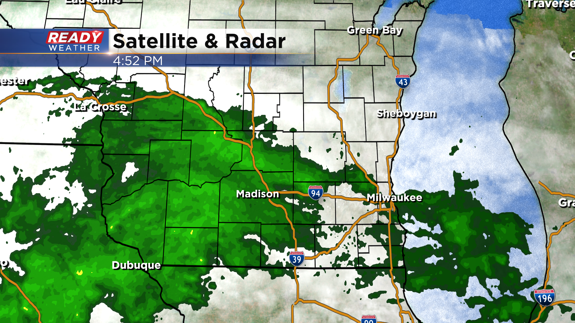
Waves of rain will continue to track through tonight into Sunday morning, with the band of rain gradually lifting northward and into northern parts of the area by midday Sunday.
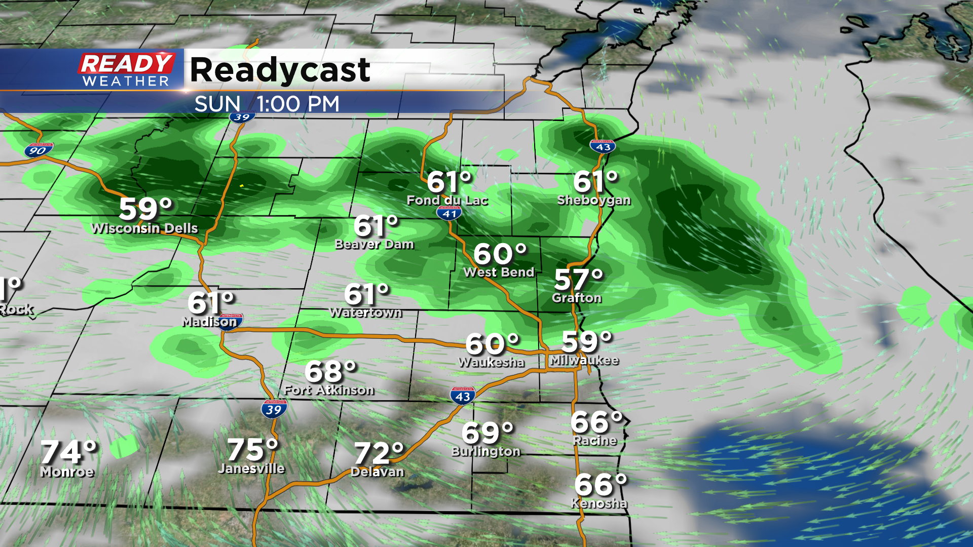
The best window for dry time on Sunday will be from midday through late afternoon for most of the area, but we still can't rule out a few isolated showers like today.
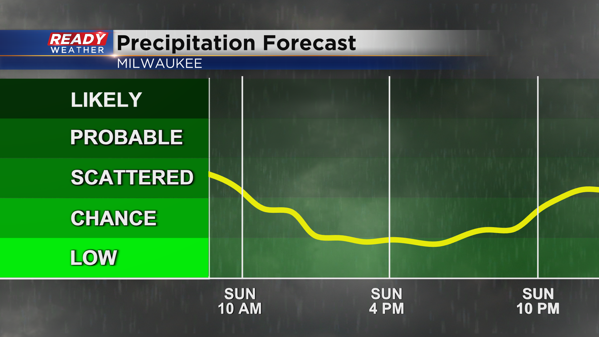
Rain will ramp back up Sunday evening/night and continue into Monday as a low pressure system tracks through the area. Scattered shower and isolated storm chances will continue until the cold front passes sometime Monday afternoon.
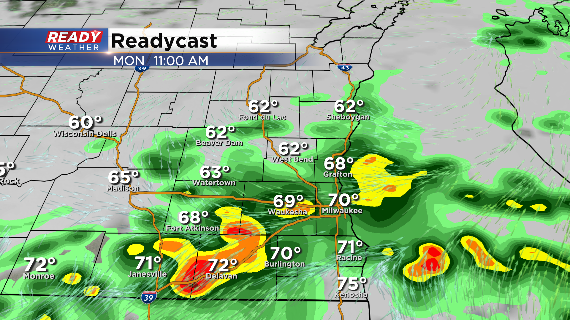
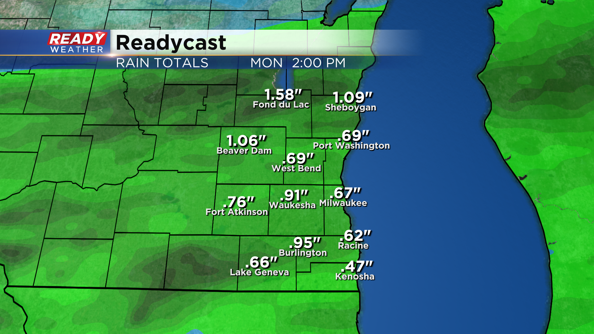
Around .15-.35" of rain is expected through midday Sunday with an additional .25-.75" of rain Sunday evening through Monday. There could be localized spots that pick up over an inch due to more persistent rain or multiple storms.
Either way, you won't have to water your gardens or lawns for a few days! The clouds and showers will hold temps in the upper 60s to low 70s through the start of next week. Download the CBS 58 Ready Weather App to track the waves of rain.