One last warm day before cool temperatures arrive

-
2:54

’Don’t understand the logic’: Local response to USDA cutting...
-
1:22

Video shows Kia being stolen in broad daylight, leaving Milwaukee...
-
2:35

UW-Madison may lose federal funding for ’antisemitic discrimination’
-
3:09

Milwaukeeans reflect on 5-year anniversary of COVID-19 pandemic
-
1:54

Former Bucks player Junior Bridgeman dies after suffering medical...
-
2:00

Wisconsin officials remind travelers about REAL ID requirements...
-
1:52

Education Department to cut about 50% of workforce
-
0:57

Waukesha County students take part in interactive health care...
-
1:57

’People are dying every single day on our roads’: Milwaukee...
-
1:17

Body found near Mama Mia’s in West Allis, police say death...
-
1:38

ZinnDahlia Designs hosts pop-up workshops to create framed wall...
-
4:02

Milwaukee creator named to TikTok’s The Discover List 2025

There's some up and downs when it comes to temperatures this August, but nothing too drastic. We've had one day that hit 90° - August 5th. The coldest high temp so far has been August 14th when we hit 74°. Through August 20th, we've had 13 above-average days, four days right at average and three days below-average. Currently the average temp is exactly 73° which would make it the 20th warmest August on record if the month ended today.
Temperatures are showing some signs of cooling down. Highs are only expected to be in the low to middle 70s from Thursday through Sunday.

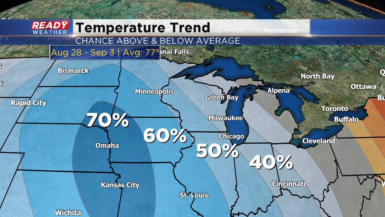
We could see a little warming as we go into next week with a high right around 80° to start the new work week. The temperature trend to end August and go into September, which does include Labor Day, shows a 40% to 50% chance for below-average temps in Wisconsin. Think more lower 70s rather than upper 70s.
Download the CBS 58 Ready Weather App to see that full 10-Day forecast.