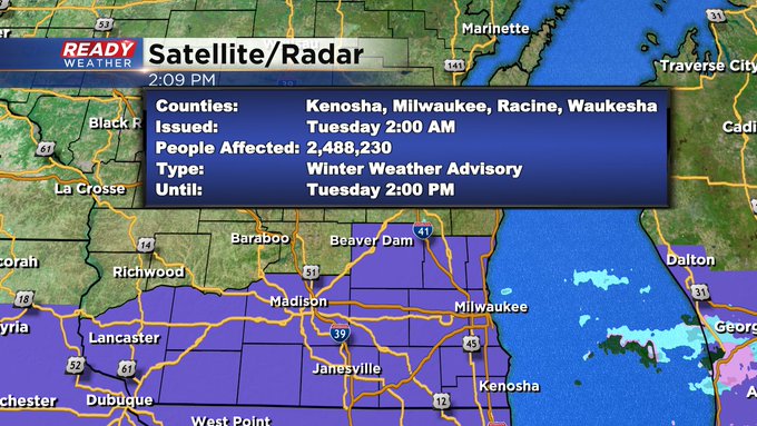
Update: Winter Weather Advisory Issued for Tuesday


As of 2pm the National Weather Advisory has issued a Winter Weather Advisory for the mixed precipitation on the way tomorrow.
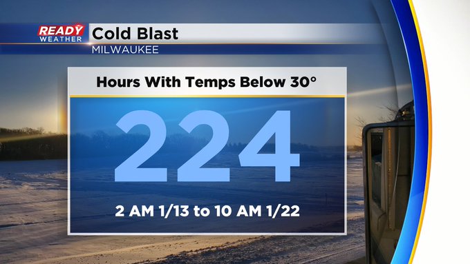
On the other hand at least the cold blast is over!
---------------------------------------------------------------------------------------------------------------------------------------------------
Well the temperatures may have started to finally warm up but now the precipitation chances have returned. A few areas of snow, sleet and freezing rain have rolled into southeast Wisconsin Monday morning with slippery roads reported across most of southeast Wisconsin. A dusting of sleet and snow will be possible Monday morning then during the afternoon some pockets of drizzle and freezing drizzle depending on the temps will be possible.
Here's a look at the winter road conditions that will update with time:

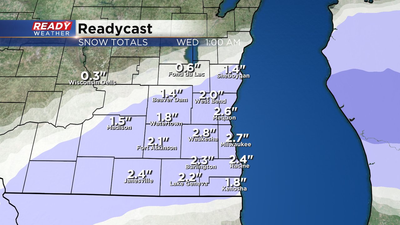
Monday night into Tuesday morning another round of wintry weather will roll in from the south. There could be some sleet and freezing rain mixing in to start but this will be mostly snow in areas north of I-94 and mostly rain/snow mix Tuesday morning in southern counties. By late Tuesday morning this will switch to all wet snow for southeast Wisconsin that lasts through the afternoon.

About 1-3" of wet snow will be possible on Tuesday with most of the accumulation from mid-morning through late afternoon. All of the commutes over the next 48 hours will be impacted. Slick roads for the Monday morning and afternoon commutes and some snow covered roads during the commutes on Tuesday.
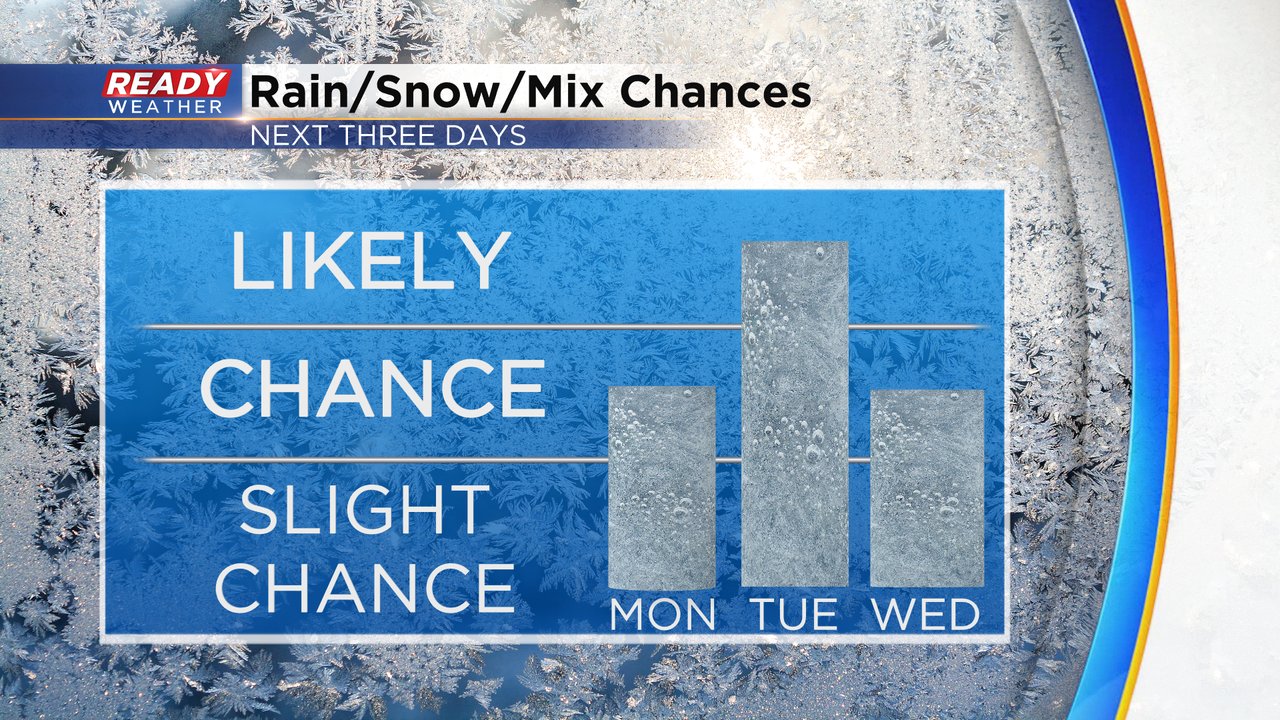
The precipitation chances will continue through Wednesday and Thursday. Monday it's mostly freezing rain, snow and sleet, Tuesday is mostly rain and snow with a little sleet and has the best chance for accumulation, Wednesday and Thursday will be mostly rain.
Download the CBS 58 Ready Weather app to track all of the different precipitation types with the interactive radar.