


It's a wet start to this Tuesday with a round of showers and storms rolling through southeast Wisconsin. So far, the steadiest rain has been in our northern counties where most of Fond du Lac and Sheboygan Counties have seen steady rain since 3 AM. The Milwaukee/Waukesha and areas south hasn't seen as much steady rain or storms but still plenty of scattered showers.
Here's a radar image that will update with time:

The morning rain likely lasts through the late morning hours. The best chance for some dry time Tuesday will be during the afternoon and early evening but another round of storms and rain is likely late Tuesday evening through early Wednesday morning.

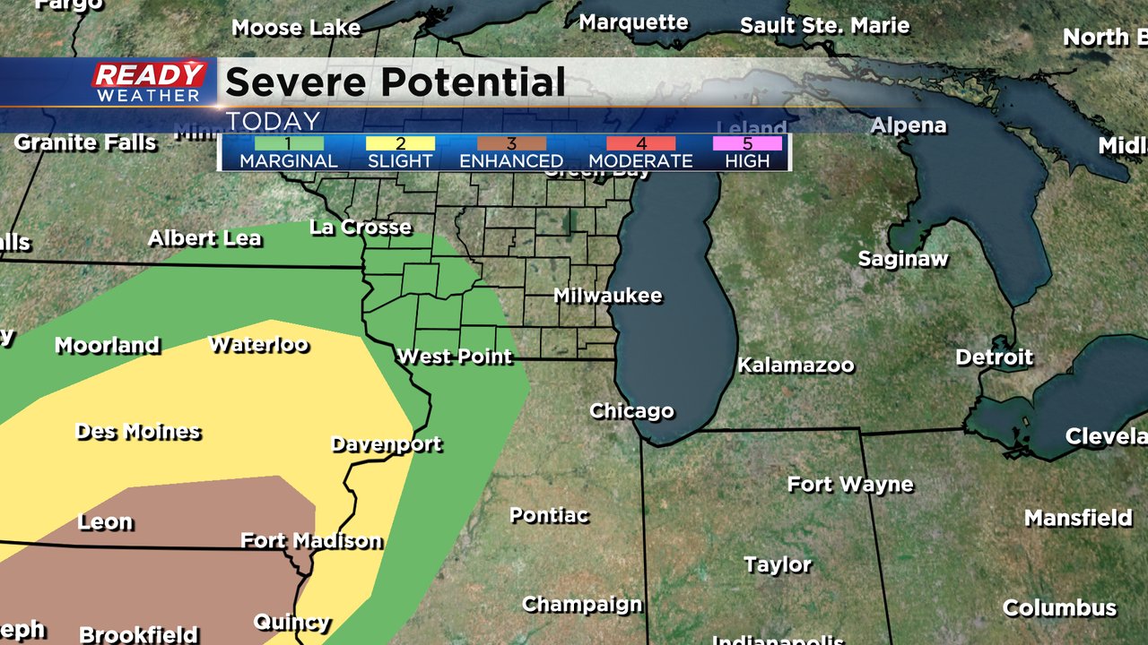
There's no big chance locally for any strong to severe storms with a Level 1 Marginal risk west of a line from Baraboo to Madison to Janesville and including no counties in southeast Wisconsin. The best chance for severe weather across the country will be in southern Iowa and northern Missouri.
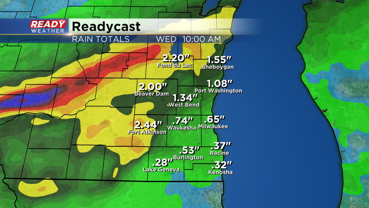
Heavy rain will be the biggest threat with any storms that develop Tuesday. Some northern and western counties could see 1"-2"+ of rain with the rest of southeast Wisconsin getting at least 0.25-0.50".
Download the CBS 58 Ready Weather app to track the rain throughout the day.