


Although there have been more clouds in the area today, it's still been dry and pleasant with lighter winds and temps around 60 degrees. It's been 8 days since we've had any rain in the area, but that will come to an end on Monday as a cold front moves across the state.
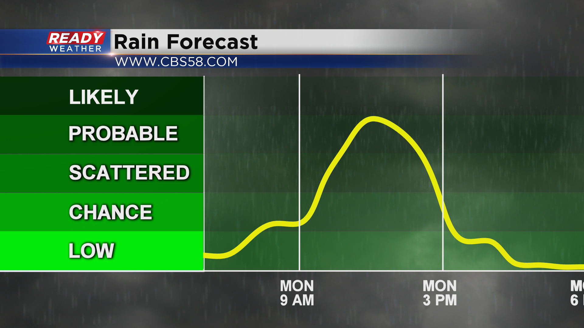
Dry conditions are expected overnight and to start the day Monday, but the line of rain and storms will start moving into our western counties between 10-11 am.
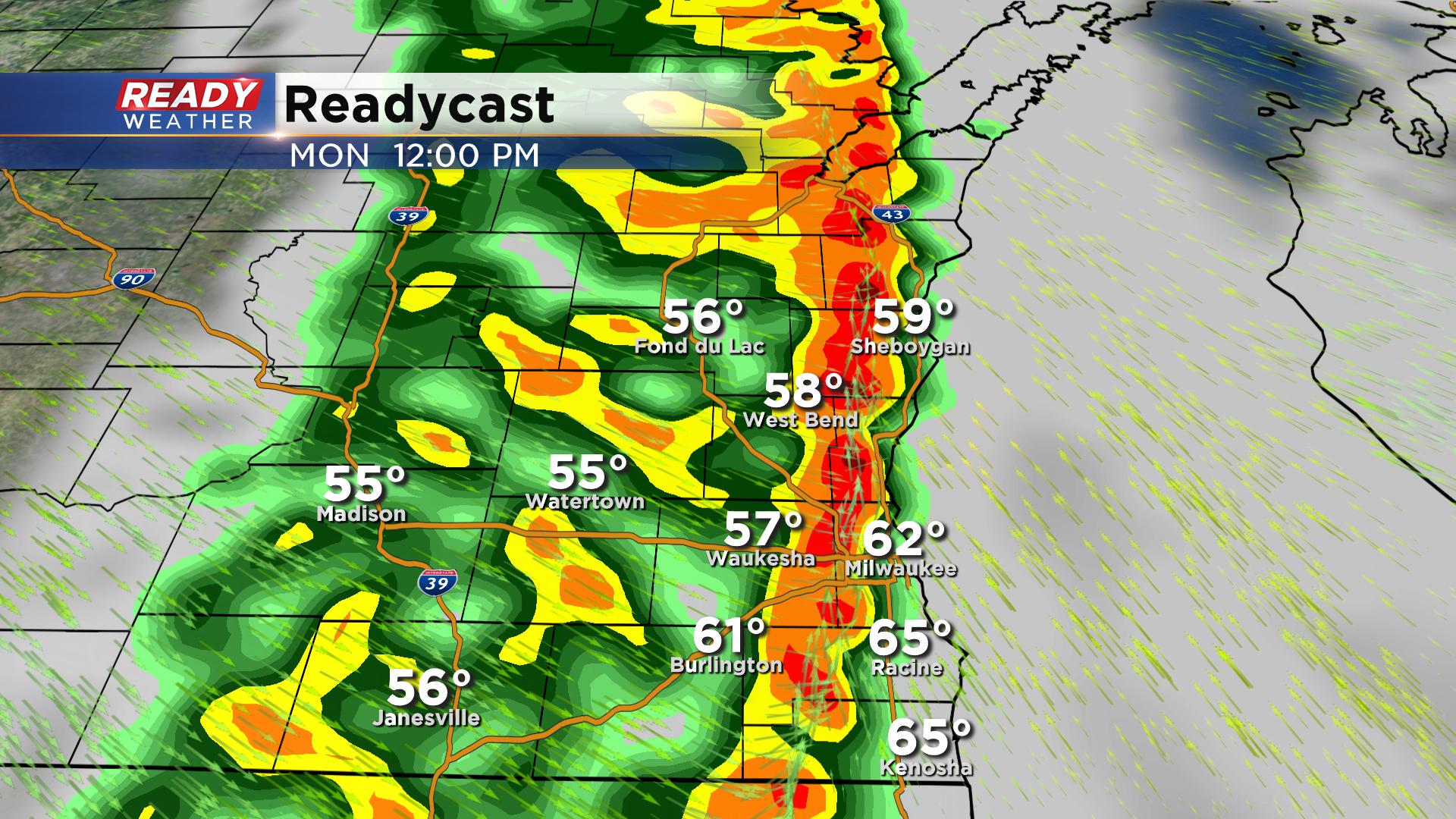
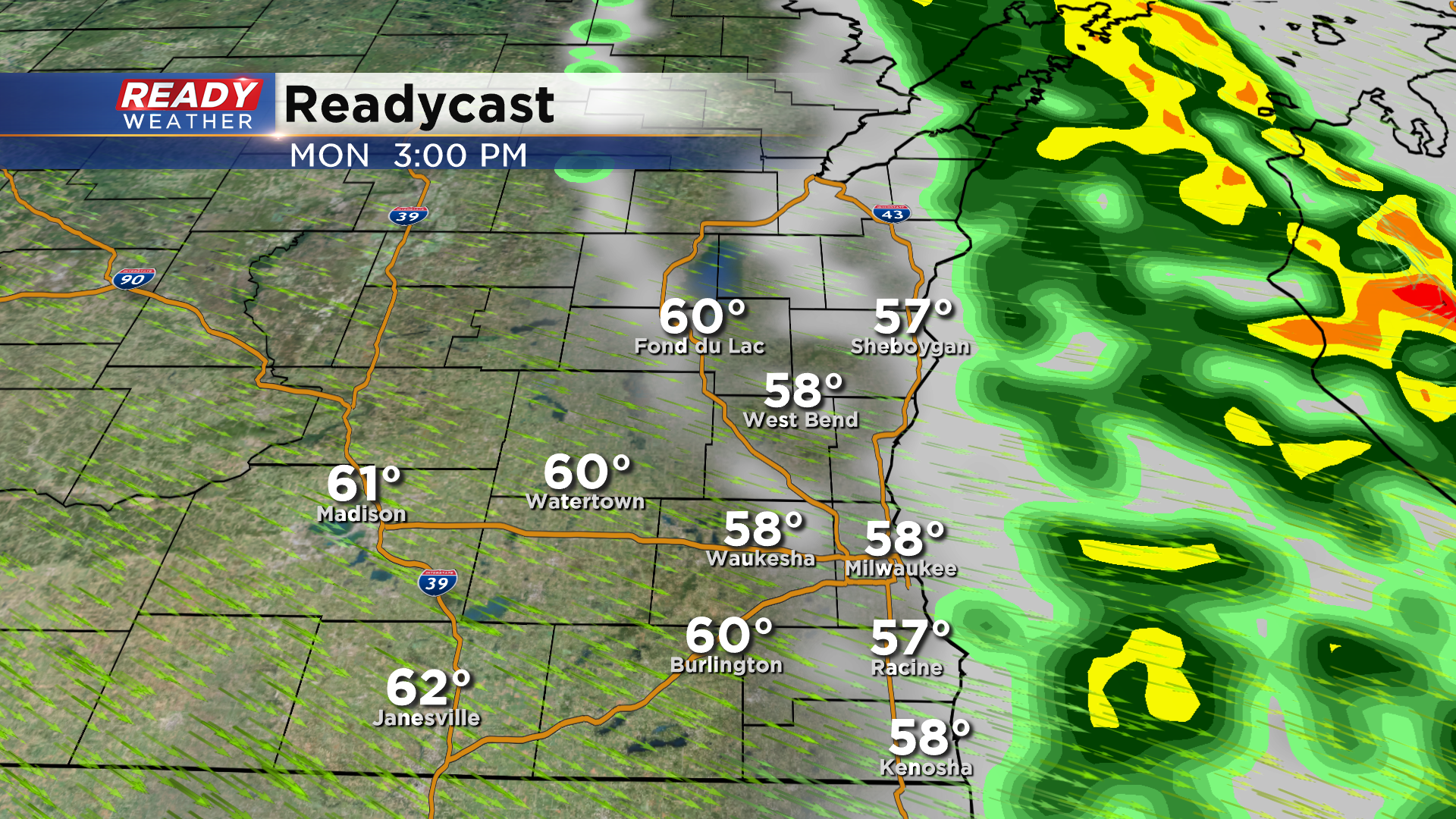
Rain will be most widespread around midday as the cold front pushes through, with showers tapering off between 2-3 pm. Skies will clear out quickly behind the rain during the afternoon.
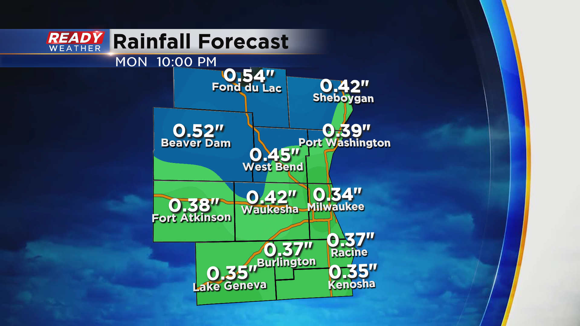
Most of southeast Wisconsin is about .75" below normal for rainfall this month. Monday's rain will make a good dent in that deficit as .30-.60" of rain is expected.
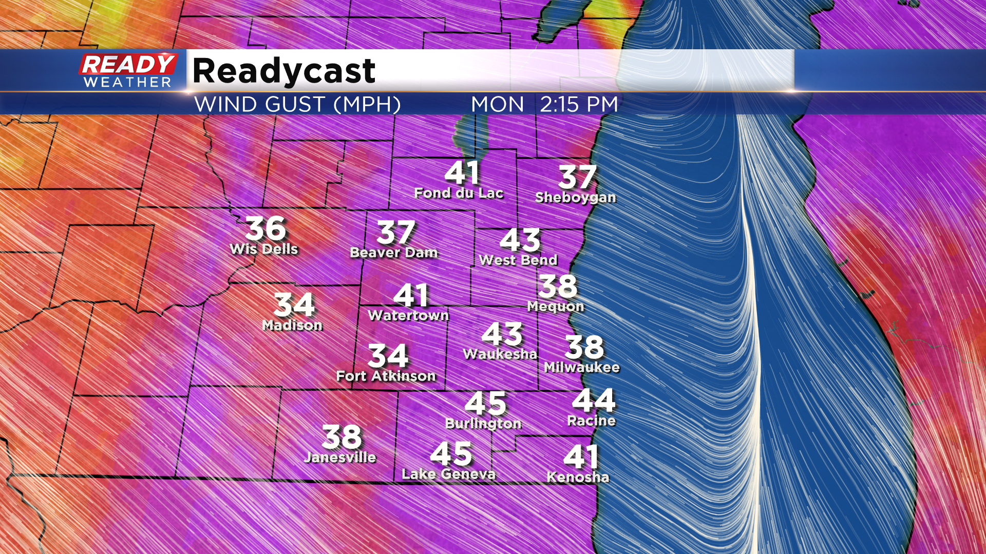
Although we aren't expecting severe weather, strong winds are expected right behind the cold front Monday afternoon. Winds could gust over 40 mph at times.
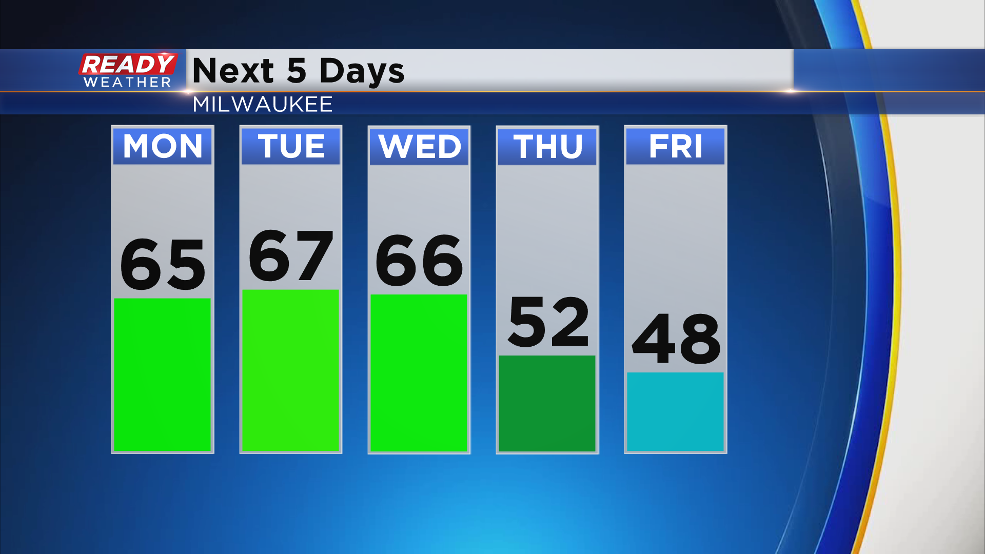
Another cold front will move through Tuesday afternoon, but it'll move through dry and just bring some breezy winds into the area. A stronger cold front moves through Wednesday night, bringing some of the coldest air so far this season into the state for the second half of the week.
Download the CBS 58 Ready Weather App to see if the cold air will continue into next weekend.