Soaking rain and storms return tonight through Thursday
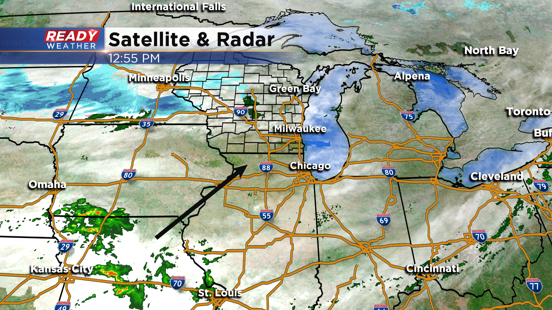
Our latest round of showers moved out overnight after dropping around .10 - .20" of rain. Dry weather with a mix of sun and clouds is expected through the rest of the afternoon, but we won't stay dry for long. Scattered rain and storms currently in Missouri will work back into the area later this evening, which will kick off a rather active 36 hours of weather across southeast Wisconsin.
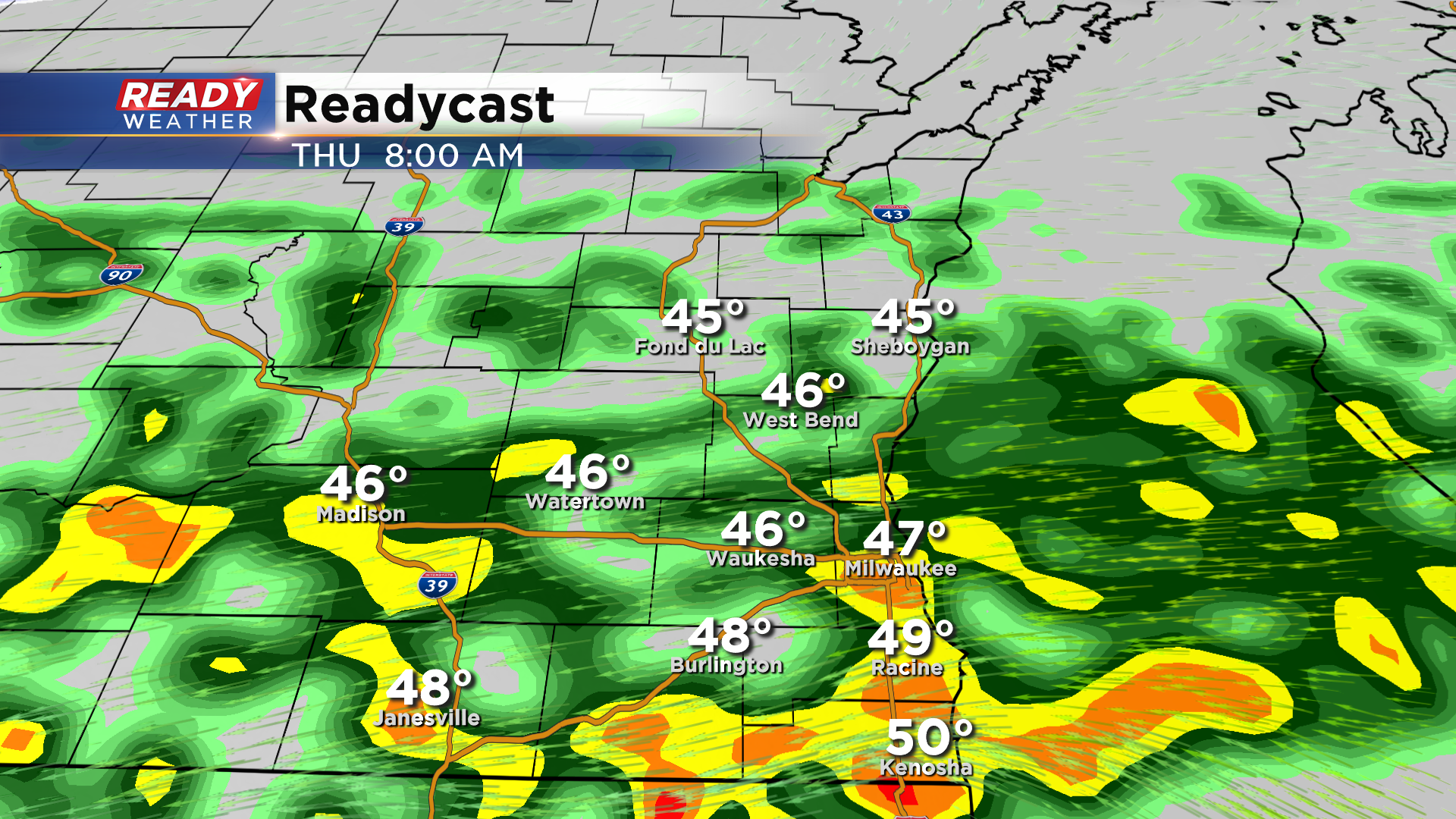
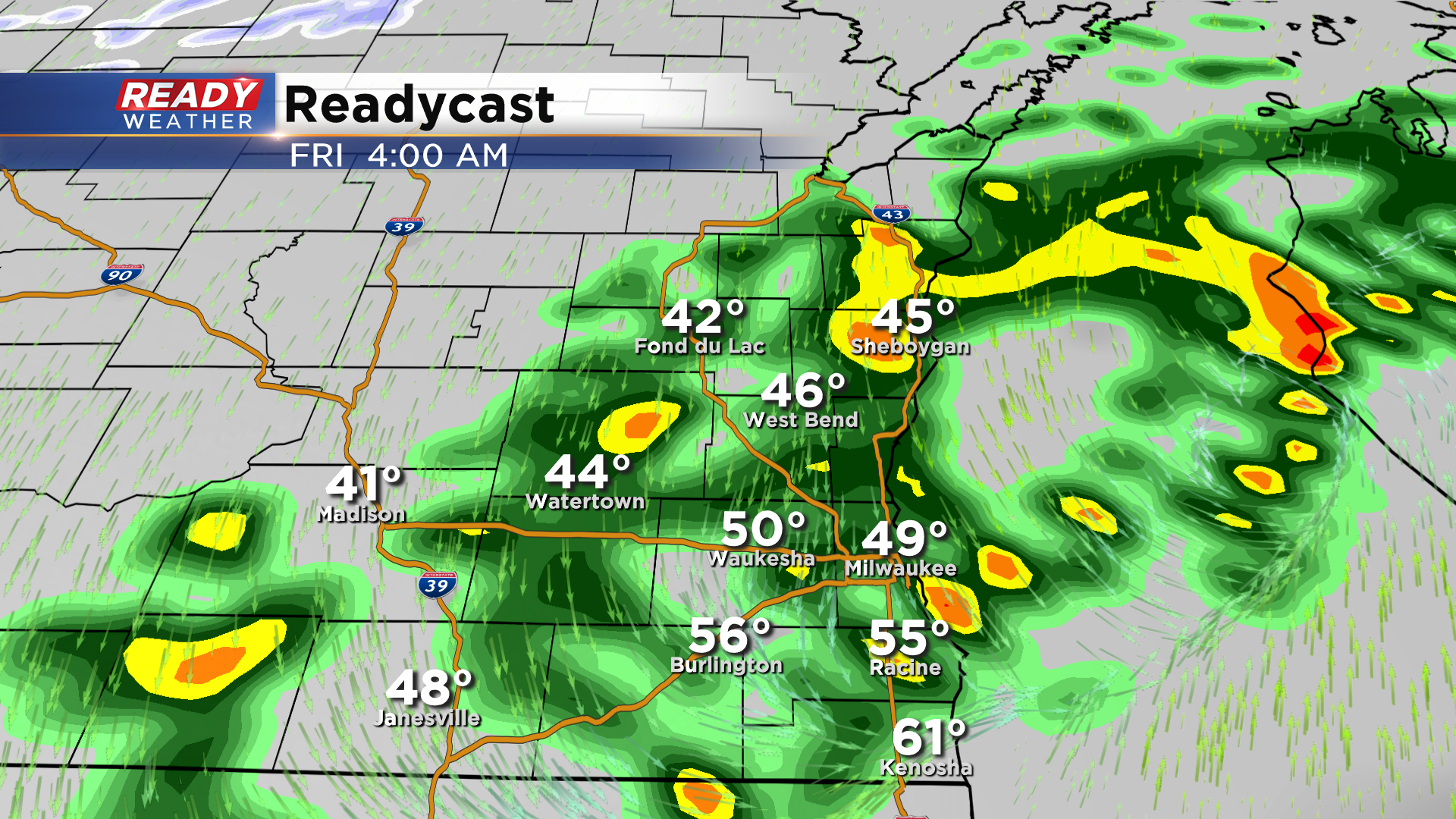
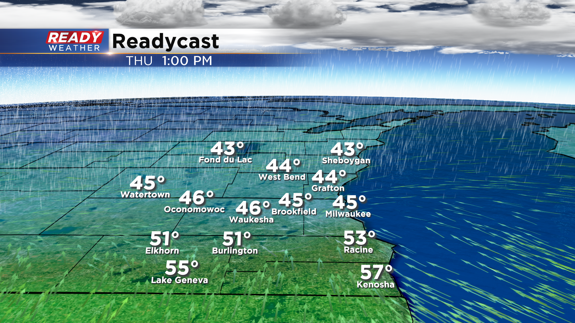
The rain and storms will become widespread overnight through Thursday morning and could drop some fairly heavy rain at times through the morning commute.
The rain and storms will start to shift northward later in the afternoon as a warm front lifts into the state.
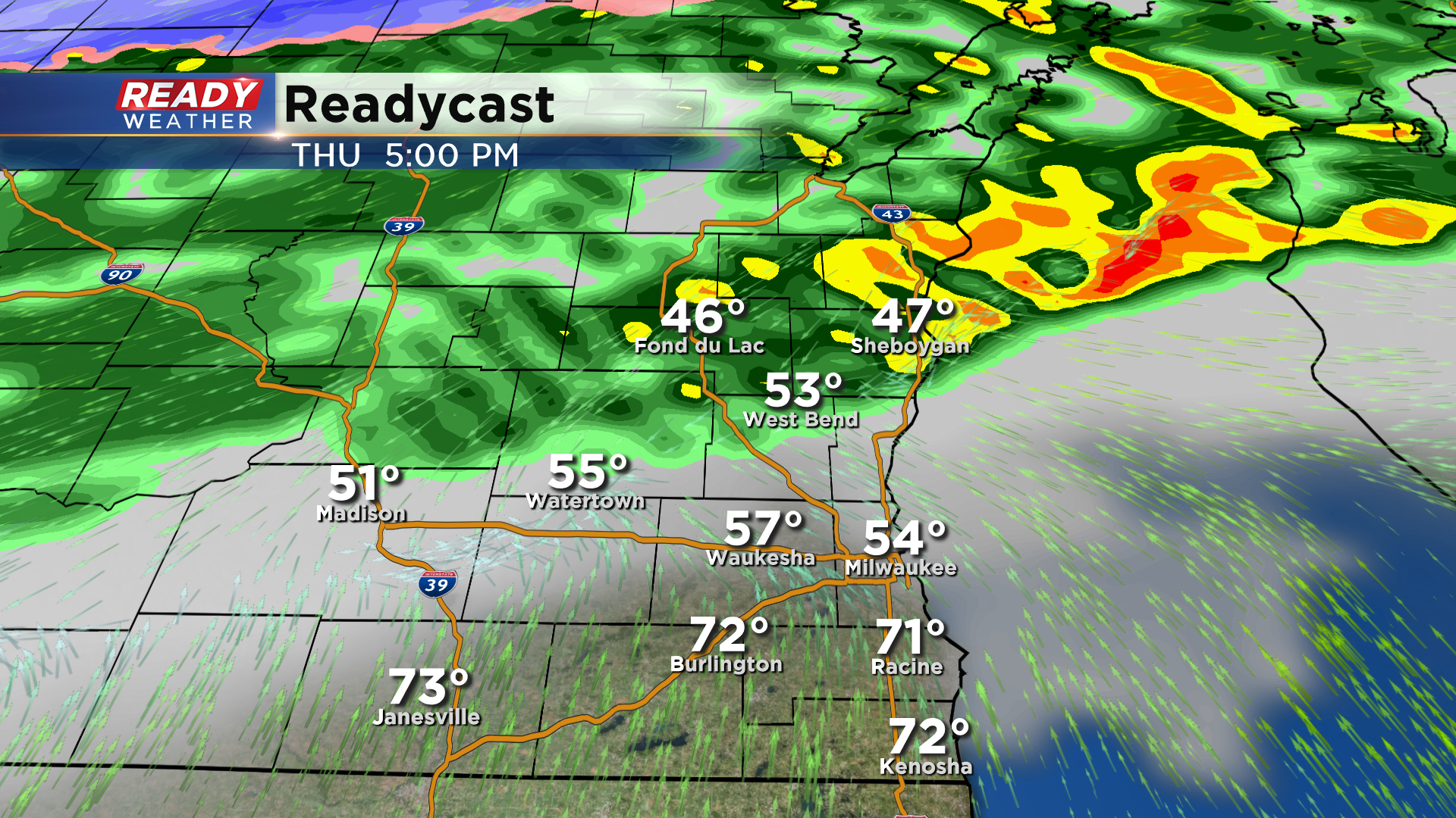
There’s some uncertainty as to how far north this front will get, which will determine if the whole area sees a break in the rain or not. There will likely be a dry period from Milwaukee southward Thursday evening, but areas north/northwest of Milwaukee not have any break in the rain.
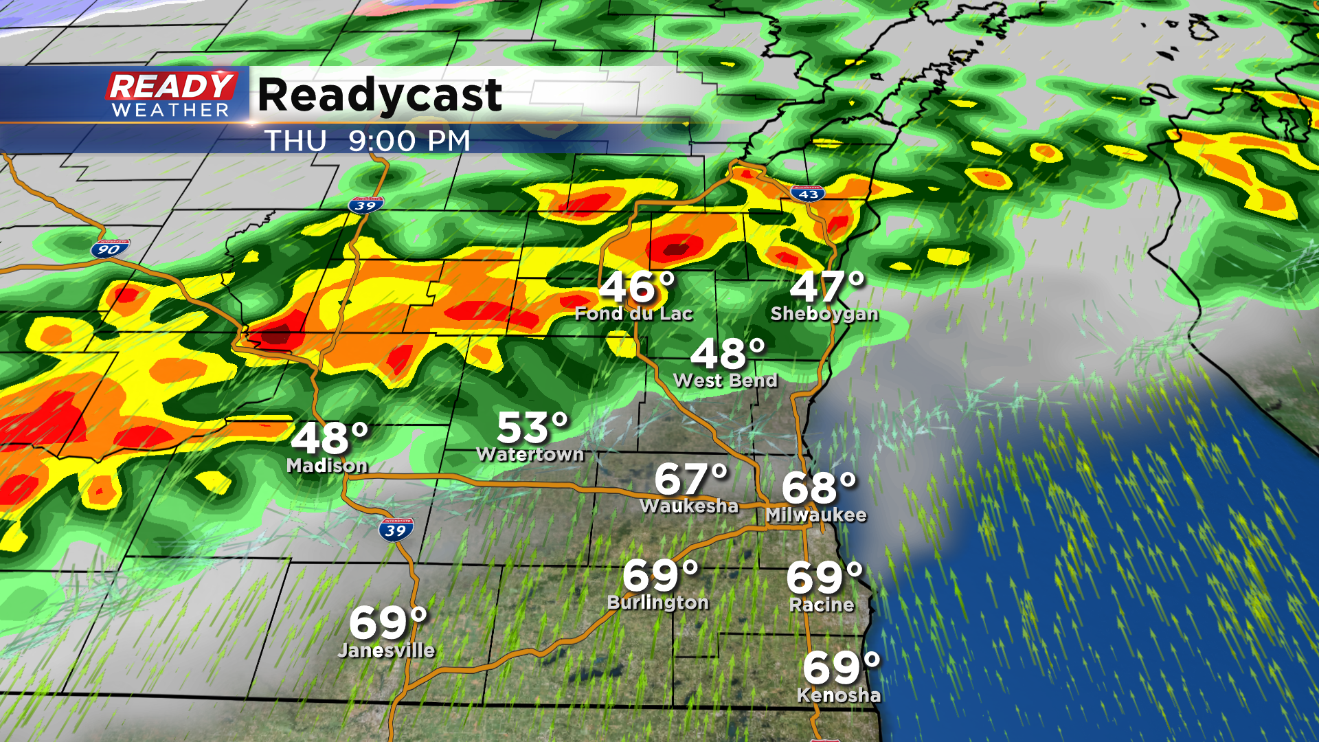
Rain and storms will move back in Thursday night and taper off from west to east Friday morning as the cold front with this system swings through the state.
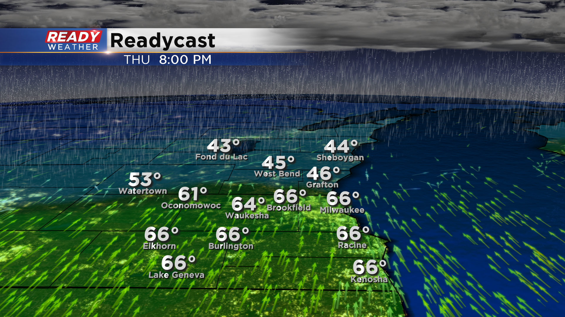
Although our forecast calls for a high in the mid 60s on Thursday, it won't feel that way until the evening. Temperatures will be stuck in the 40s to low 50s underneath the showers and fog tomorrow afternoon.
However, areas along and south of I-94 will see temps jump into the mid to upper 60s during the evening behind the warm front.
Temps will crash back into the 40s Friday morning behind the cold front and remain there through the weekend.
Between .75-1.50" of rain is expected tonight through Friday morning, but higher amounts of 2" or more will be possible in training storms and closer to the Fox Valley where there may not be a break in the rain.
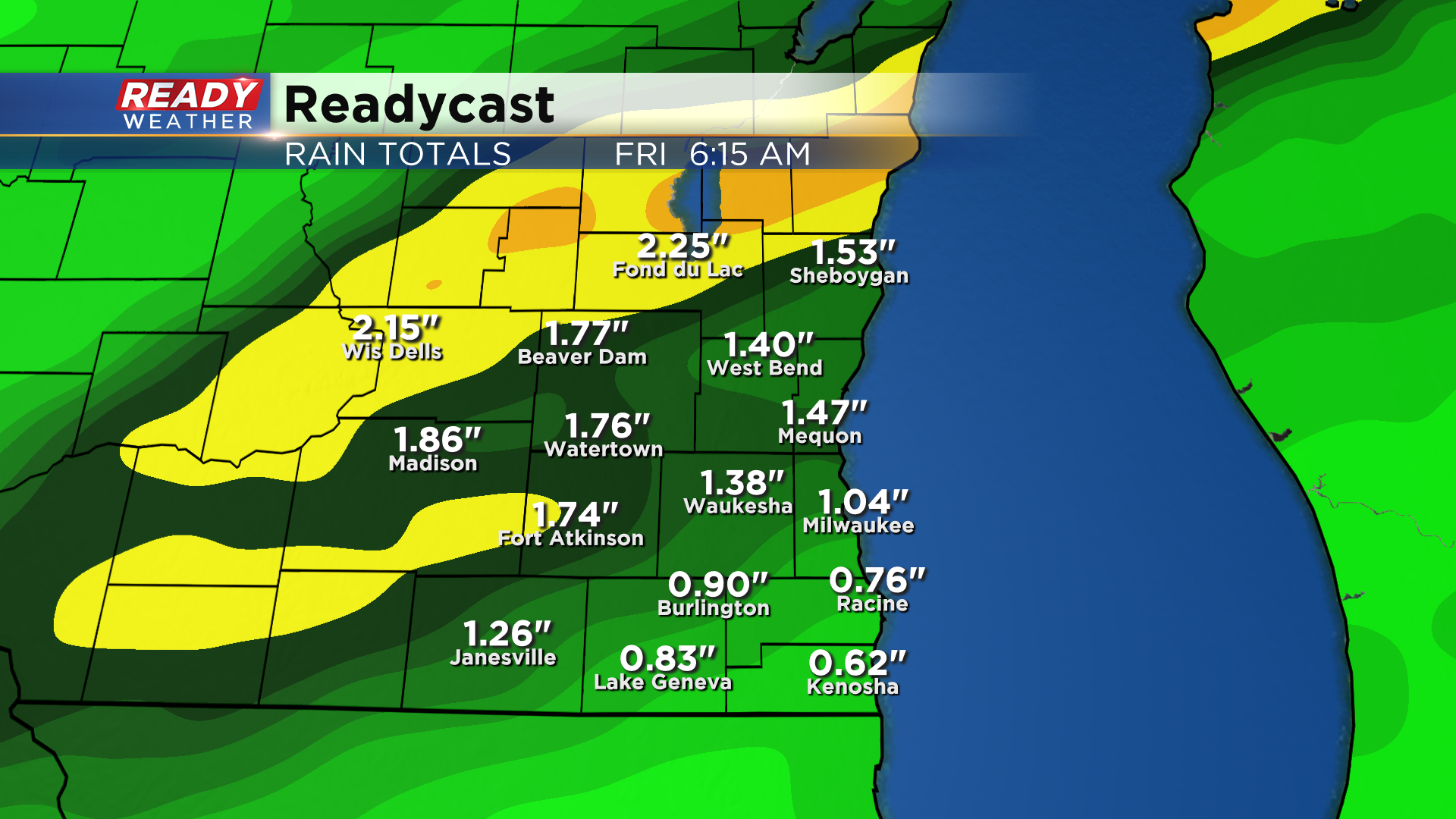
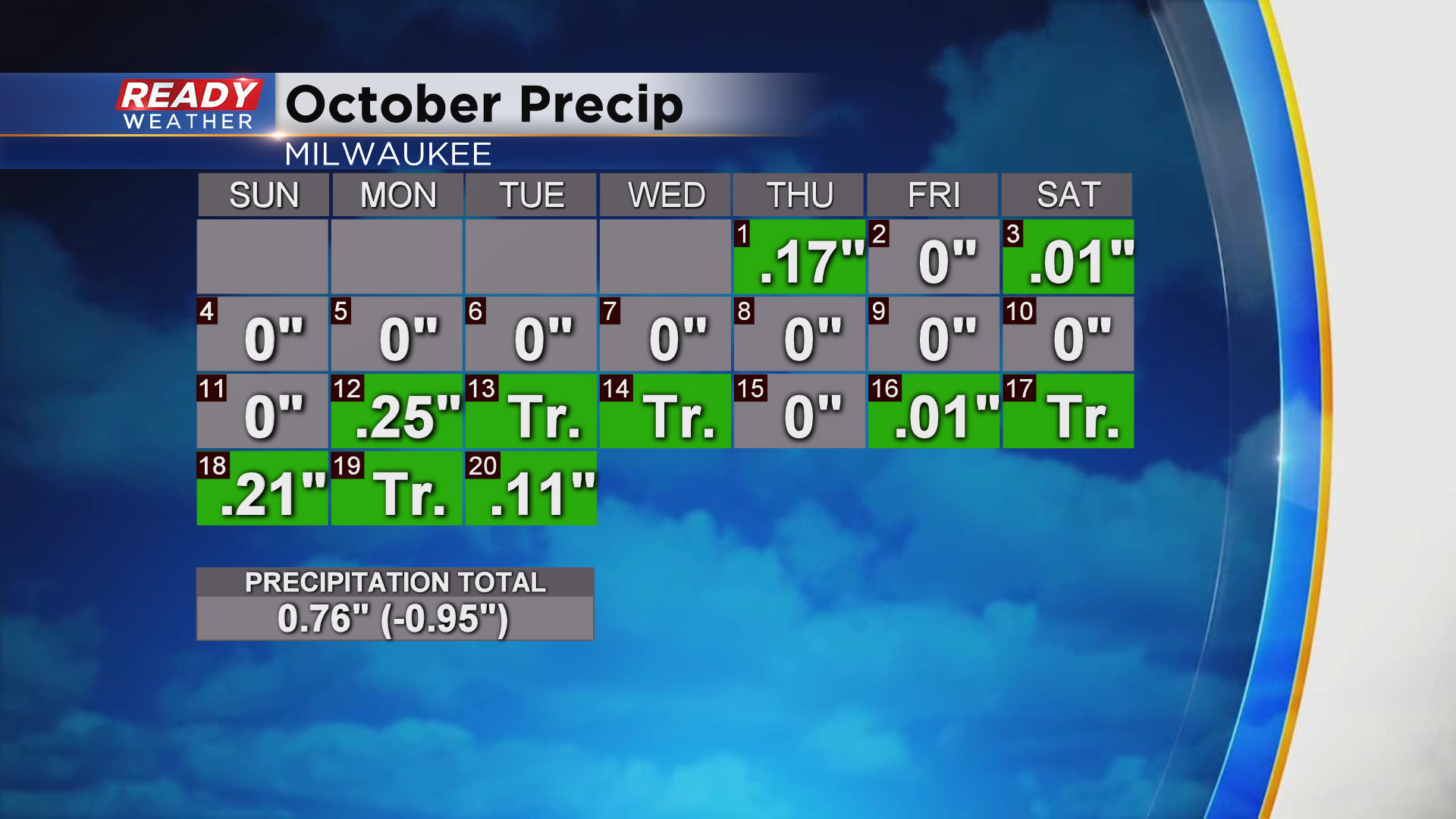
Although we've been in an active weather pattern, there hasn't been a ton of rain recently, so the looming soaking rain shouldn't cause any flash flooding. Milwaukee is nearly an inch below normal for rainfall in October, and 1.51" below normal since the beginning of September.
Watch out for ponding on the roads during the Thursday morning commute, and download the CBS 58 Ready Weather app to track the storms.
