


Temperatures have stayed mild since the weekend with highs in the low 50s. Highs will stay in the 50s for Tuesday before warming up into the 60s on Wednesday. Thursday will be the day when temperatures fall from the 60s early in the morning to 40s by mid-morning and 30s by the end of the day. A seasonable chill returns for the weekend.

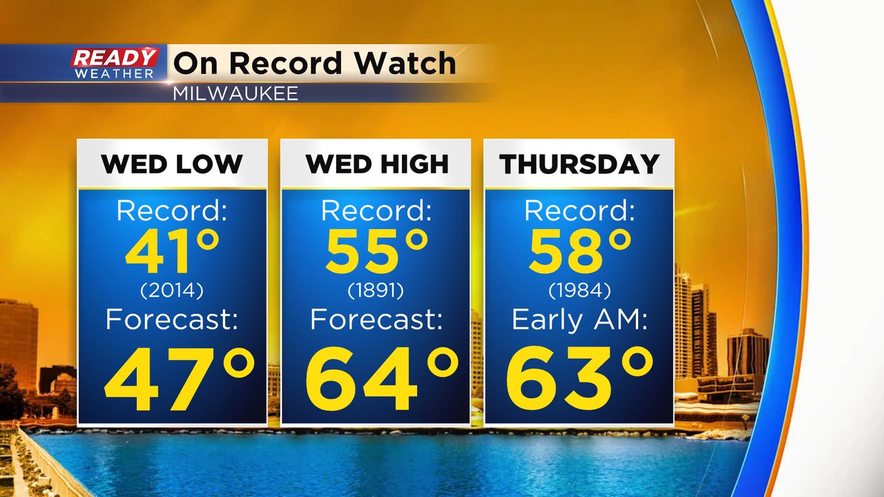
During this very warm stretch of weather we are watching three records that could be shattered. The warmest low temperature for Wednesday is 41* and the current midnight to midnight low Is expected to only drop to 47* breaking that record. Wednesday's record high of 55* will likely be shattered by almost ten degrees with forecasted highs in the 60s. We could still be in the low 60s just after midnight Thursday morning which would break their record high of 58*.
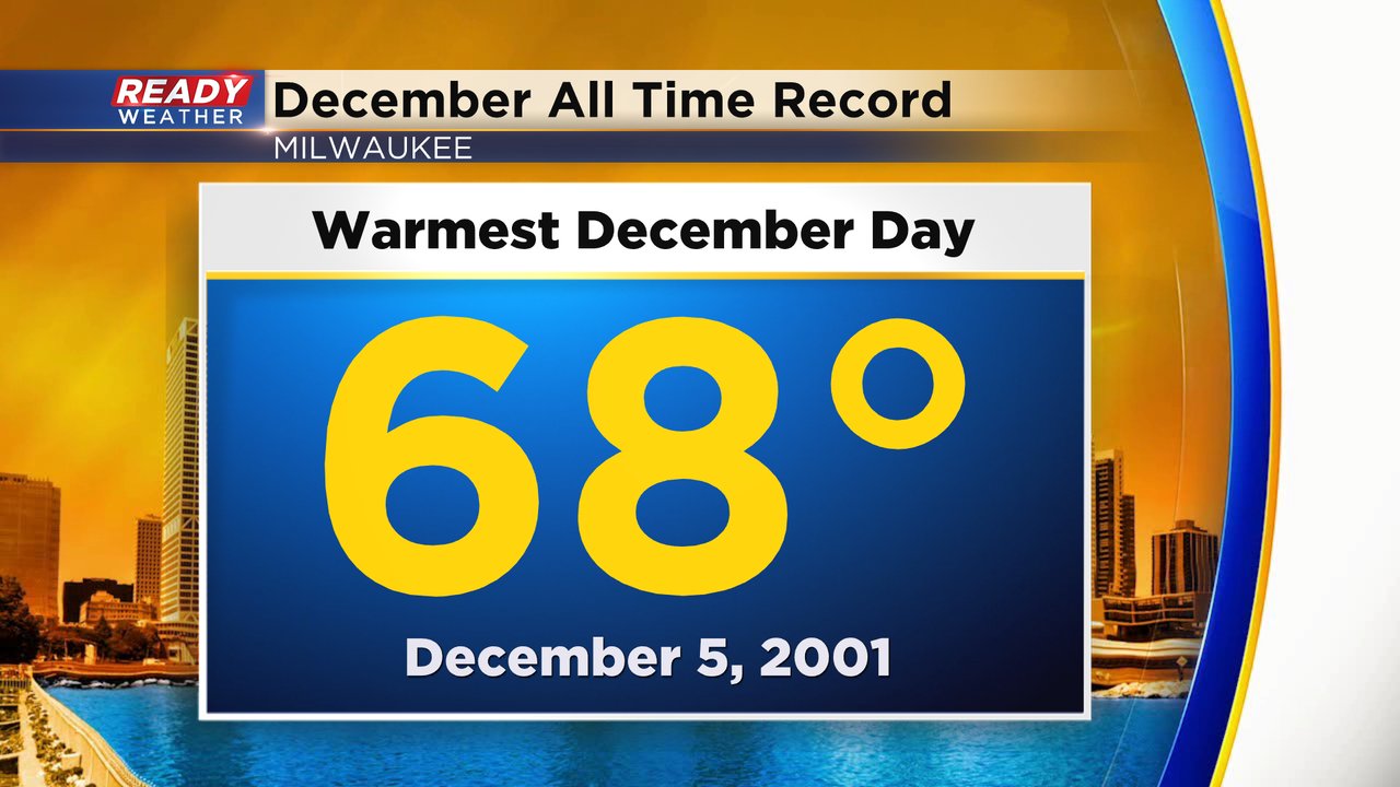
In addition to the daily record highs the all time warmest December temperature record is in jeopardy. The current record is 68* was set on December 5, 2001. Our high on Wednesday could come close.
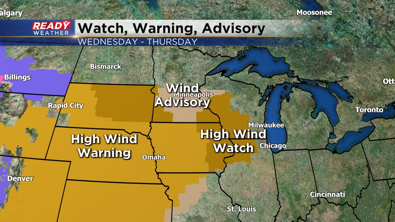
It takes a lot of wind to see record shattering temps and we will certainly get that wind on Wednesday and Thursday. High Wind Warnings have already been posted for much of the Plains and there's a High Wind Watch for western and south central Wisconsin. Southeast Wisconsin should at least see a Wind Advisory if not a High Wind Warning.
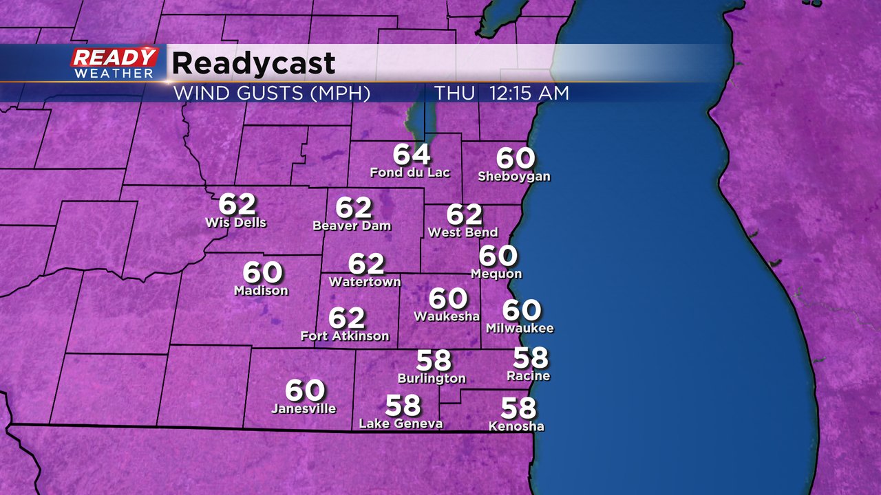
Wind gusts on Tuesday are a bit breezy in the 20-25 mph range. Wednesday the wind will ramp up throughout the day with gusts to about 30 mph during the day. The strongest wind will happen Wednesday night with gusts between 50-60 mph. Gusts will stay strong for most of Thursday with gusts to 40 mph.
Download the CBS 58 Ready Weather app to track the record shattering temps and strong wind.