


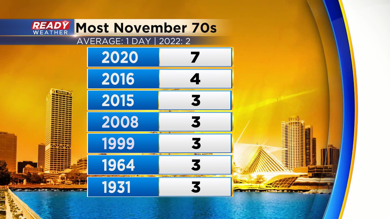
Going back to the end of October we've gone through a really nice stretch of weather. The start of November has already seen two straight days in the 70s. Highs in the 70s are actually hard to come by in November. Milwaukee only averages one day in the 70s each November and the record is seven set in 2020. We likely see at least three if not four just to begin November this year!
We did not get to a record on Wednesday with the high reaching 71* short of the record of 77*. Thursday is our best chance to tie a record with a forecast high of 74* equally the current record set in 1964. Friday also comes close to the record with highs in the upper 60s and records in the low 70s.

The warmth this week will come with an increase of wind. Gusts on Thursday and Friday will reach 30 mph. But the real strong wind moves in for Saturday. The National Weather Service is already discussing the possibility of a wind advisory with gusts reaching as high as 50 mph.

After the possibility of a record on Thursday with sunshine we see good rain chances arrive on Friday and Saturday. A few showers may be possible for the Friday morning commute, but the steady rain arrives around midday Friday lasting for over 24 hours in some communities. Our northwest counties have the best chance for see the steady rain with more showers in southeast spots. A few thunderstorms will also be possible Friday. Rain totals will range from under an inch in southeast counties to 1-2" in northwest counites like Fond du Lac and Dodge.

Download the CBS 58 Ready Weather app to track the record heat and then the rain.