Scattered shower and storm chances continue

-
2:06

’It’s such a strong historical aspect of Waterford’: Community...
-
3:21

Old text messages between GOP operatives spark anger; voting...
-
2:04

’I just wanted to get the bus to stop’: 8th grader takes...
-
0:22

Milwaukee Diaper Mission celebrates documentary about the nonprofit’s...
-
1:31

Under 90 days until RNC: How fundraising, security is ramping...
-
2:18

’It’s certainly an honor’: Milwaukee Public Market named...
-
1:35

Is now the time to buy a home? New report shows home prices up...
-
1:18

Fans sendoff Milwaukee Bucks
-
1:55

One of the Wisconsin Humane Society’s newest intakes who has...
-
2:34

VISIT Milwaukee preview April 26-28
-
0:45

Milwaukee County Zoo announces groundbreaking of new rhino exhibit
-
6:16

’We Grown Now’ and ’Boy Kills World’ hitting the screens...

We've had a decent amount of rain over the last 10 days with most of southeast Wisconsin getting 1-3" of rain. It's been a nice change from how dry we've been since March.

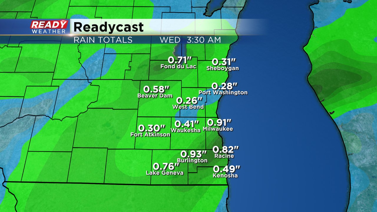
More scattered showers and storms are possible Monday and Tuesday. Tuesday's rain chance looks a little more widespread than Monday's but both days will likely still see some decent dry time. A few stronger thunderstorms are possible on Tuesday as well. Over the next 48 hours rain totals will depend on who sees the biggest thunderstorms. Those that see the storms could get around an inch of rain but others that just see showers may just get a few tenths to around a quarter inch.
The rain chance looks best on Tuesday but scattered showers are still likely on Monday. Wednesday is looking mostly dry besides a stray shower or storm.

The upcoming July 4th weekend looks potentially unsettled. One of the major weather models we uses has shower chances every day but the other one is completely dry so expect some changes for the weekend forecast. Download the CBS 58 Ready Weather app to track the changes and track any rain the next few days.