Scattered showers and even a few storms possible Tuesday afternoon and night


After a few weeks without any good rain we have a decent chance for showers and even storms the next 48 hours. After starting Tuesday with some sunshine we will see the clouds roll in during the afternoon and rain chances start after 3 PM. Thanks to the warmth of the day we could have enough energy to get a thunderstorm.
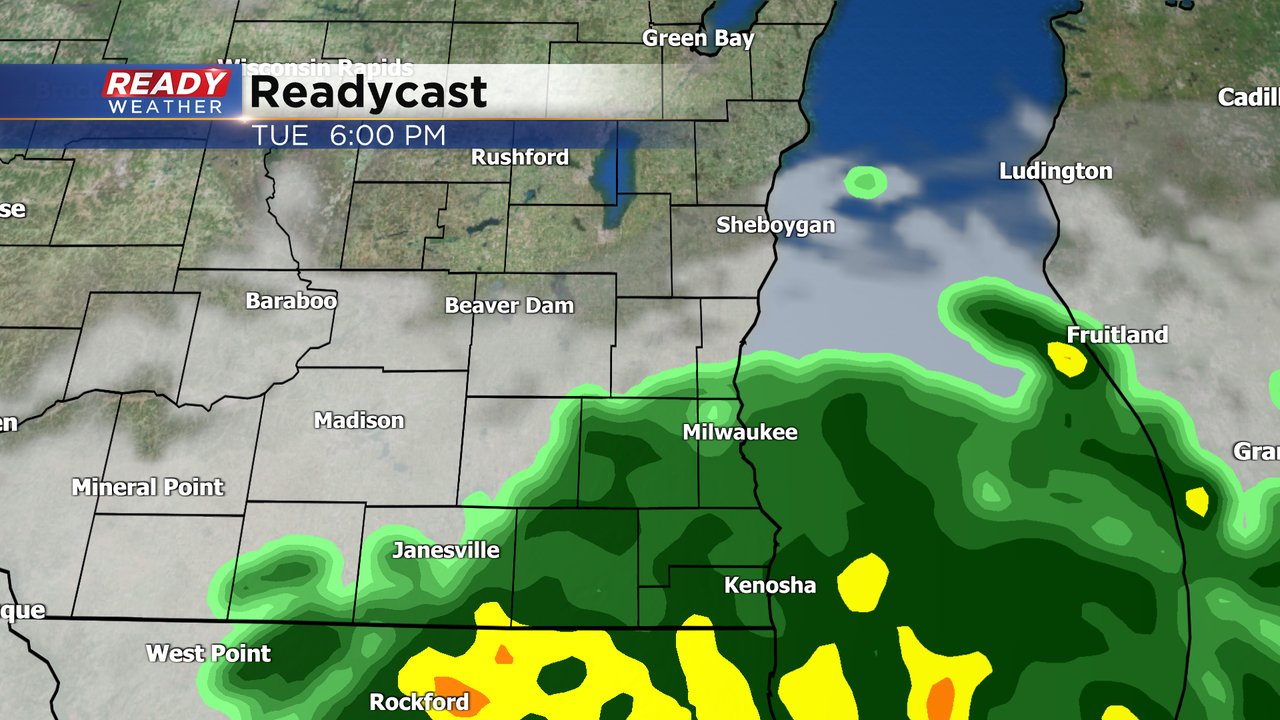
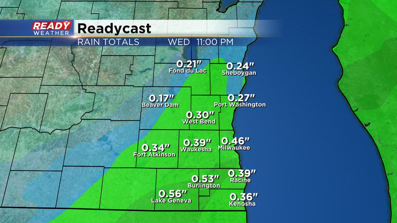
Our shower and storm chances will continue through Tuesday evening and at night with lots of dry breaks. Wednesday's rain chance is even better with scattered showers throughout the day. There will be some dry time as well. Maybe an isolated shower lingering through Wednesday night into early Thursday. Rain totals by the time we are all done will amount to 0.10" to 0.50".
Temperatures will peak Tuesday in the 70s then drop about 10* heading into Wednesday which still isn't bad but then another 10* drop will happen Thursday and highs will stay in the 50s through the rest of the weekend and beginning of next week.

Download the CBS 58 Ready Weather app to track the rain and storm chances.