


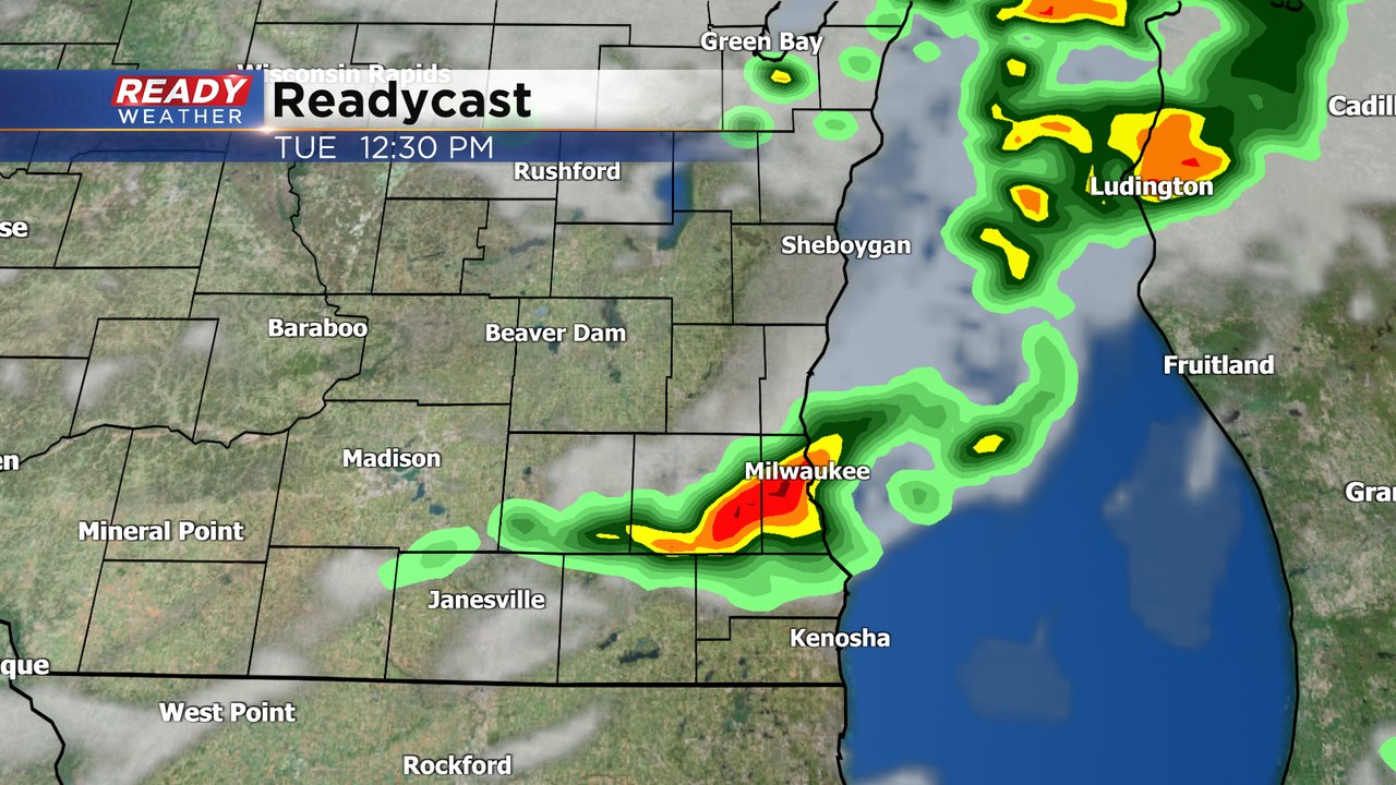
After almost a full week of dry time for most of southeast Wisconsin, showers and storms are likely for Tuesday. Some rain started to roll into our northwest counties around 5 AM Tuesday morning with a broken line of showers and a few storms moving southeast.
Here's a radar image that will update with time throughout the day:

The rain is expected to reach the Milwaukee/Waukesha Metro Area by the mid to late morning hours. This likely won't just be one round of rain with a few more scattered showers and storms likely the rest of the afternoon and early evening with a few lingering showers and storms through the overnight hours.
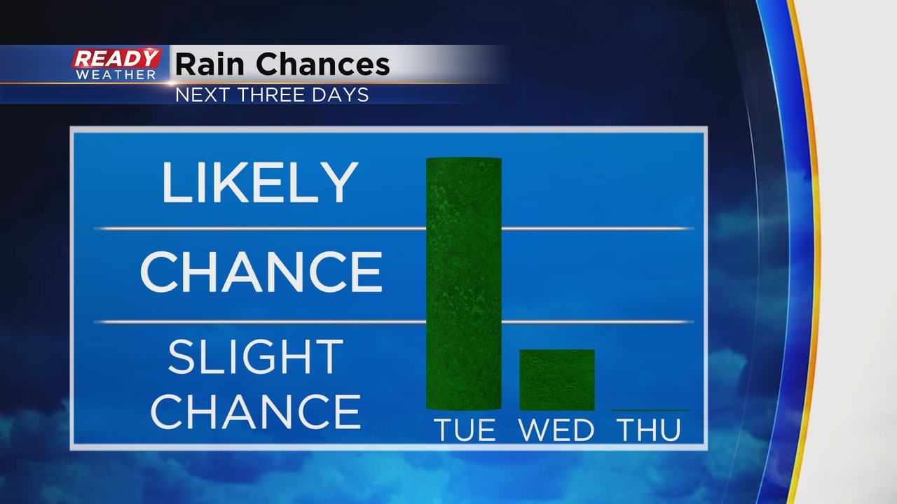
With the earlier arrival of the rain on Tuesday, most of Wednesday is drying out. We will have to watch some rain that mostly looks to impact SW Wisconsin Wednesday morning and a sprinkle or isolated shower that could pop up in the afternoon and evening but most of the day now looks dry. Thursday will kick off another round of dry weather.
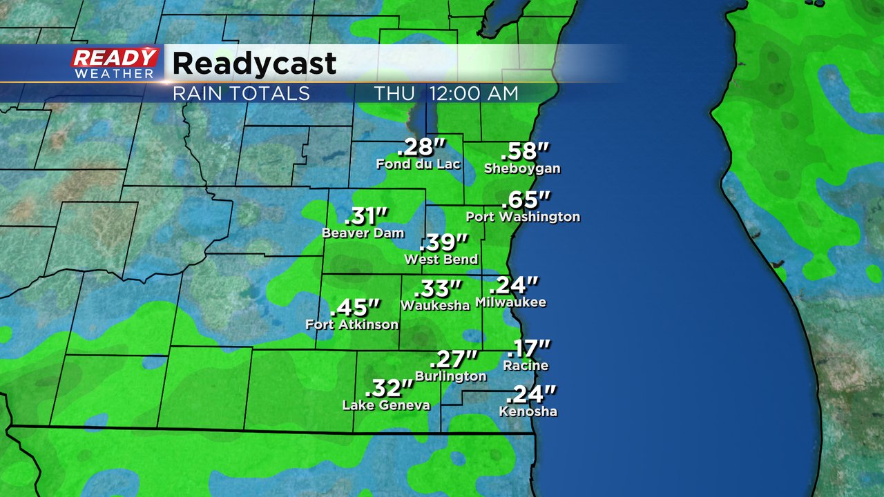
Rain totals for most of southeast Wisconsin will range from a quarter to half inch. A nice drink of water and a break from watering the lawn and garden but not too much rain for flooding concerns.
Download the CBS 58 Ready Weather app to track the rain.