Early Evening Update: Severe line of storms barreling down on southeast WI


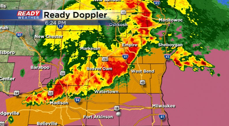
Updated: Saturday July 23rd 6:20pm:
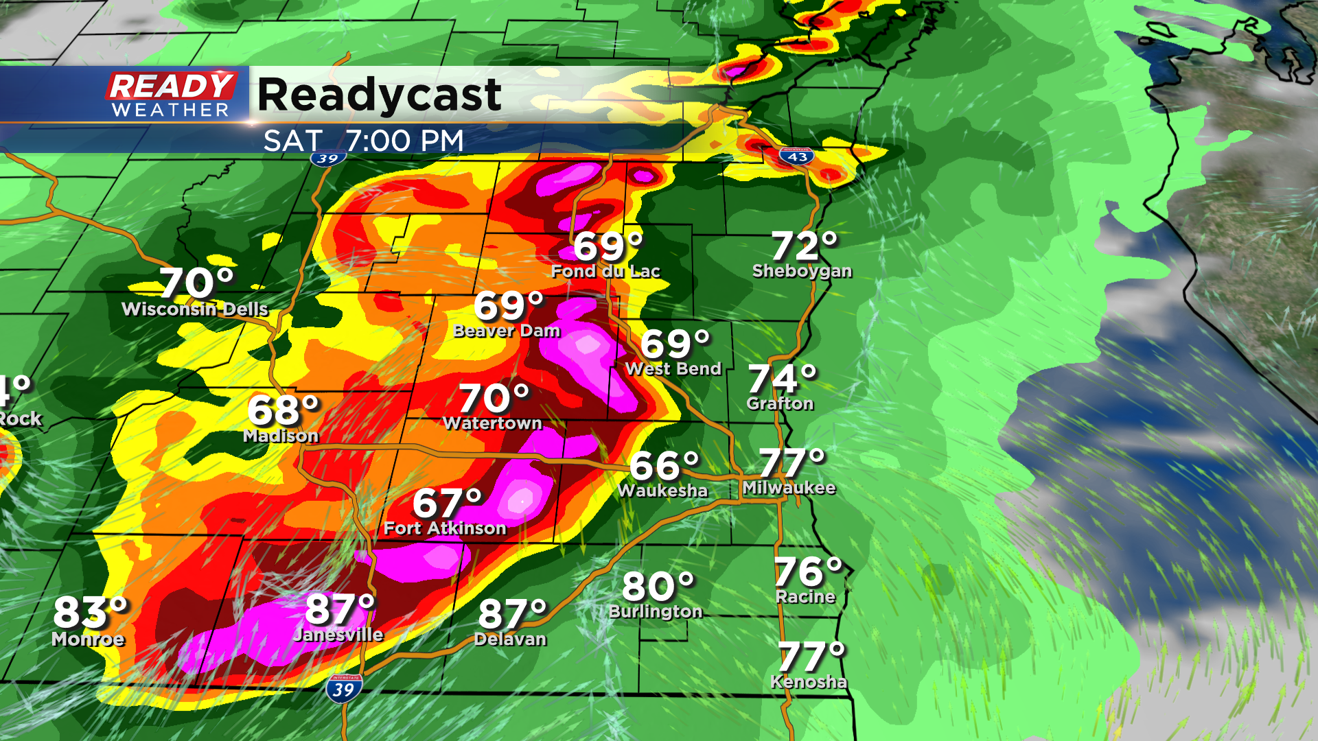
A line of Severe Thunderstorm Warnings is in place for Sheboygan, Fond du Lac, Dodge, Washington, Ozaukee, Jefferson, and northern Waukesha counties until 7:45pm. The line is now moving east to southeast at 45 mph. Wind damage has been reported in Fond du lac and Beaver Dam. Potential for 60-70 mph gusts exists within this line.
--------------------------------------------------------------------
Updated: Saturday, July 23rd 4:05 pm:
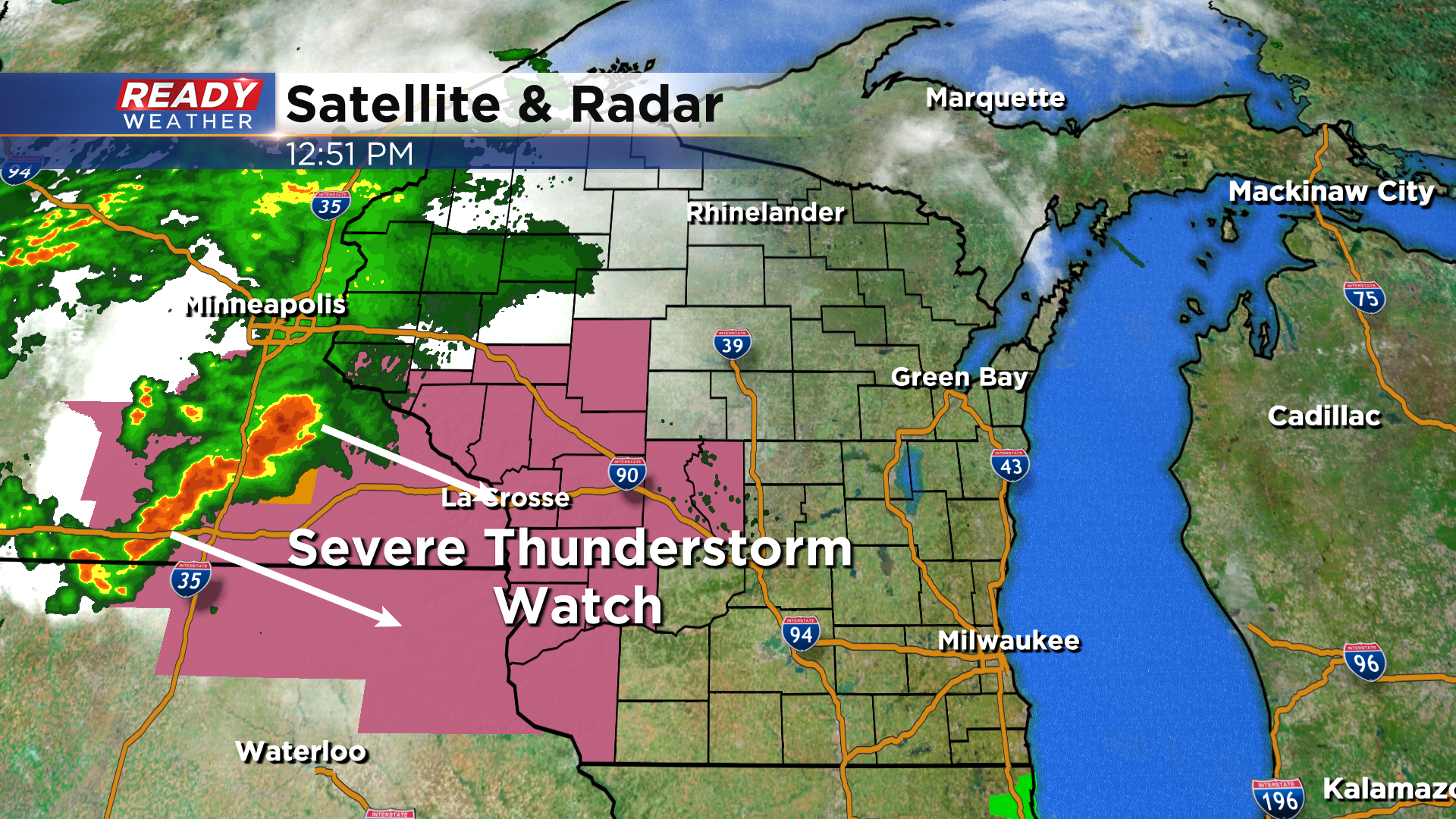
A Severe Thunderstorm Watch has been issued for all of southeast Wisconsin through 11pm. The storms to our west are really getting their act together with a measured wind gust of 81 mph at the La Crosse Airport as the storms moved through.
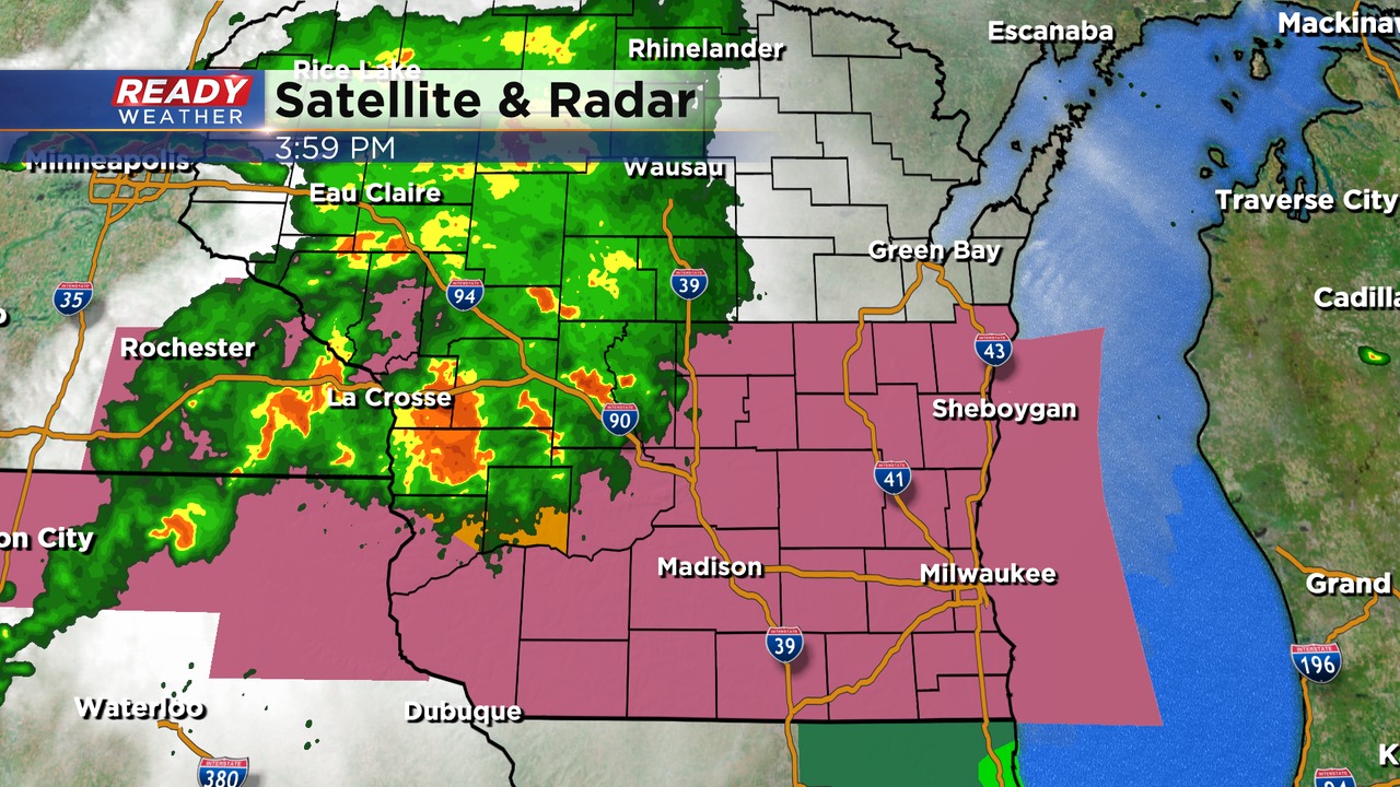
Timing for the worst of the severe weather for southeast Wisconsin is 6pm through 8:30pm.
--------------------------------------------------------------------------------------------
Updated: Saturday, July 23rd 3:05 pm:
Severe storms with a history of wind damage are just about to cross the Mississippi River into Wisconsin. As these two clusters of storms continue to track east/southeast into the southern half of the state, they are expected to become more organized and accelerate towards southeast Wisconsin. A Severe Thunderstorm Watch will likely be issued within the next hour or two.
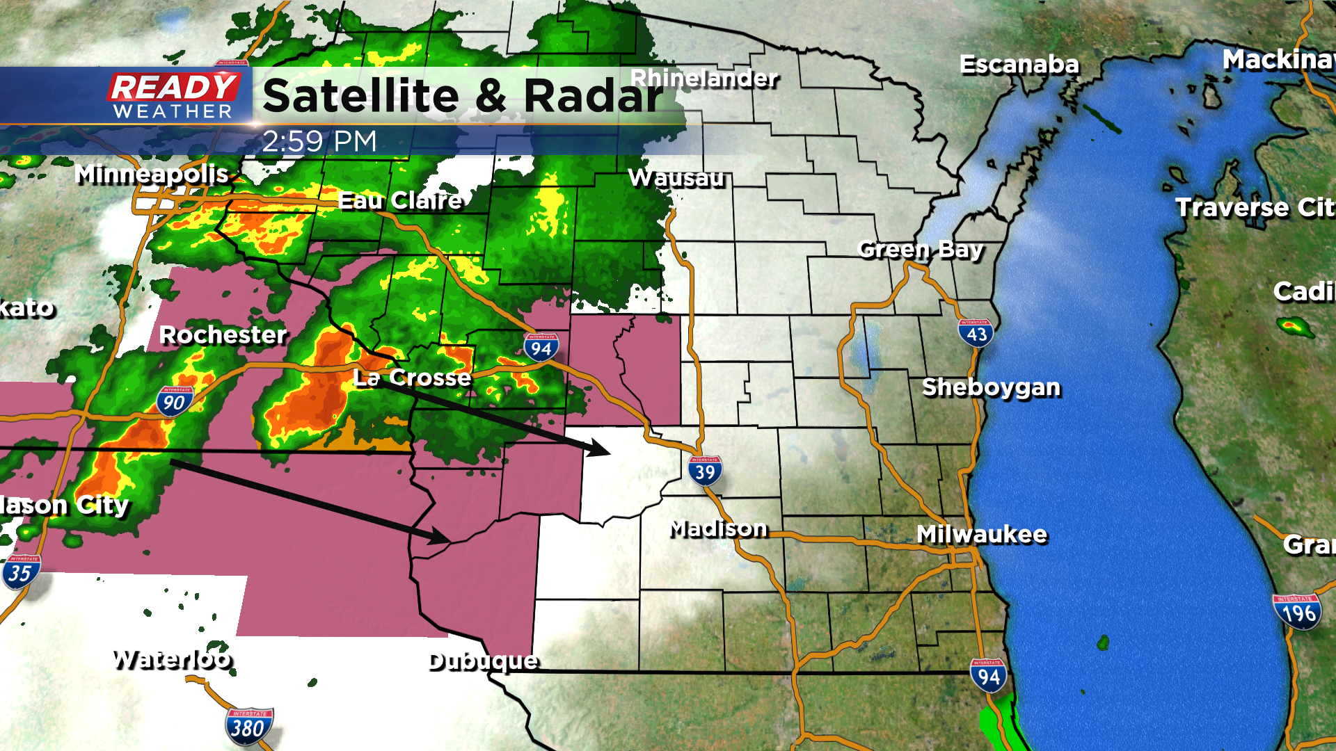
Widespread damaging straight-line wind gusts are expected throughout this line, including some near or over 70 mph. Embedded spin-ups within the line are also a concern.
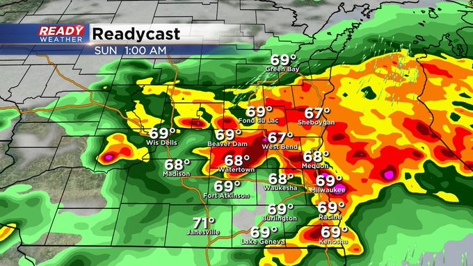
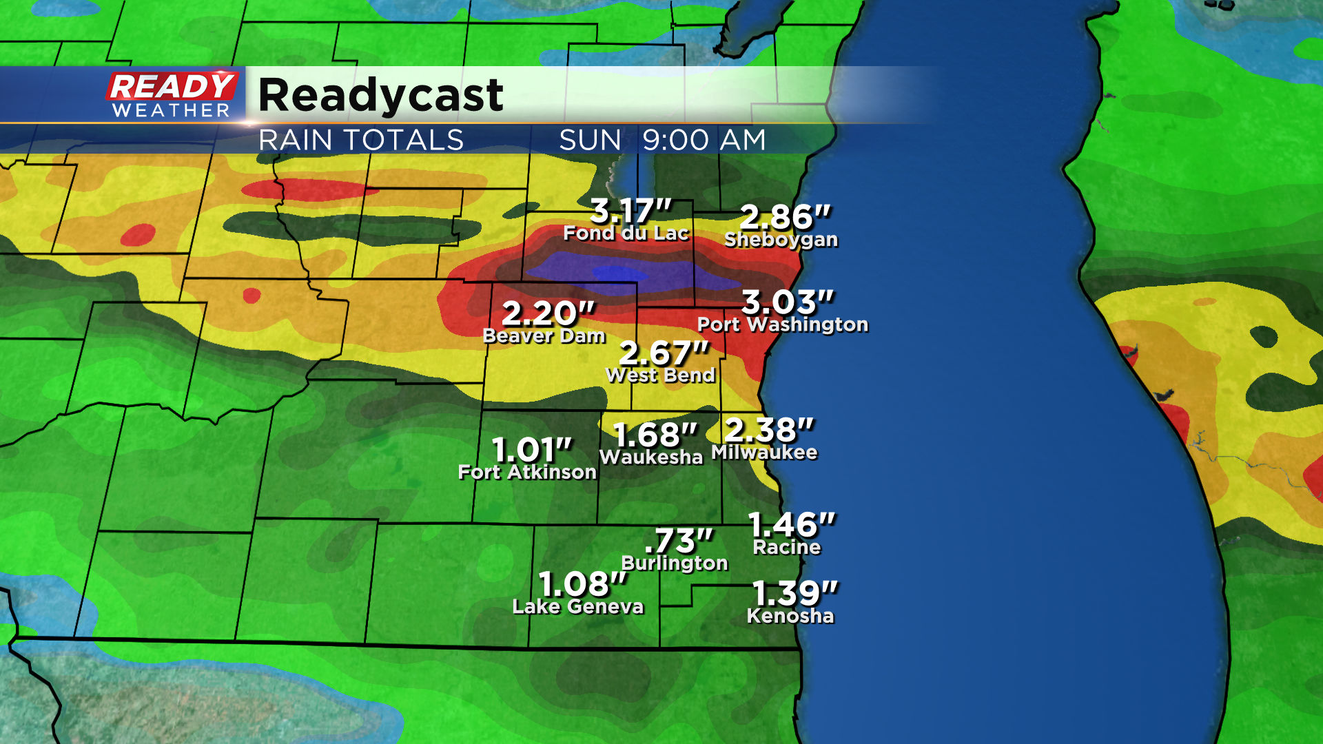
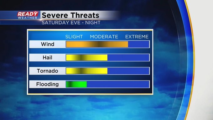
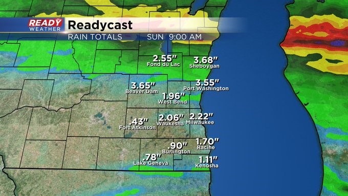
Additional strong, but less organized, storms are expected late evening through the night, which will likely be very heavy rain producers which could lead to flooding. A general 1 to 3" of rain is expected across southeast Wisconsin before the rain ends early Sunday morning.
------------------------------------------
Updated: Saturday, July 23rd 12:55 pm:
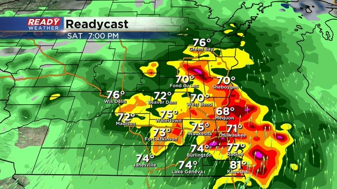
Confidence continues to grow for a significant line of severe storms tracking across southeast Wisconsin between 5pm and 8pm. This complex of storms is currently growing in southern Minnesota and will continue to track to the southeast through the afternoon.
Significant severe wind gusts, potentially of 70 mph or strong, are expected with this line of storms. Embedded tornadoes are possible as well as hail. I highly recommend NOT going to any outdoor fairs/concerts/etc. later today as you'll want to be in a sturdy structure as this moves through.
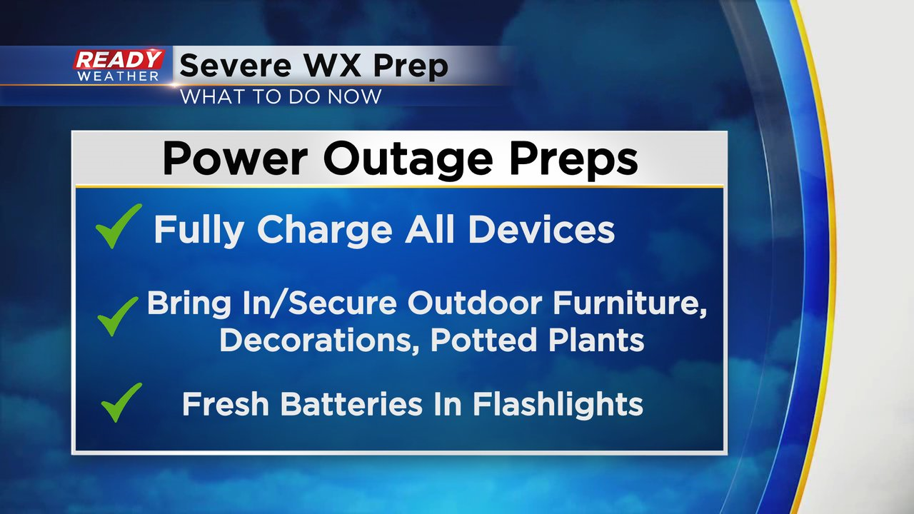
Here's what you can do now to prepare for the incoming severe winds. Please alert your friends who are camping in tents or campers that they'll need to find a sturdy building for shelter.
---------------------------------------------------------------------------------
Update as of 11:15 am Saturday, July 23rd...
It looks like we're still on track to see strong to severe storms arriving late in the day (after 4 or 5 pm) and lingering into the overnight. The big question is will a secondary line develop behind the first like some computer models are indicating. It's just a wait and see but realize heavy rain is a real potential with these storms in addition to strong wind and damaging hail. Please stay tuned to cbs58.com and CBS 58 for the latest weather developments as the afternoon progresses.
_____________________________________________________________________________________________________________
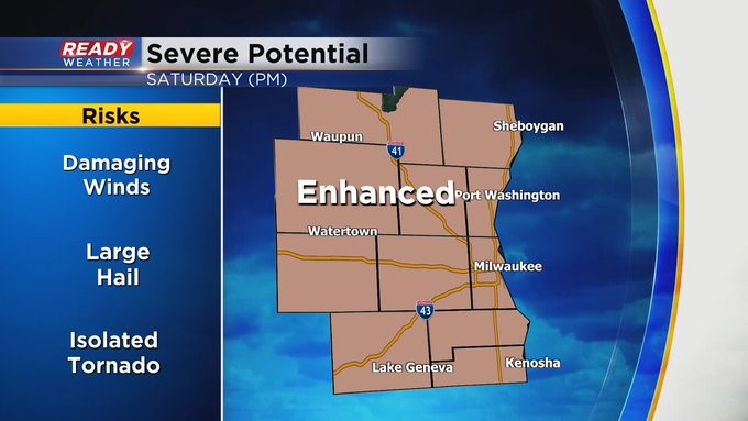
MILWAUKEE (CBS 58)--Of course this would have to be the one weekend when so much is happening. The Waukesha County Fair and Country Thunder just to name a few events. Unfortunately Mother Nature will give us her own thunder, some of it could be strong to severe into this evening. The best timeline for severe weather is 4 pm to 10 pm but wouldn't be surprised if the activity pushes into the midnight hour. Rainfall could exceed several inches as well. An "enhanced" risk of severe weather, scale 3 out of 5, is also in place.
Heavy rain, frequent lightning, damaging hail and wind are all possible even possible tornadoes. The forecast will improve vastly as we work into the day on Sunday as low pressure pulls away.
The upcoming week looks nice with the exception of late Tuesday and Wednesday with another storm system. The chance for rain and storms will increase then. Highs will be near 80. Lows in the 50s and 60s.
Please stay weather alert today and make sure the CBS 58 weather app is downloaded and ready to go. We'll keep you updated throughout the day.