Several rounds of precipitation expected on Thursday
By:
Drew Burgoyne
Posted: Mar 4, 2020 9:25 PM CDT

-
0:14

Entire pier seen floating down Milwaukee River raises questions
-
1:47

Students across Wisconsin compete in 8th annual underwater robot...
-
3:41

One of the crazier weather forecasts you’ll see in quite some...
-
4:30

Spring and Summer Camps at Racine Campus of WHS
-
5:57

Reviews of ’Undertone’ and ’Paradise’
-
6:03

Spring Clean Up Day & more!
-
4:15

Downtown Racine hosting Candy Hop for families and Soup & Steins...
-
1:25

Villa Grove Park
-
4:01

Fiserv Forum’s ’Popcorn Queen’ wears her title as a badge...
-
2:53

Oak Creek preschool’s ‘Little Engineers’ program helps...
-
2:46

’It had just peeled back’: Surveillance video catches high...
-
2:43

A weekend to keep tuned to the weather forecast as we deal with...

A fast moving upper level disturbance will sweep across Wisconsin on Thursday. This will provide several rounds of precipitation from the morning through the late evening.
The first round will impact the area between 5 am to 10 am. There will be enough cold air aloft that some of the rain will mix in with some wet snow flakes; however, we aren't expecting any accumulation or problems with the morning commute.
Very windy during the afternoon with highs rebounding into the 40s. Light rain showers will be possible during the afternoon before the cold front arrives.
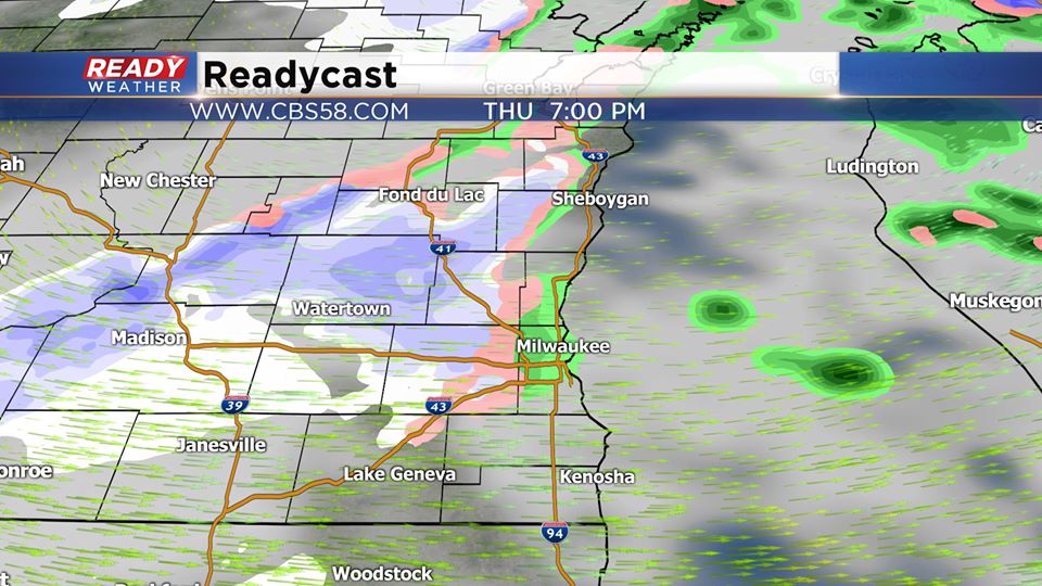
That front will bring in another batch of rain and snow between 5 pm and 10 pm. Additional snow showers are possible late Thursday night before clearing out for Friday.
Sign up for the CBS 58 Newsletter