


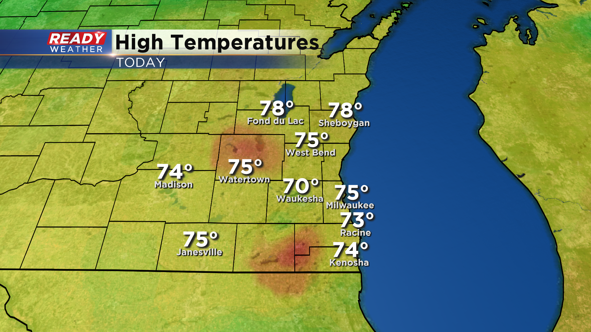
The cloud cover was a bit more stubborn than expected around the area today, and it kept temperatures in check with highs only reaching the 70s.
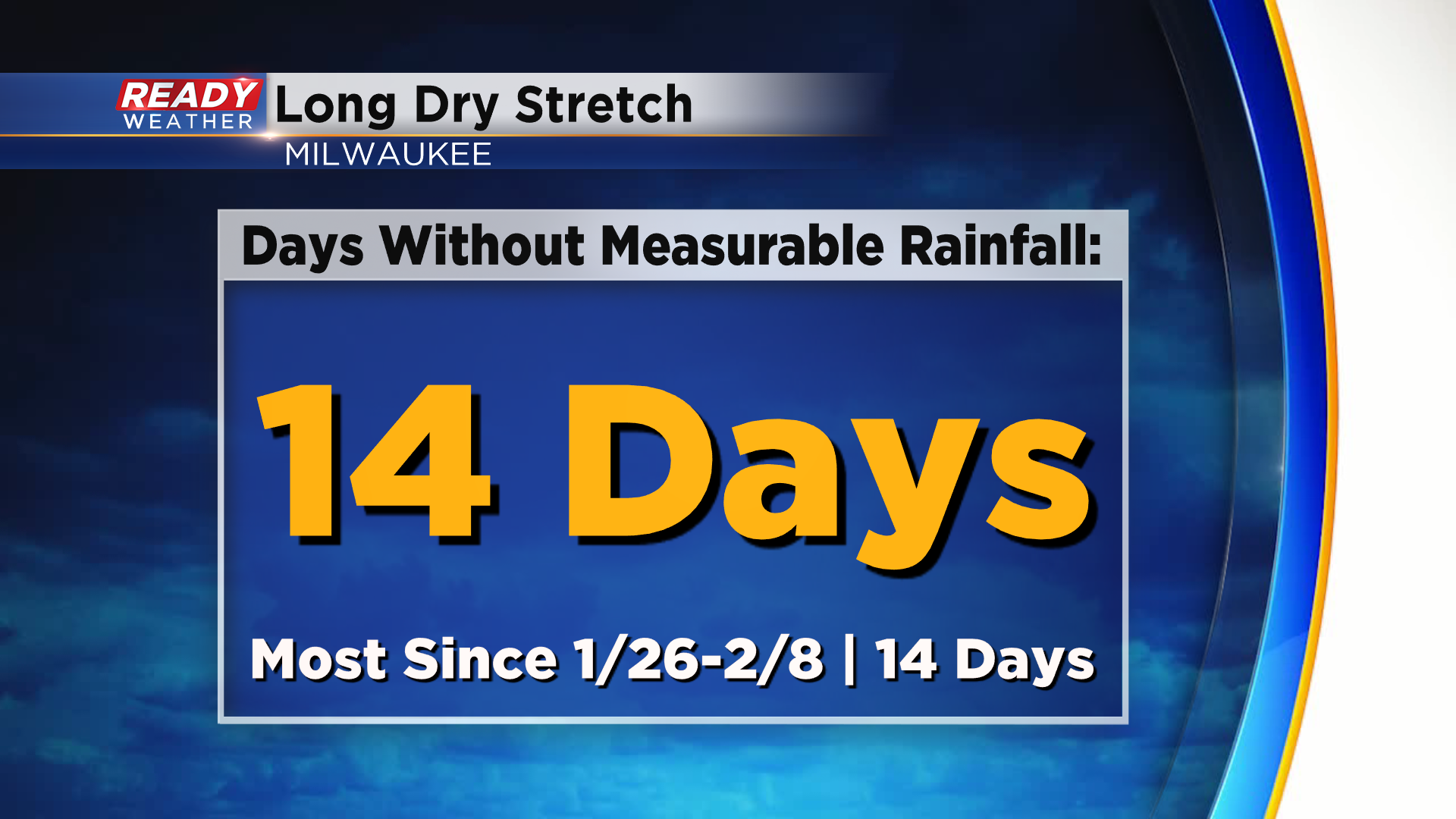
Despite the cloud cover, we remained dry across southeast Wisconsin. For many of us, today marks two weeks since there's been measurable rainfall. This ties the longest dry stretch of weather Milwaukee has had this year with a two week stretch from January 26th through February 8th.
Dry weather will continue tonight through Sunday morning, but a band of light rain will develop and slowly drift through southeastern Wisconsin during the afternoon and early evening.
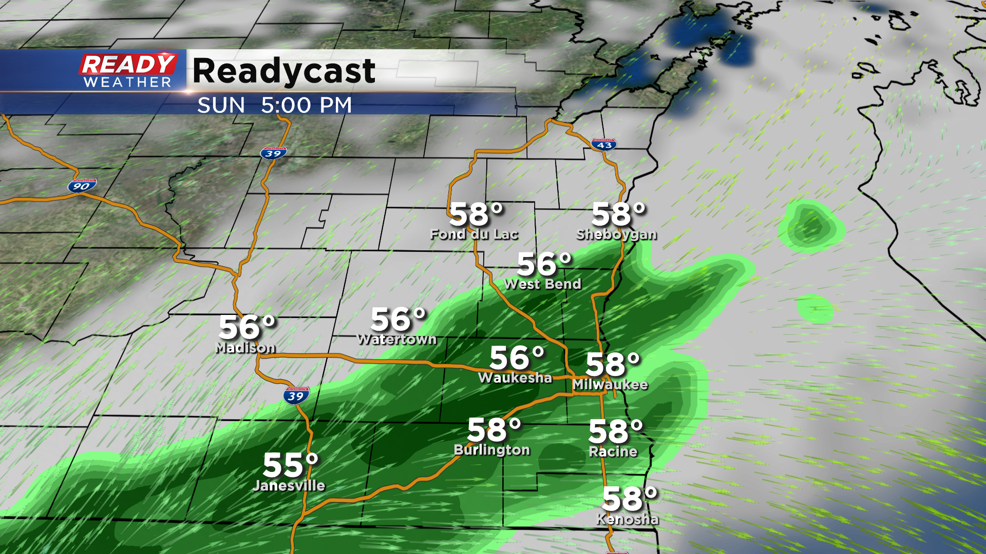
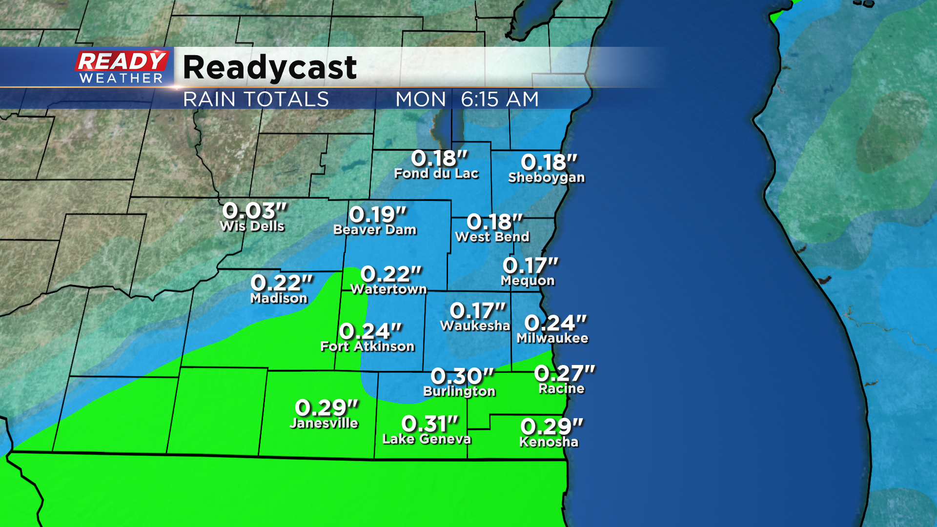
A general .10-.25" of rain is expected through tomorrow evening before drying out Sunday night into Monday.
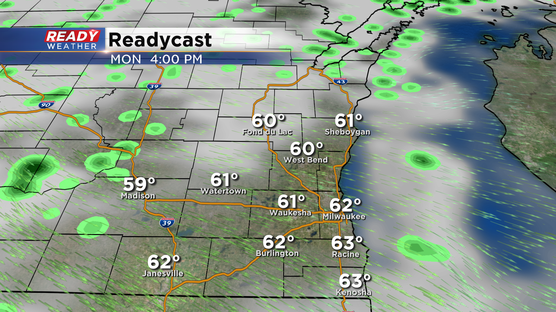
We'll be stuck in a cool and active weather pattern through this week, with wrap around light showers possible at times. Most of Monday and Tuesday should be dry, but we can't rule out a pop up sprinkle or two during the afternoon with the best chance being well north and west of Milwaukee.
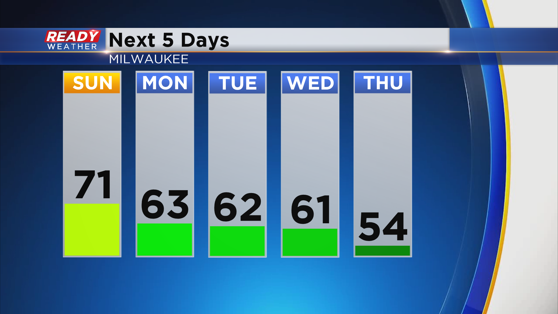
A better chance for scattered showers will come Wednesday afternoon into Thursday as a strong cold front moves through the area. Temps will be dropping into the 50s behind that front after spending the first half of the week in the 60s.
See how long temps stay in the 50s by downloading the CBS 58 Ready Weather App.