


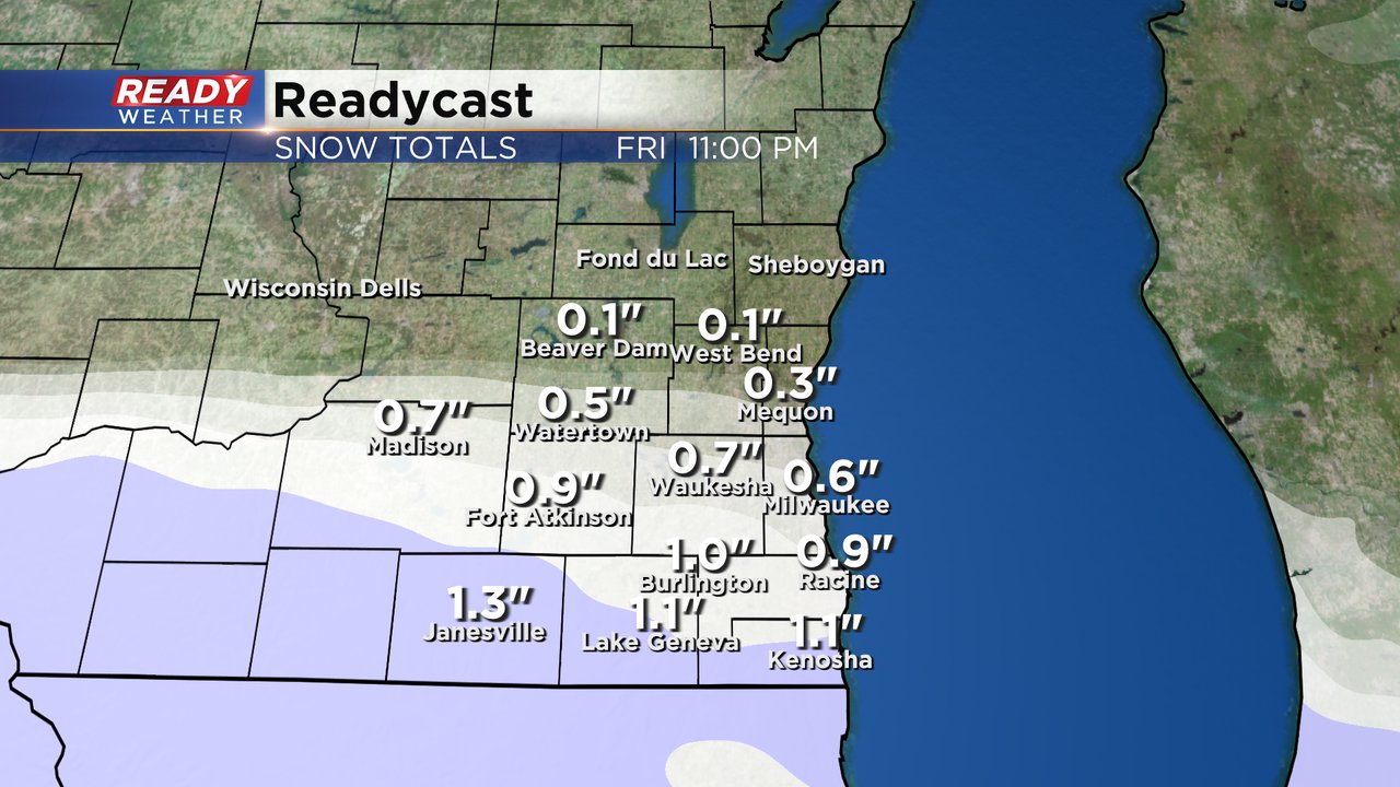
Snow showers are approaching southeast Wisconsin from the west Friday morning. Most of the morning commute should be fine besides a few flurries but accumulating snow is likely for a good chunk of our local area from mid-morning through the late afternoon. The overall model trend has been for the snow to move farther north which means areas like Beaver Dam, West Bend and Port Washington could see some snow and we can't even rule out a flurry in Fond du Lac and Sheboygan. But the best chance for snow remains in our southern areas, along and south of I-94.

Snow totals should be around 1" near the IL border or even a touch more. The rest of southeast Wisconsin gets under an inch with around a half inch of slush in Waukesha/Milwaukee and maybe a dusting in some northern counties.
After the snow showers on Friday the rest of the weekend looks pretty good. Can't rule out a sprinkle on Saturday but Sunday looks all dry. Both days are mild in the upper 40s and low 50s with a bit of a breeze.

Download the CBS 58 Ready Weather app to track the snow for Friday.