


It's been a pleasant start to the weekend with temperatures in the low to mid 70s with filtered sunshine. High pressure to our east has been keeping us dry so far today, but a few sprinkles are starting to lift over the WI/IL border.
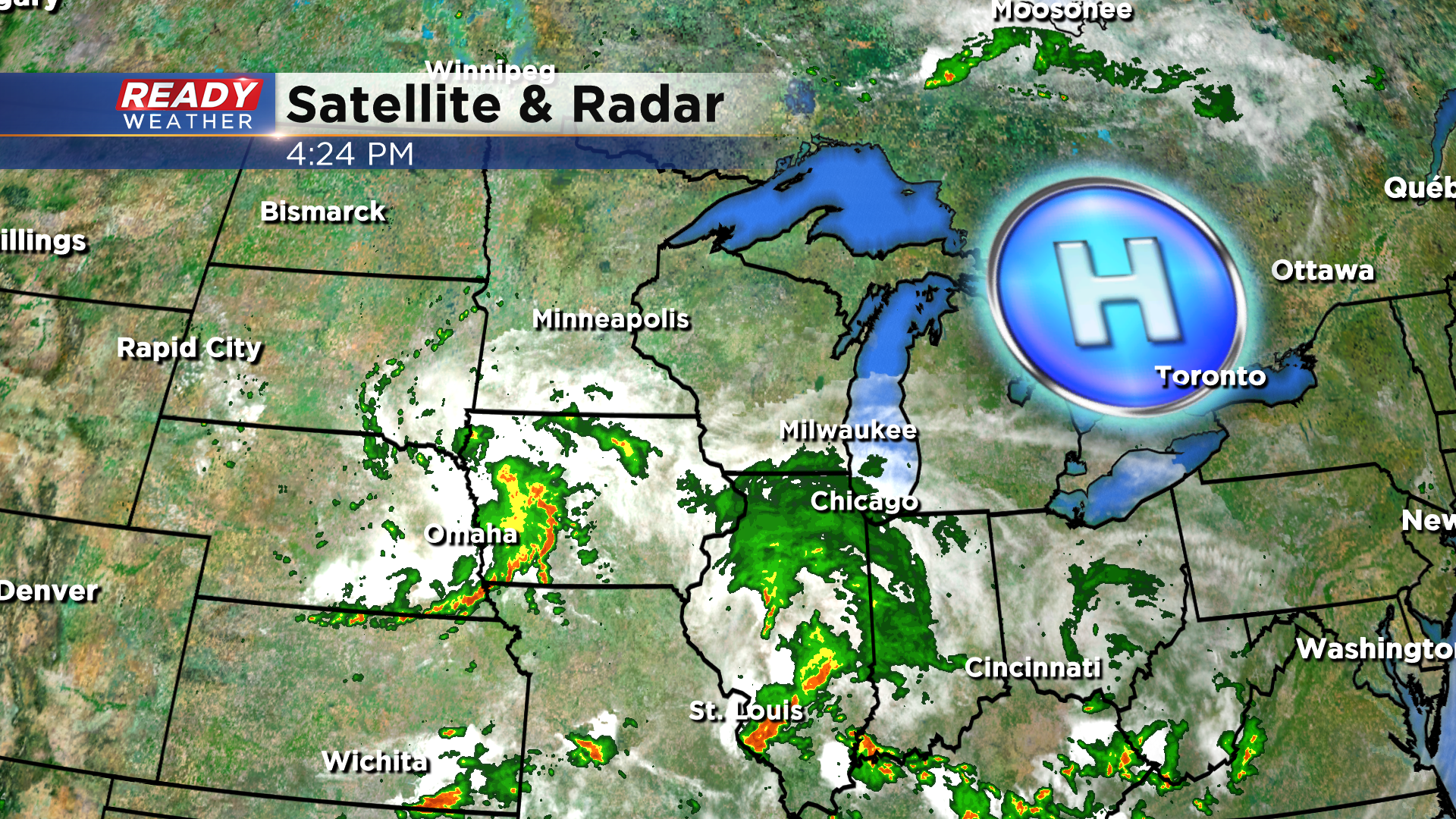
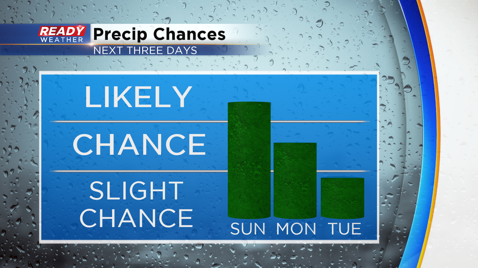
Any sprinkles or brief showers that have made it over the border should dissipate this evening, with folks along and north of 94 staying dry. However, the low pressure system in Illinois will lift farther north overnight into Sunday, which will allow for scattered showers to rotate into far southeast Wisconsin well after midnight tonight.
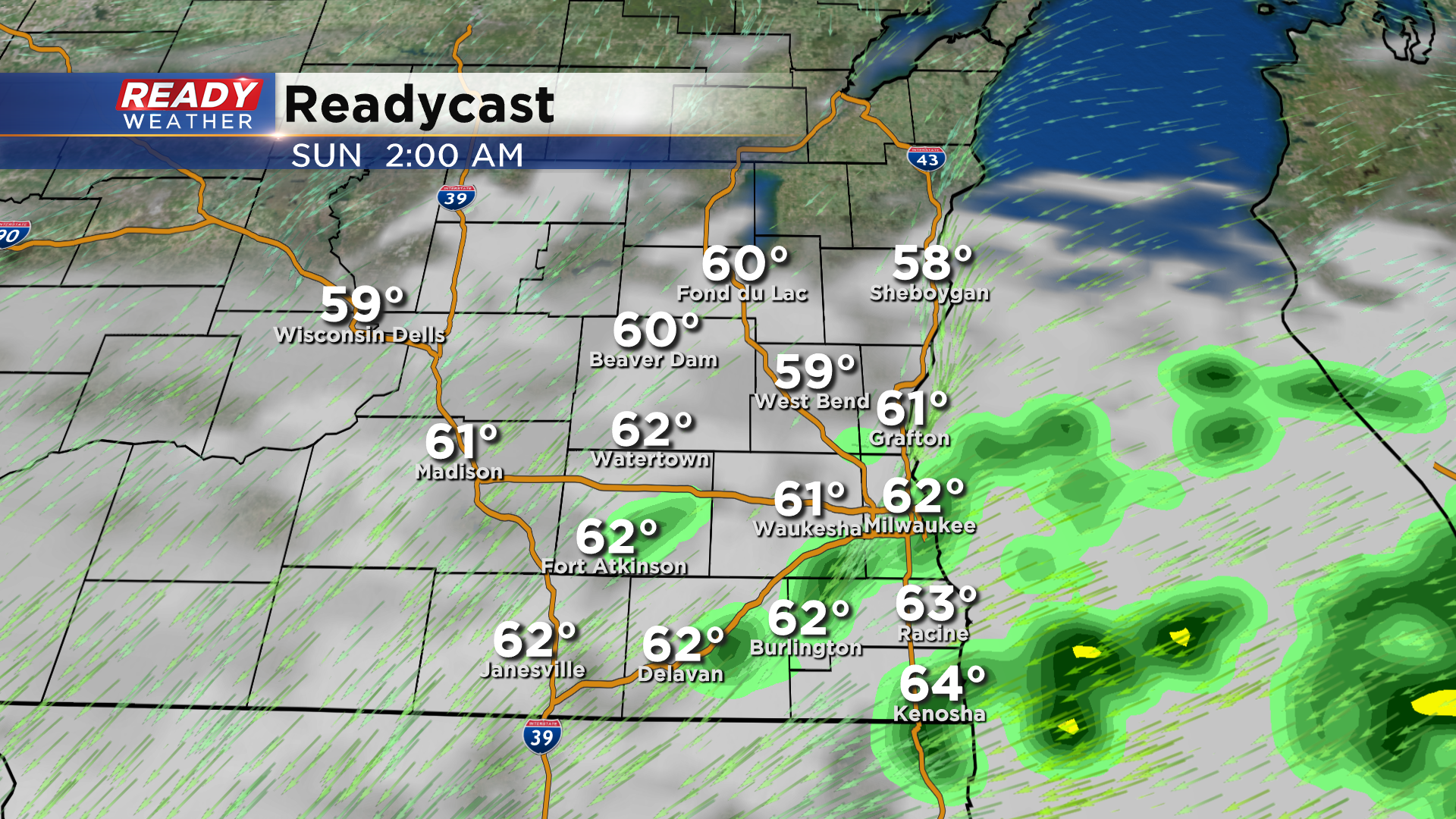
The steadiest and heaviest rain for Sunday has been trending south due to lingering dry air from the same high pressure system to our east. The best chance for showers on Sunday will be in Racine, Kenosha, Walworth, and southern Milwaukee counties as the northeast wind continues to pull drier air into our northern counties. Folks in Dodge and Fond du Lac counties could even stay dry all day.
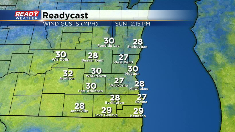
In addition to the rain, northeast winds will crank up between 25-30 mph on Sunday, making it feel rather raw for folks stuck under the steadier rain.
The steadier rain should become lighter and more hit or miss during the evening hours, but this low pressure system will stall over Illinois so expect more hit or miss showers and storms on Monday. Cold front moves through Tuesday morning, which will briefly bring an end to the shower chances before another system moves in late Wednesday into Thursday.
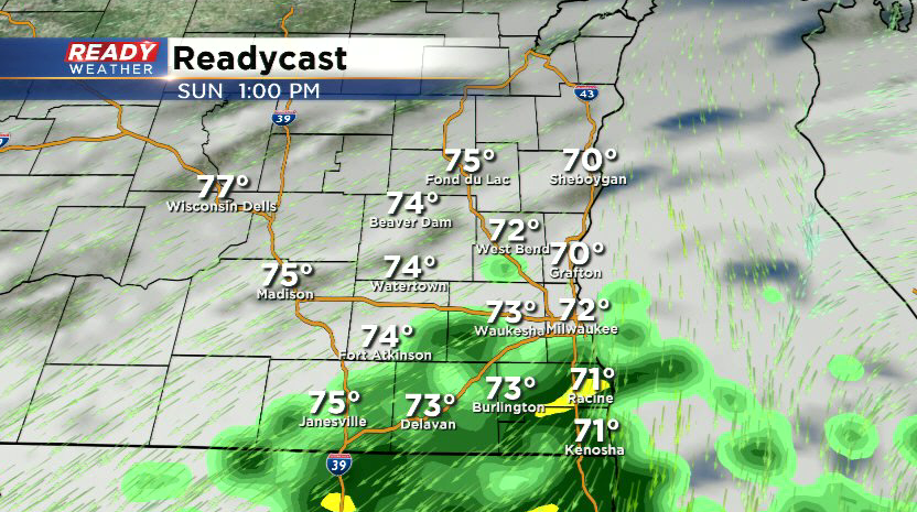
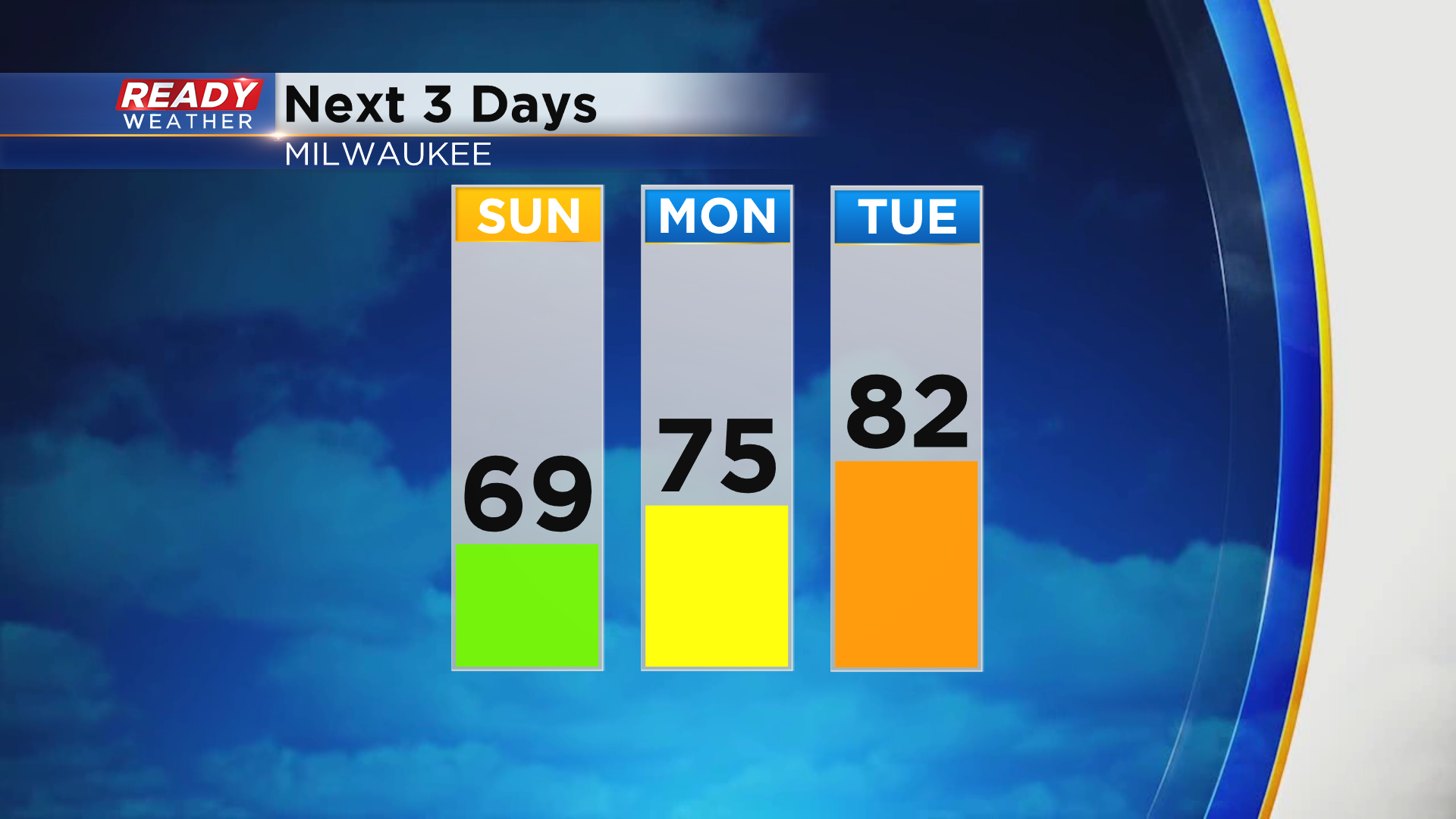
Clouds, rain, and a strong wind off the lake will keep temps in the 60s across far southeast Wisconsin on Sunday, while far northern spots climb into the lower to mid 70s. Temps will be on a gradual warming trend to start the week, getting back into the 80s by Tuesday.
Download the CBS 58 Ready Weather App to track Sunday's showers.