


Here's the good news: We have lots of sunshine for Friday and Saturday is trending warmer and less wet. The bad news? Easter itself looks pretty soggy and by the time this storm system has moved out it likely leaves at least some of us with accumulating snow.
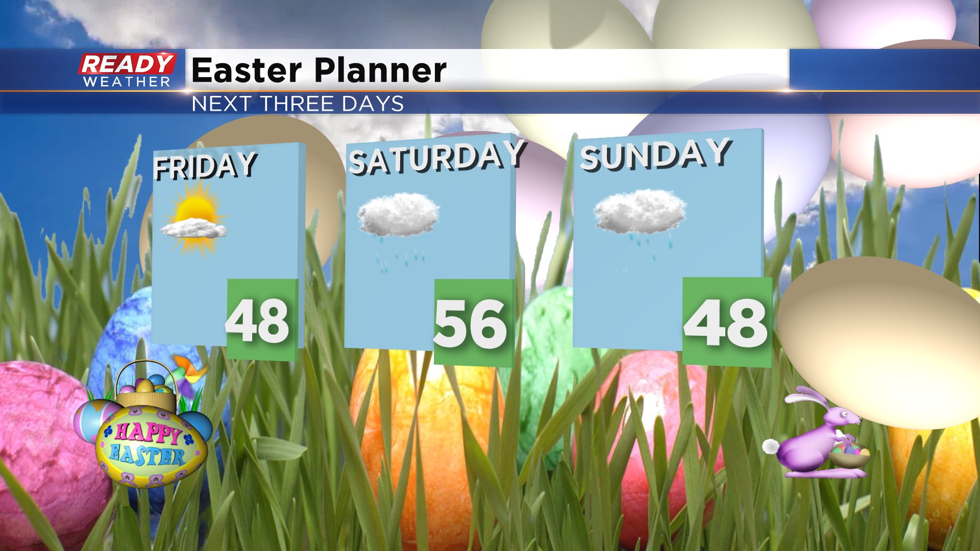
An isolated shower can't be ruled out Saturday morning but the bulk of the rain has trended later towards the middle to late afternoon. Once the rain starts it's not going to stop with steady rain that could be heavy at times for Saturday night and most of Sunday looks soggy.
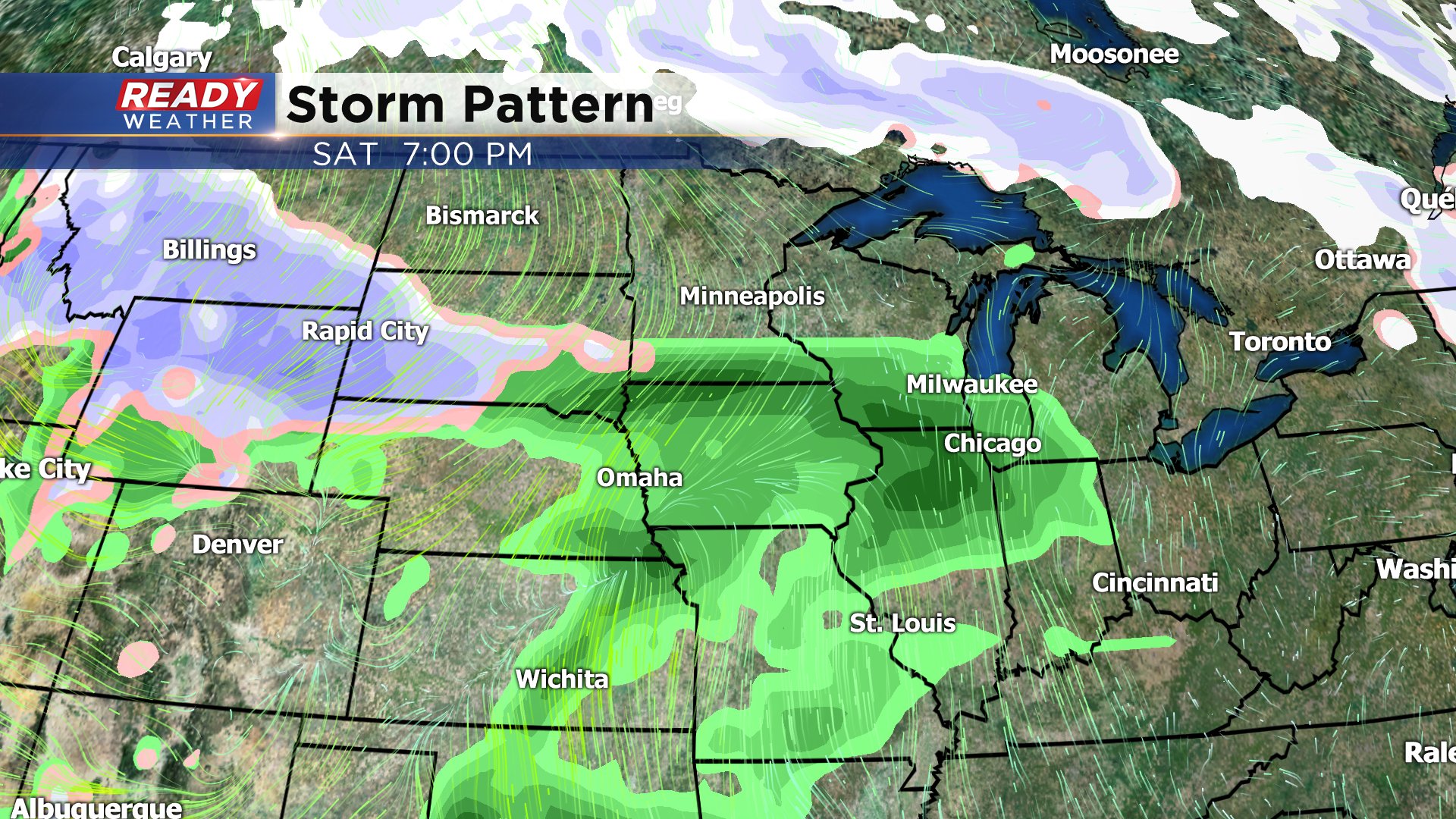
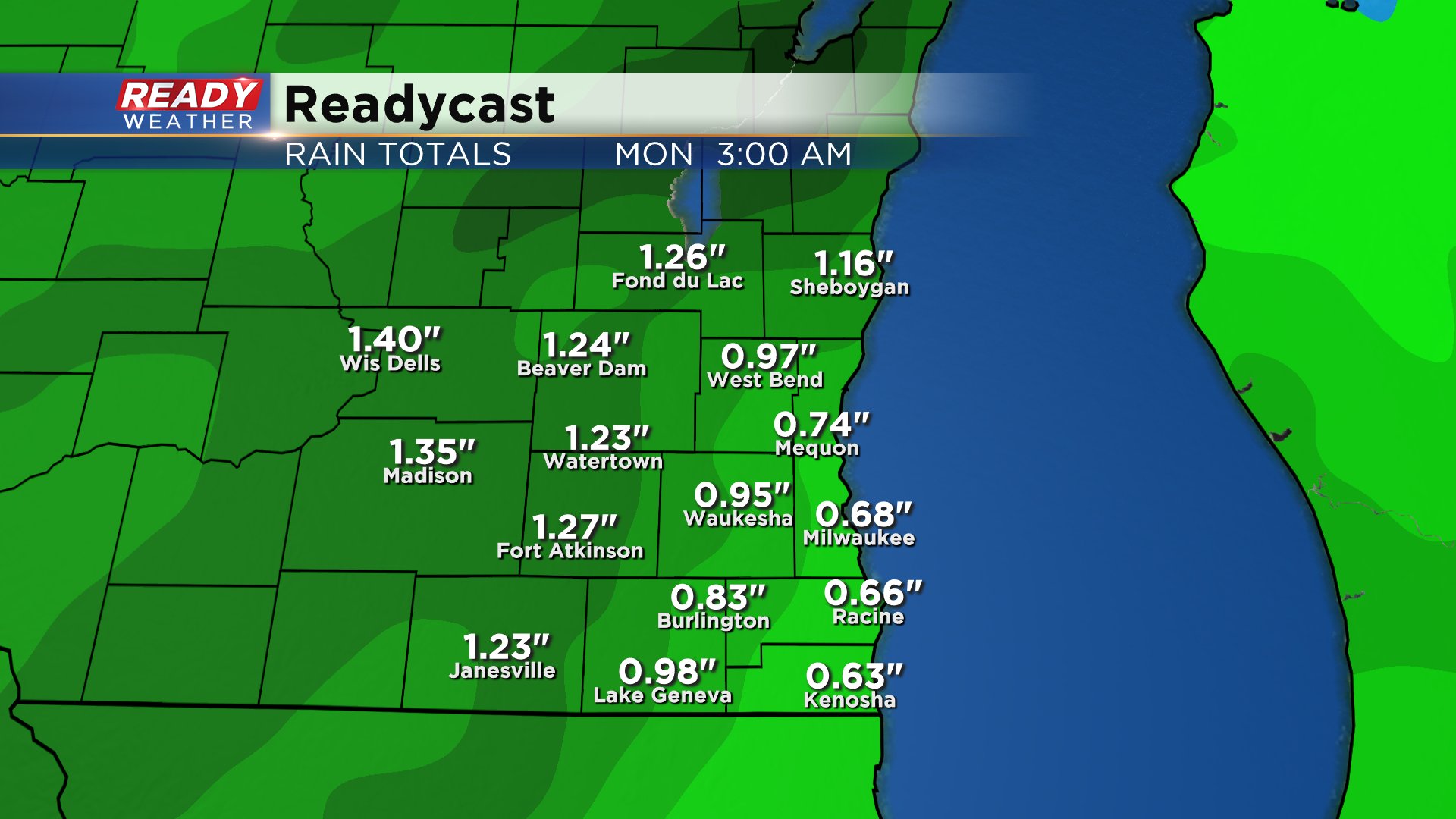
A few breaks in the rain may be possible Sunday but it's hard to pinpoint when that could happen and even if it does it won't last long. Saturday morning will definitely be the better time for any outdoor Easter plans you have like egg hunts. This is going to be a soaking rain with most spots picking up at least a half inch and some areas getting a full inch and a half. Some minor river flooding is possible.
On the colder side of the storm that slides in Sunday night the rain switches over to snow. By daybreak Monday light snow will likely be falling and continues through at least noon. The threat for accumulating snow has increased Monday morning especially for our northwest counties like Fond du Lac and Dodge but everyone has at least a chance. Exact snow amounts are still in question so stay tuned for weekend updates on that.

Download the CBS 58 Ready Weather app to track the latest snowfall forecast and see the interactive radar.