Staying warm and muggy with a scattered storm chance for the first day of the Wisconsin State Fair


The Wisconsin State Fair is here! The warm temps and lots of humidity we've been dealing with this year won't go away any time soon, so expect to sweat if you're heading out to the fair. A few showers have already rolled in this Thursday morning and more scattered showers and storms will be possible throughout the rest of the day.
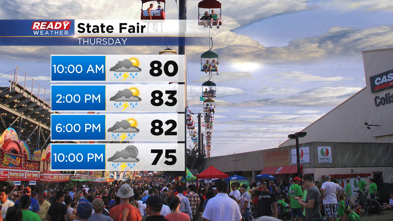
It doesn't look like we get any huge areas of steady rain and storms but scattered showers and storms are definitely possible. The best chance for some beefier storms looks to be in the later evening hours.

Any of the storms that do form today could be on the stronger side with most of the state of Wisconsin under a Level 1 Marginal Risk and a sliver of Walworth County under a Level 2 Slight Risk. Gusty wind and small hail will be the main threats with any storms that do form.

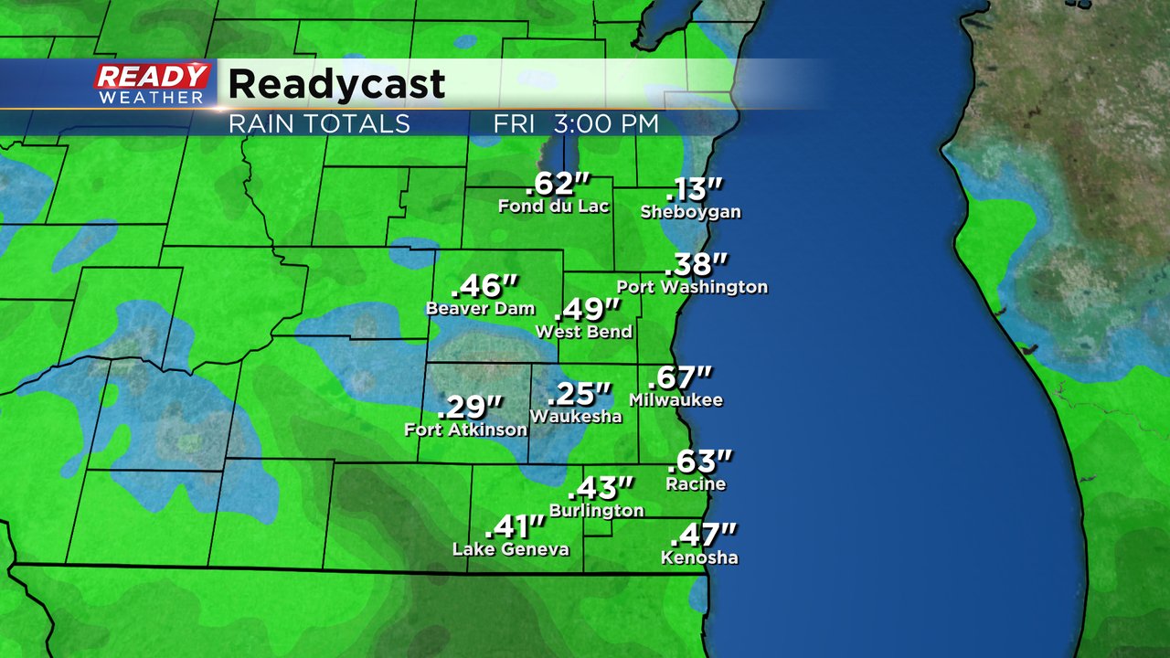
Rain totals for Thursday will hover around a half inch with some locations getting a little more and others a little less. The higher totals will happen with those that get thunderstorms and the lower totals for those that just see showers.
Download the CBS 58 Ready Weather app to track the showers and storms for the first day of the State Fair.