Mid afternoon update: Severe storm potential lowering thanks to clouds and rain


Updated: Wednesday August 3rd 3:00 pm:
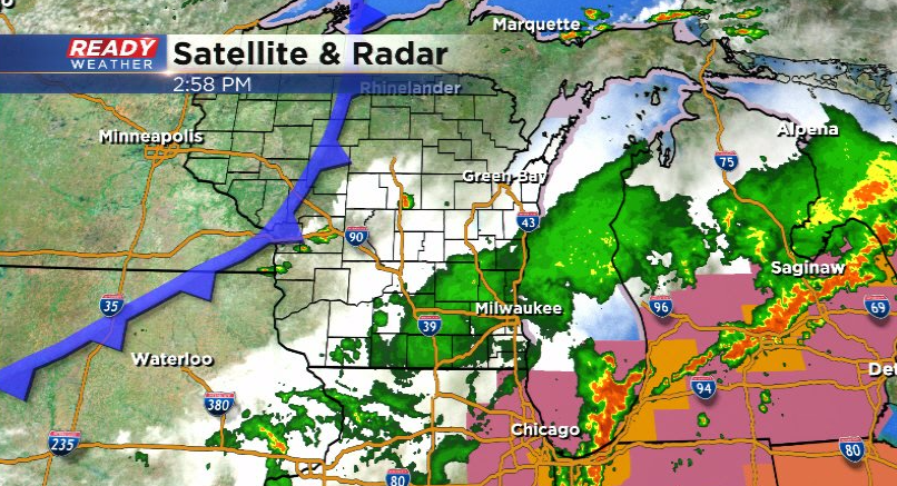
Widespread area of rain has been weakening as it pushes east this afternoon.
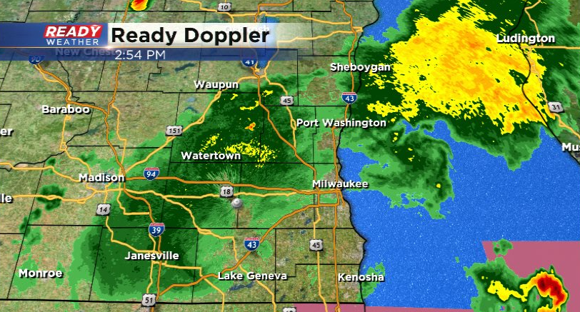
Severe storms to our south and east have been taking the energy needed to keep this rain going. Meanwhile, a few isolated storms are popping ahead of the cold front to our northwest.
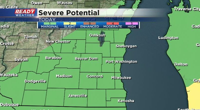
We can't rule out a few isolated storms 8 pm, but it will be hard to keep any storms going given the amount of rain and cloud cover we've had today. Our severe risk for the remainder of the day has been downgraded to a level 1 of 5, Marginal Risk.
------------------------------------------------------------------------------------------------
Updated: Wednesday August 3rd 1:20 pm:
The severe storm that pushed into Dodge county has now weakened below severe limits. While there are plenty of showers and storms out there right now, nothing is severe.
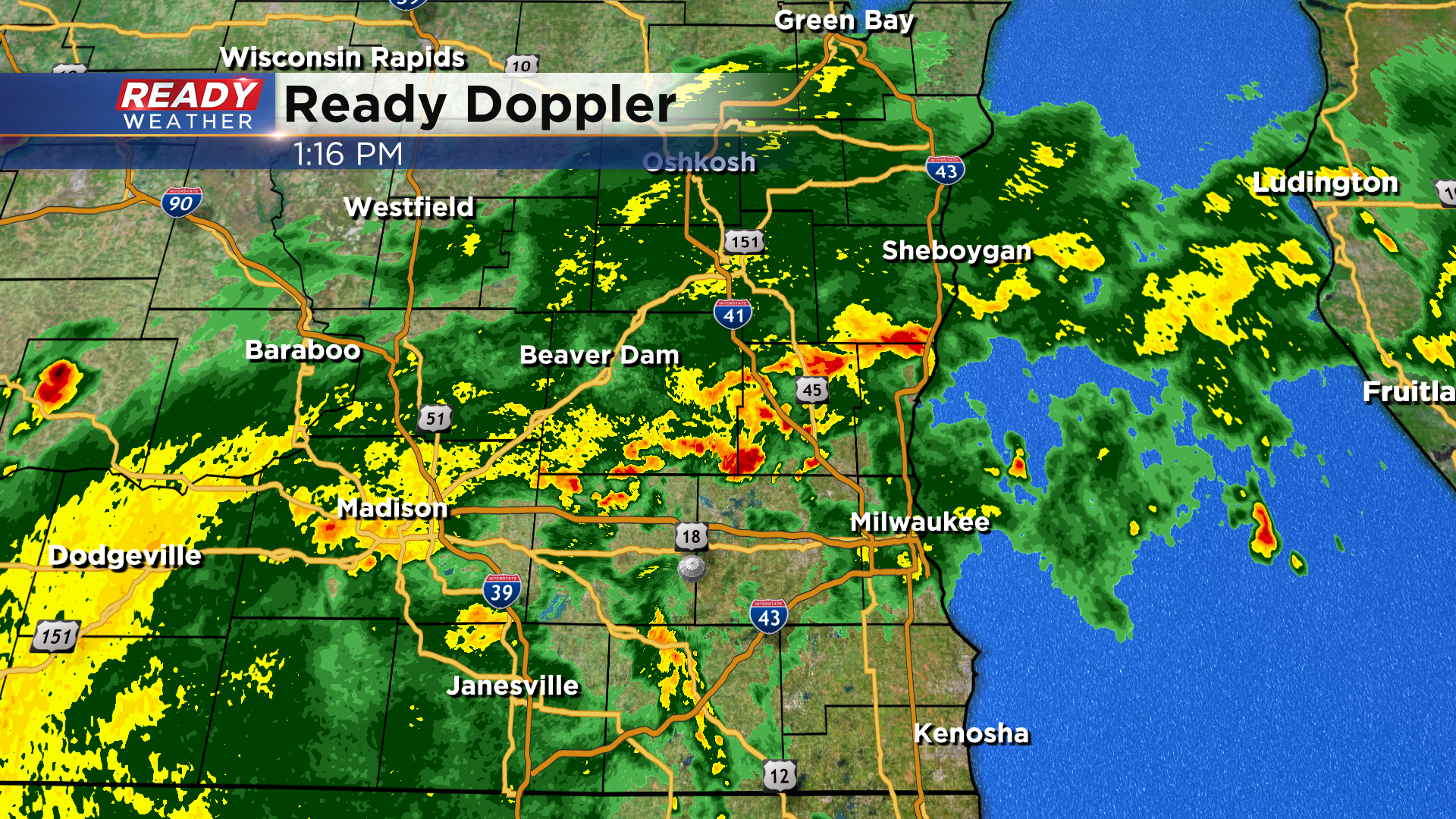
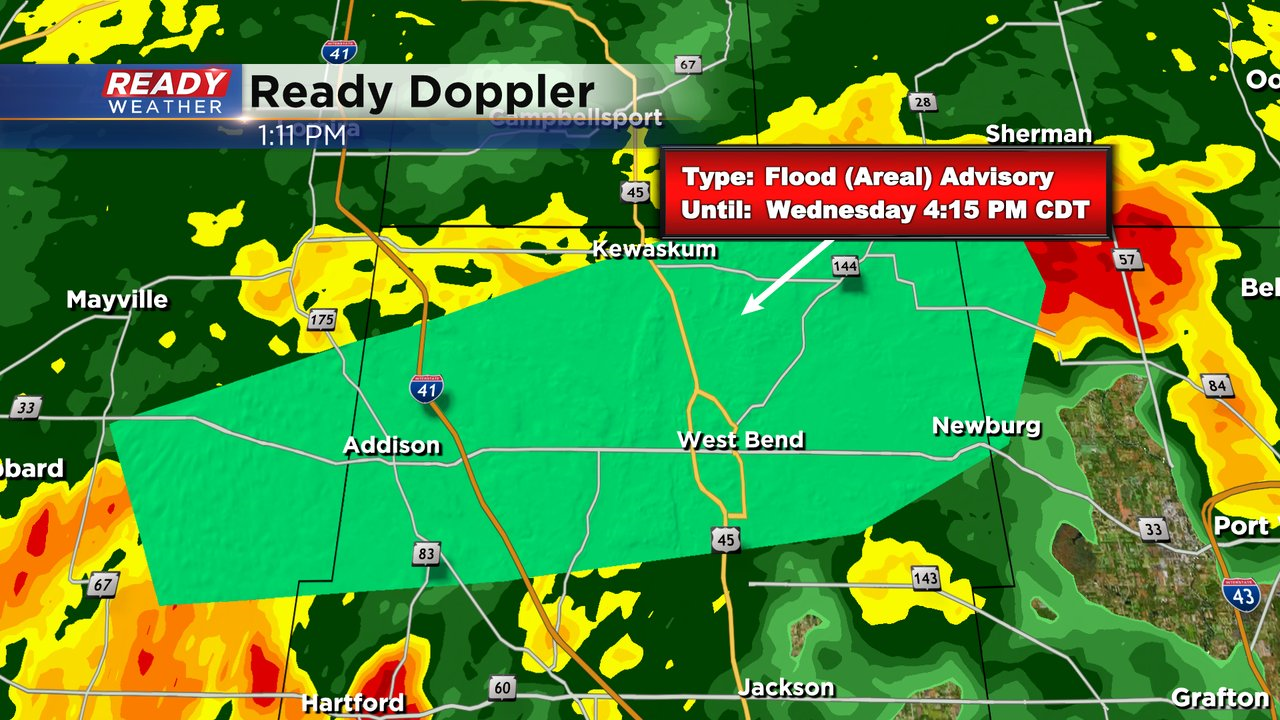
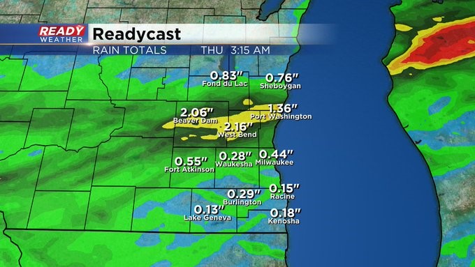
However, repeated rounds of heavy rain in Washington county has prompted an Areal Flood Advisory through 4:15pm. Between 1-2" of rain has already fallen in the highlighted area with an additional inch possible, which may lead to minor flooding.
The widespread rain closing in on the area should help limit additional severe storms, but we'll be watching to see if any storms can pop ahead of the main area of rain in Racine and Kenosha counties where storms have largely missed today.
--------------------------------------------------------------------------------------------------
Updated: Wednesday August 3rd 11:30 am:
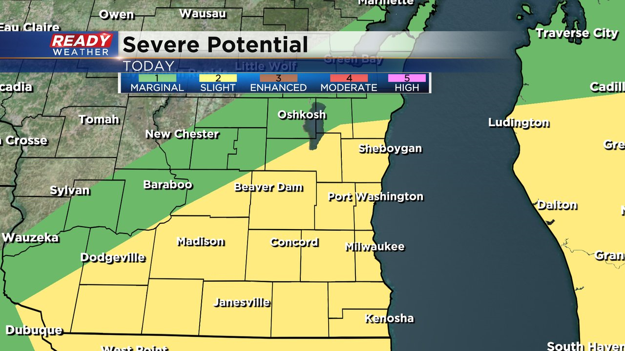
The level 2 of 5, Slight Risk, has been expanded across all of southeast Wisconsin. Confidence is increasing that scattered storms may produce damaging winds gusts as a low pressure system tracks along the WI/IL border this afternoon.
----------------------------------------------------------------------
Updated: Wednesday August 3rd 11:00am:
Clusters of showers and thunderstorms have developed across southeast Wisconsin with a few stronger storms developing back in SW WI and eastern Iowa.
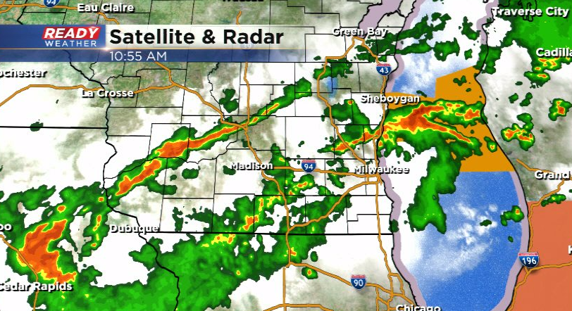
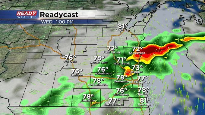
We'll continue to see numerous showers and storms through at least mid afternoon as the low pressure system in eastern Iowa tracks across southern Wisconsin. The Storm Prediction Center has indicated that it's pretty unlikely they'll issue a watch for our area, but a few severe storms will be possible, especially early afternoon. Damaging wind and hail are the main threats.
Storms are also producing very heavy rain, which could lead to flooding in spots that see more than one storm.
---------------------------------------------------------------------
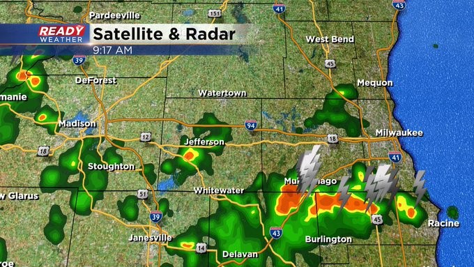
Update as of 9:25 am Wednesday, Aug. 3rd...
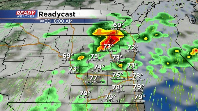
Storms beginning to increase across the area, especially south of I-94. Still thinking the biggest push of storms will be around lunch into the afternoon. Not sure if another round will move in for the middle of the evening ahead of a cold front. The weather team is watching the situation carefully and will keep you updated.
_____________________________________________________________________________________________________________
Update as of 8 am Wednesday, Aug. 3rd...
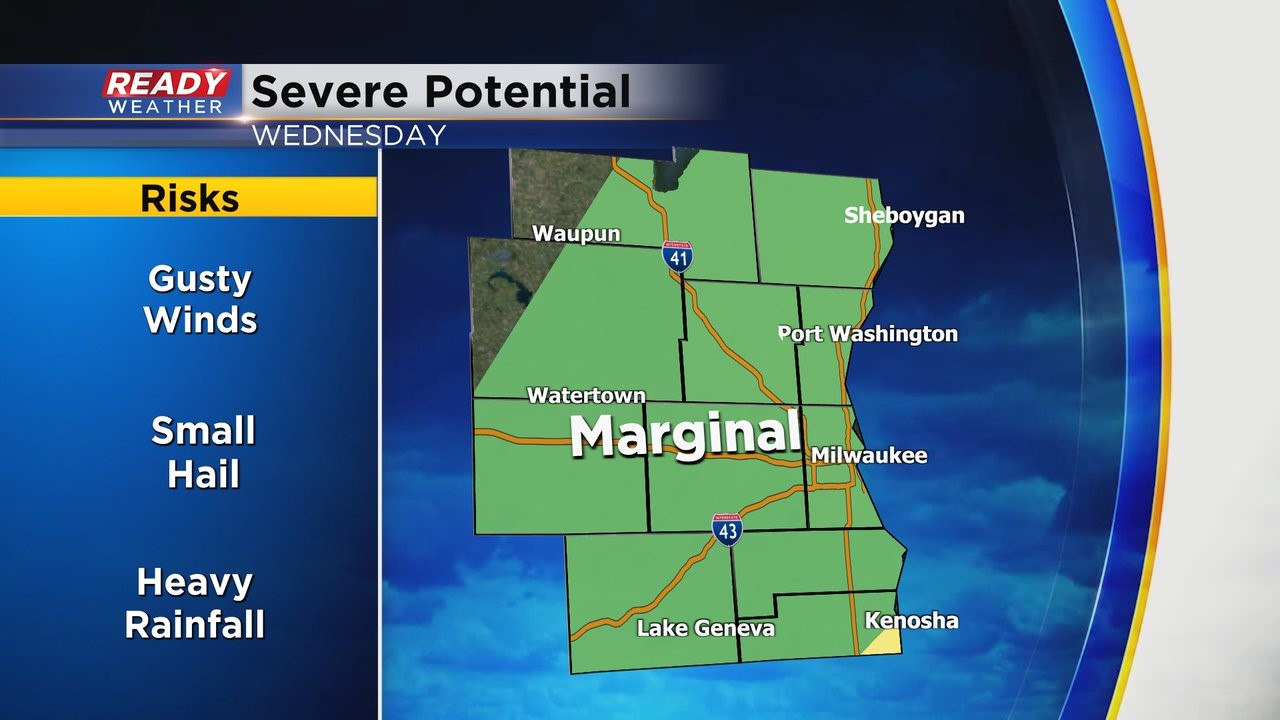
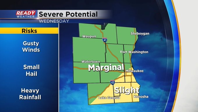
Milwaukee, Racine, and Lake Geneva are all under a slight risk of severe weather today. Most locations north of I-94 are under a marginal risk. It's a lower chance. Stay tuned to CBS58 for all the latest weather information.
_____________________________________________________________________________________________________________
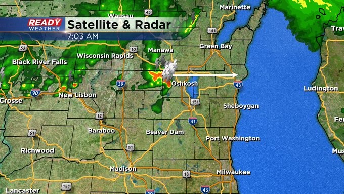
Update as of 7 am, Wednesday, Aug. 3rd...
Most of the storms are staying north of us. However, I think our better chance will be late this morning into the early afternoon. The big question is will we see development into the evening ahead of a strong cold front. We have a marginal risk of severe weather, but it's a little bit better risk Kenosha points south. Stay tuned to CBS58 for the latest weather developments.
____________________________________________________________________________________________________________
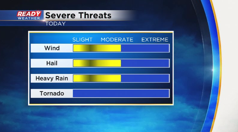
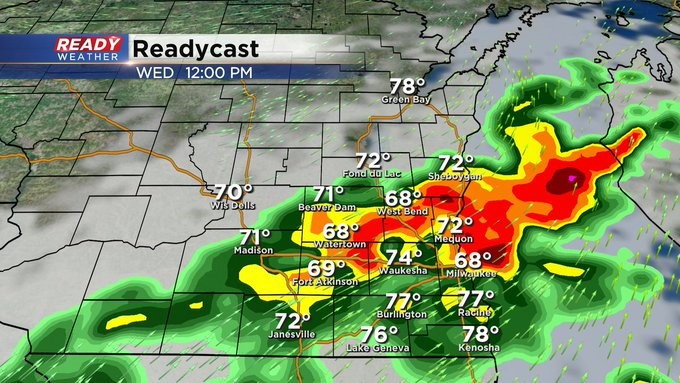
MILWAUKEE (CBS 58)--This looks to be the stormiest day of the entire week. Scattered showers and storms are possible, especially into the afternoon and evening. We have a marginal risk for severe weather with large hail and damaging winds the largest threats. Heavy rain is possible too, perhaps an inch or more in spots. Highs will approach 90 with heat indices near 100.
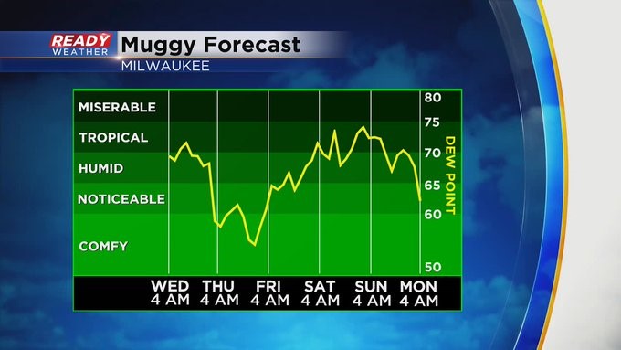
A cold front moving through later this evening will help scour out the atmosphere with all the heat and humidity. Look for highs near 80 on Thursday and Friday with prevalent onshore winds. This means cooler by the lake. Another chance of rain and storms will come by Sunday. Highs during the weekend mainly in the 80s with higher humidity too. Better weather into next week.