Midday Update: Damaging winds and isolated tornadoes are possible through 1 pm


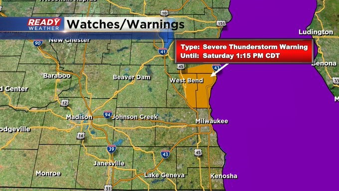
Update as of 12:55 pm Saturday, November 5th...
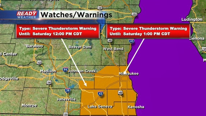
The severe weather threat has shifted north of the metro. There' s a warning in place until 1:15 pm north of Milwaukee. 60 mph winds still possible.
_____________________________________________________________________________________________________________
Update as of midday Saturday, November 5th...
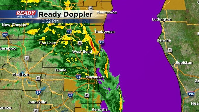
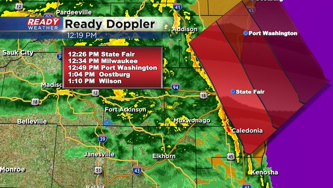
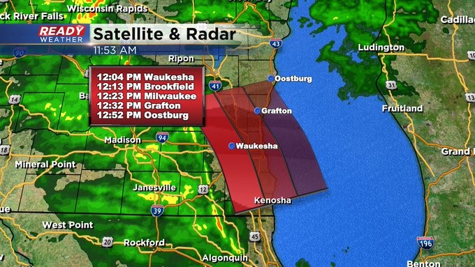
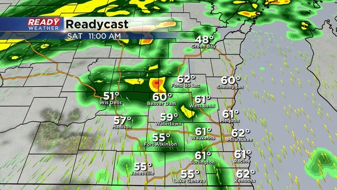
Here's the latest storm track, showing you the communities impacted in the next half hour or so. A Severe Thunderstorm Warning remains in place for the next half hour or so.
_____________________________________________________________________________________________________________
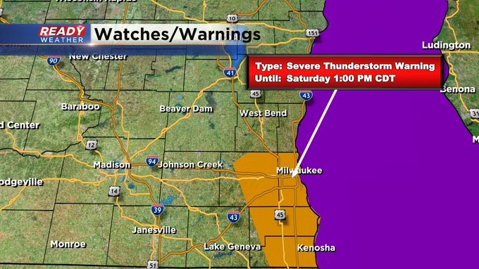
A Severe Thunderstorm Warning is in place until 1 pm for the metro area. Expect strong to severe storms in the next hour. 60 mph winds or higher can be expected. Find a place of shelter now. Stay tuned to @cbs58 for the latest weather information.
______________________________________________________________________________________________________________
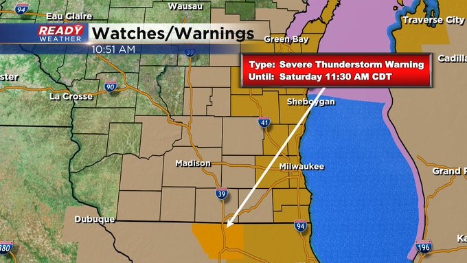
Update as of 11:45 am Saturday, November 5th
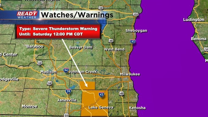
A Severe Thunderstorm Warning remains in place until noon for southern Jefferson and Walworth Counties. 60-70 mph winds are possible. Storms could impact the metro hour in the next 30-40 minutes. Stay tuned to CBS 58 for the latest weather information.
_____________________________________________________________________________________________________________
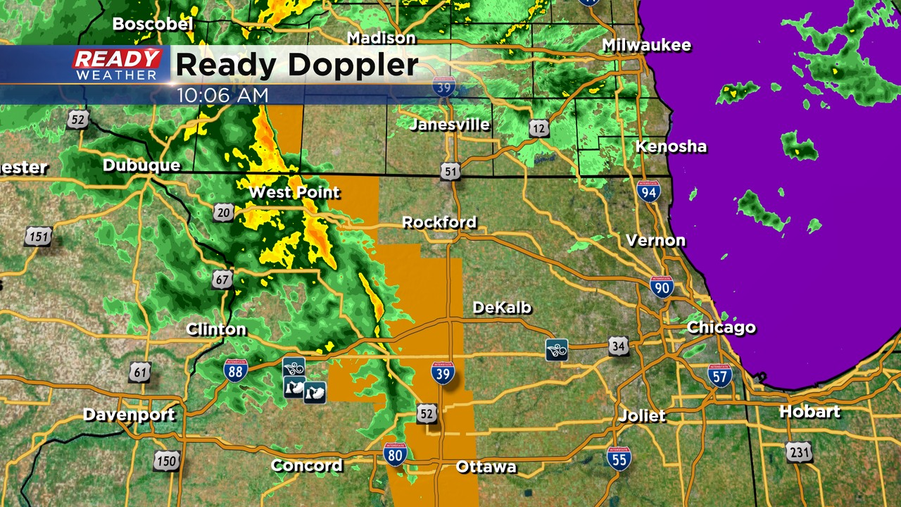
Update as of 11:10 am Saturday, November 5th
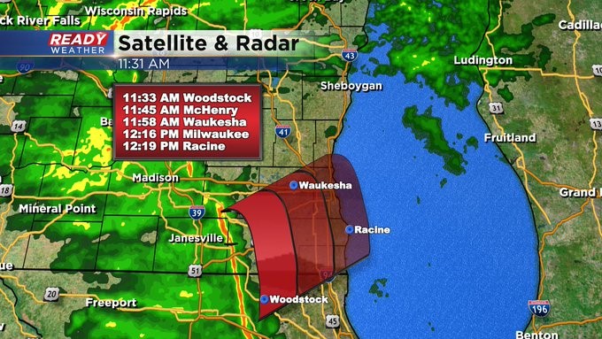
Severe weather is firing around Rockford and working toward our area. Wind gusts more than 60 mph are possible over the course of the next few hours. The entire CBS 58 Ready Weather team is in place to track what's coming our way. Stay tuned to CBS58 throughout the day, on air and online, for the latest weather updates.
_____________________________________________________________________________________________________________
Update as of 10:00 am Saturday, November 5th.
A line of showers and storms to our southwest will pivot across our area this morning into the early afternoon. There's enough wind shear where isolated tornadoes are possible. They would be very short lived and move through quickly.
In addition to the tornado threat, these storms could pull down 70 mph wind gusts. Even showers moving through could produce strong winds at the surface.
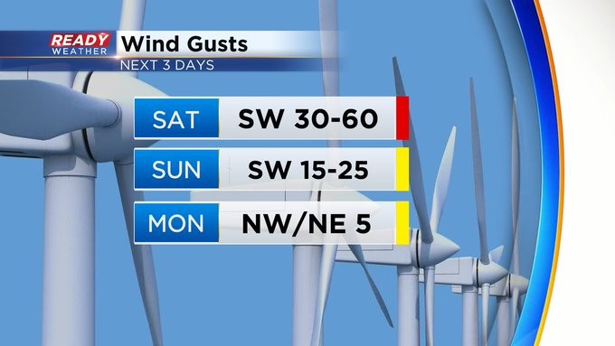
After 1 pm we will focus on non-thunderstorm wind gusts to 60 mph. A high wind warning has been issued for the lakefront counties!
____________________________________________________________________________________________________________
Update as of 8:15 am Saturday, November 5th...
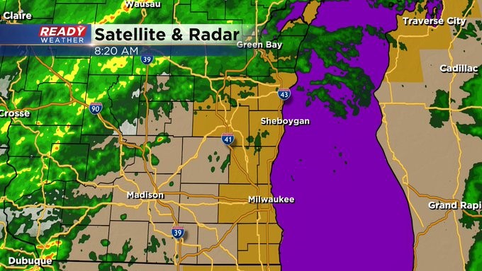
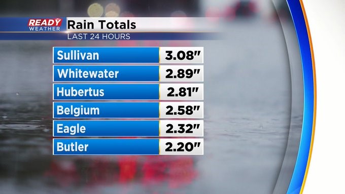
We're in the middle of a few dry hours. The rain out west will eventually come our way. Embedded storms, some strong to severe, are possible between 10 am and 1 pm. Wind gusts of more than 50 mph are also possible through the day. Don't think we'll be adding a lot more to the rainfall totals over the last day at least widespread.
______________________________________________________________________________________________________________
MILWAUKEE (CBS 58)--We're on weather watch to start this weekend. We now have a High Wind Warning in place from 7 am until 9 pm Saturday for most of the area (except Dodge, Jefferson, and Walworth Counties where there's Wind Advisory). Look for gusts from the southwest at 60 mph at least. There's also an opportunity to see strong to severe weather, mainly in the morning hours, as a strong cold front crosses the area. A few isolated spin ups are possible too. The winds won't really die down until later tonight. Make sure to change the clocks back an hour before going to bed Saturday night as Daylight Saving Time ends.
It'll be cool to start the week. Election Day on Tuesday looking dry and seasonable. Then another front moves through on Thursday. Highs will drop into the 40s for the end of the week. Looks like a better chance of rain on Thursday as well. Find the heavier jackets and coats by then.