New record high for Milwaukee today!


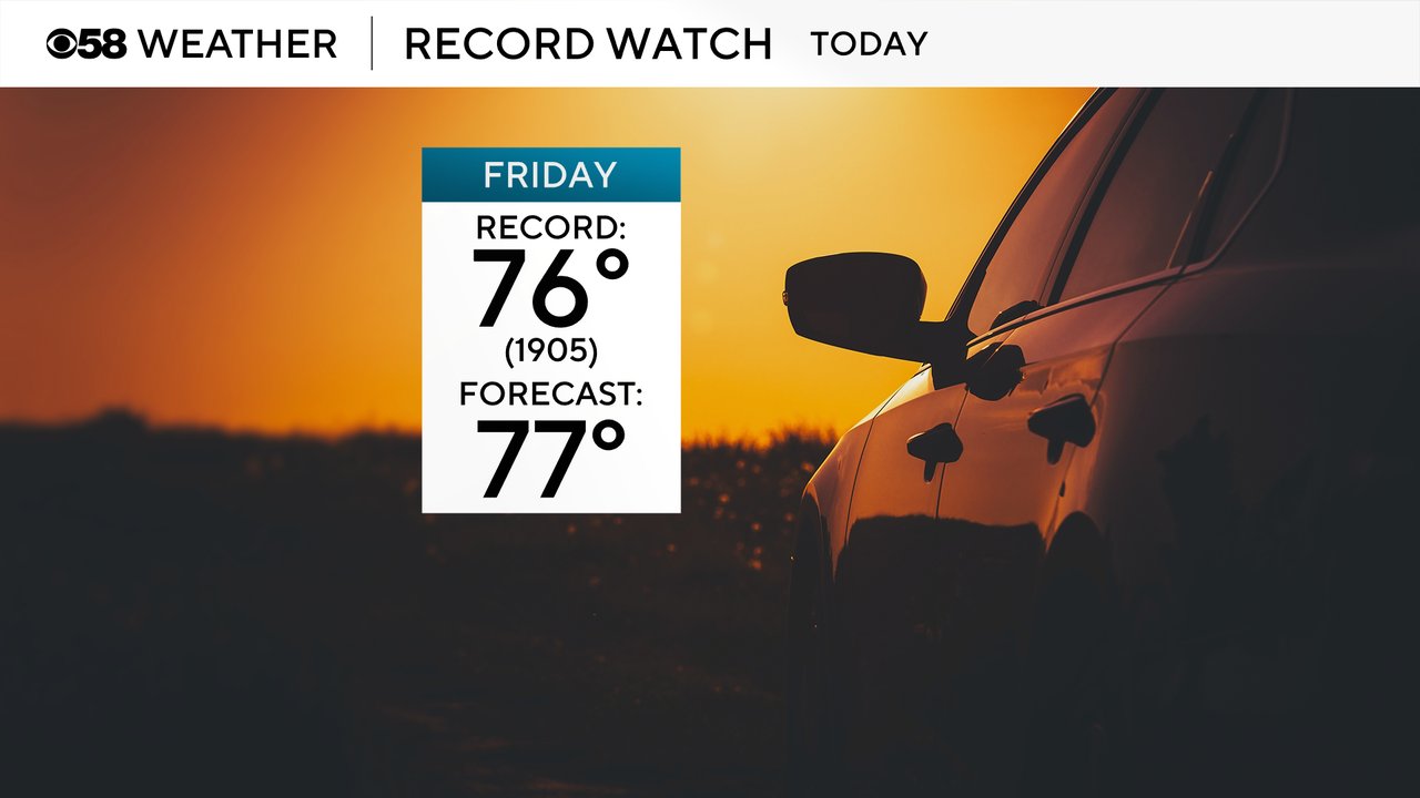
Friday was unbelievable after the storms cleared out. A southwest wind pushed highs into the middle 70s. Milwaukee broke the old high of 76 set back in 1905. The new high for today is 77.

This was the first 70 of the season, which usually occurs the first week of April!
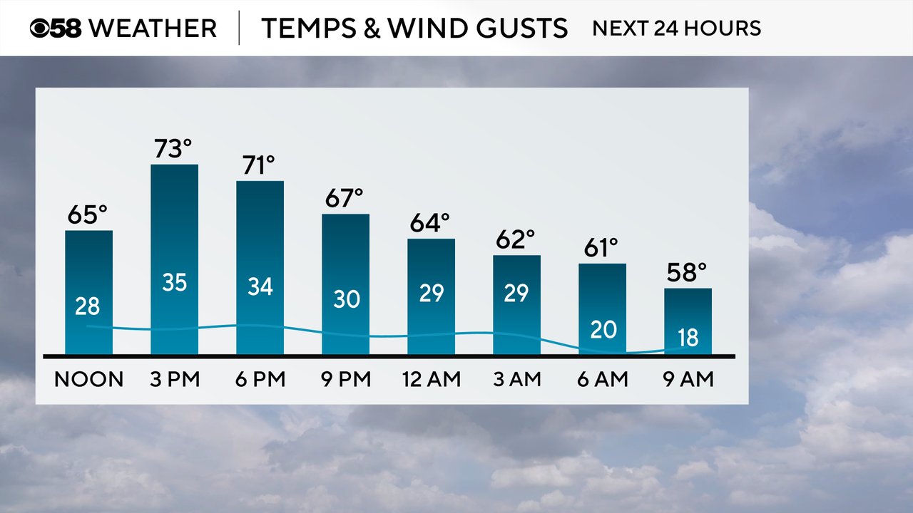
Friday started off loud for most of southeast Wisconsin with a round of heavy rain and thunderstorms moving through. As of 9 AM those storms have all ended and a few lingering showers will wrap up shortly. The rest of the day looks dry with decreasing clouds and some good sunshine at times. Temperatures will warm fast as well after the storms end with afternoon highs reaching into the 70s! The wind will increase as well with wind gusts this afternoon and evening above 30 mph.
We are on record watch Friday! The current record is over 100-years-old and was set in 1905 of 76 degrees! The current forecast high on Friday of 77 would break that record!
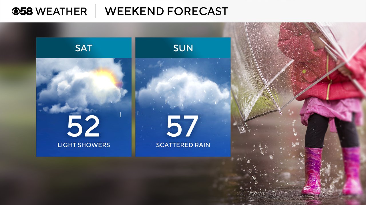
The major warmth is short lived. The "high" for Saturday will likely happen at midnight Friday night with temps still in the mid 60s. Then we drop through the 50s in the morning and into the 40s Saturday afternoon. Sunday rebounds a bit with highs in the upper 50s then another cold front drops us into the upper 30s and low 40s when we head back to work.

After the near record heat on Friday, we see wet weather continue most of the weekend. Scattered light showers are possible most of Saturday but there will likely be long stretches of dry time. Sunday's rain looks a little bit heavier, especially in the afternoon and evening when some storms are possible.
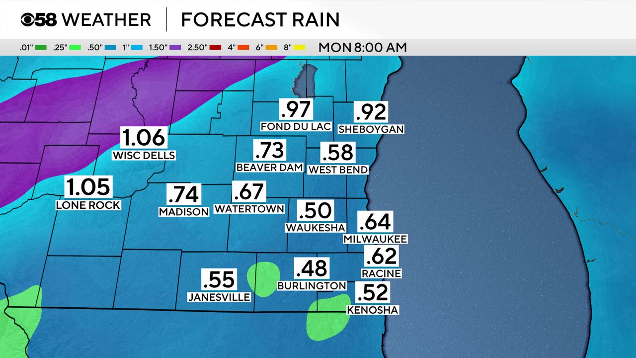
Some communities already picked up 0.25-0.50" of rain Friday morning and another 0.50-1" of rain is possible over the weekend with most of it falling on Sunday.
Download the CBS 58 Weather app to track the temps for your location on Friday and the weekend rain with the interactive radar.