


The first week of October has been warm especially after three straight days in the 80s over the weekend. Monday was also a warm day but a cold front started to roll in. Some of our northern counties stayed in the 60s to around 70 but Milwaukee almost hit 80 and Racine and Burlington did reach the low 80s. Then we saw the front arrive and it kicked up a NE lake breeze which dropped the temp in Milwaukee 15 degrees in one hour. At 2:05 PM the temperature in Milwaukee was 79 and by 3:05 PM that temp had dropped to 64. You may remember the term "pneumonia front". We came close to hitting one Monday but the threshold is 16 degrees in an hour so we fell just one degree short.

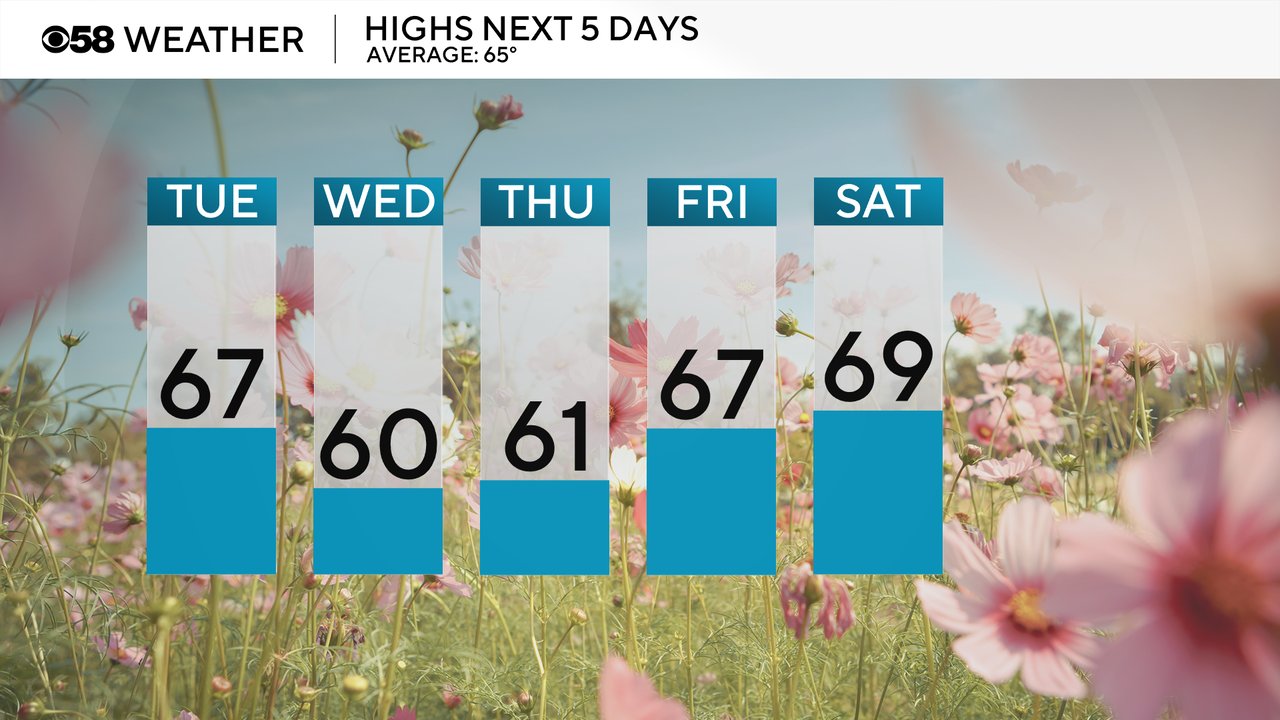
Highs over the next five days will stay cool. We see highs Tuesday afternoon in the mid to upper 60s which is technically still above average for this time of year. Wednesday and Thursday will be the coolest days of the week with highs around 60 then we warm into the upper 60s to around 70 for the weekend.
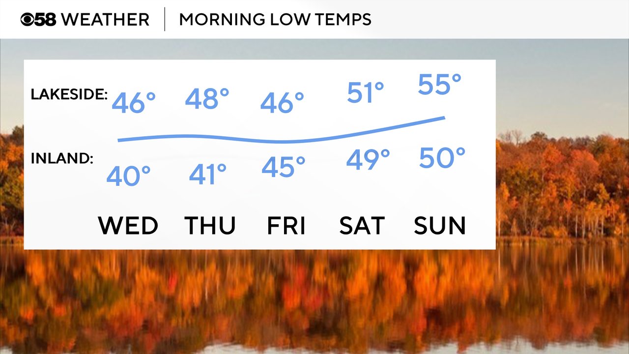
Low temps will drop into the 40s over the next few mornings for the coolest temps since the beginning of September. Some inland locations may hover right around 40 with some isolated upper 30s possible. By the weekend the overnight temperatures warm just a bit.
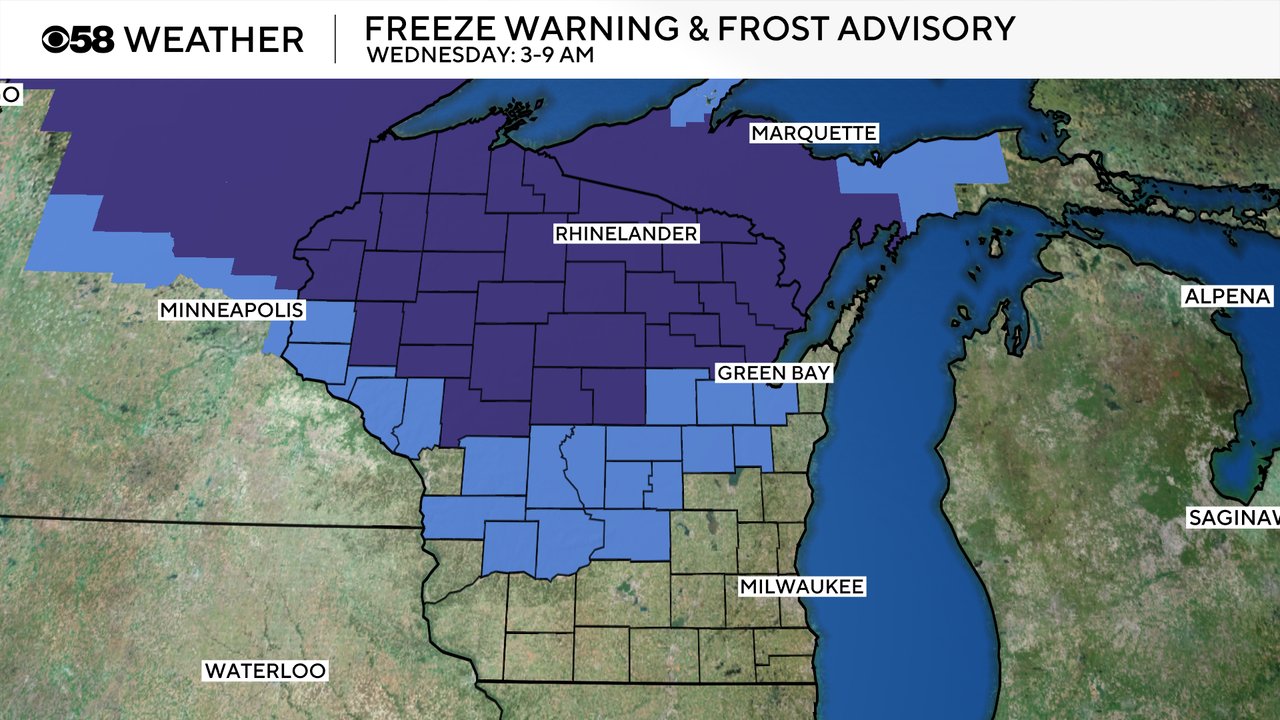
No cold weather headlines have been issued for us in southeast Wisconsin but northern Wisconsin is under a freeze warning and central Wisconsin is under a frost advisory for Wednesday morning from 3-9 AM.
Download the CBS 58 Weather app to track the blast of cool air and any more rain chances.