Strong fall cold front brings light showers and a frost and freeze by the end of the week


The last few days have been very mild with highs reaching into the 70s. That warm will come to an end with a strong fall cold front moving across the state on Thursday. Temperatures Thursday morning will get into the middle to upper 60s by midday before dropping back into the low 60s and 50s Thursday evening.

Watch the wind as well. As the cold front rolls in wind gusts will rise to 30 mph Thursday afternoon and night then expect a breezy north or west wind Friday and Saturday with gusts to 20 or 25 mph.
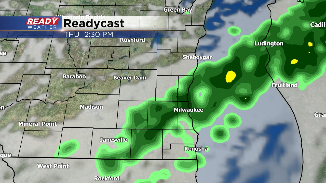
The cold front will also bring with it some light rain showers. The chance for rain arrives around 10 AM on Thursday and lasts through 6 PM. Rain will probably only fall for a couple hours in any given location but light rain is likely for at least part of the day in many areas.
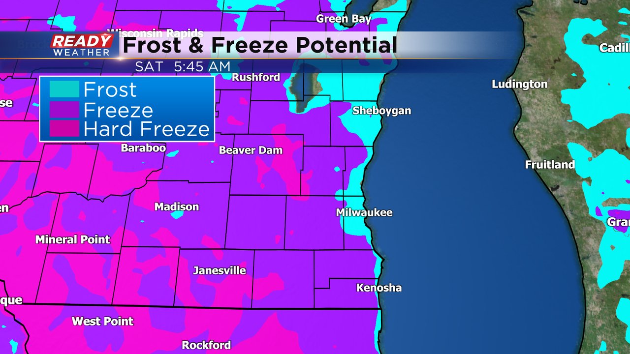
After the cold front by Friday morning temperatures will drop into the 30s to around 40*. We will probably avoid a frost lakeside but many inland hometowns could see a patchy frost with lows in the low to middle 30s.

We will be even colder Saturday morning with lakeside locations cooling into the 30s. Some inland communities could even get down to the upper 20s. A widespread frost, even lakeside, is likely with a freeze in many locations away from the Lake and even the chance at a hard freeze.
Download the CBS 58 Ready Weather app to track the temperatures.