Strong fall cold front to drop temps below normal for foreseeable future
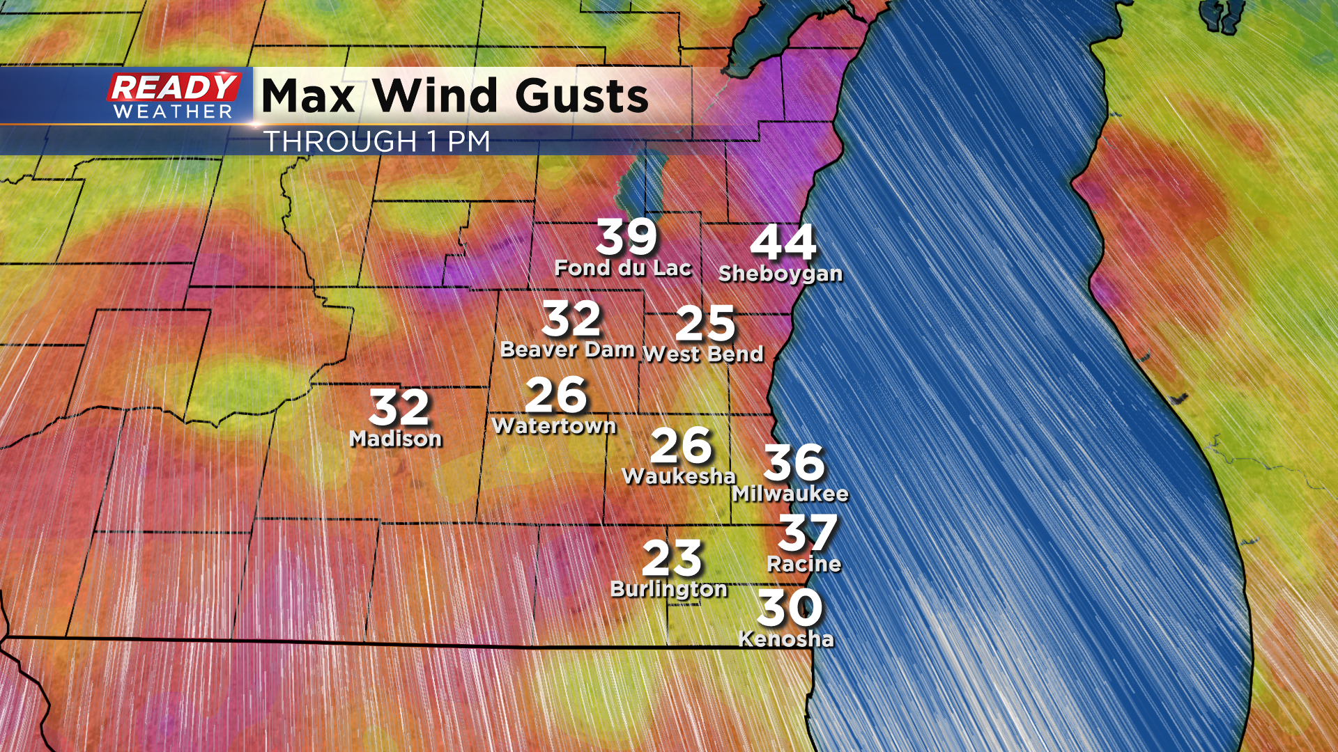
It’s shaping up to be another windy day across southeast Wisconsin. Wind gusts at midday have already topped 35 mph in many spots and could exceed 40 mph this afternoon.
This is all ahead of a low pressure system that is strengthening in northern Minnesota. This low will track through northern Wisconsin this evening and drag two cold fronts across the state before Thursday morning. The first cold front will pass through this evening and may touch off a few isolated sprinkles or light showers.
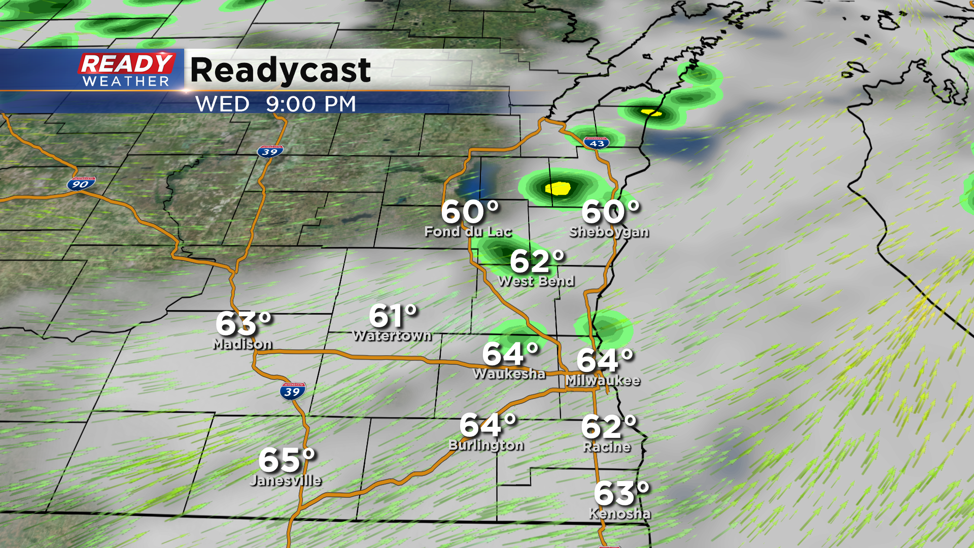
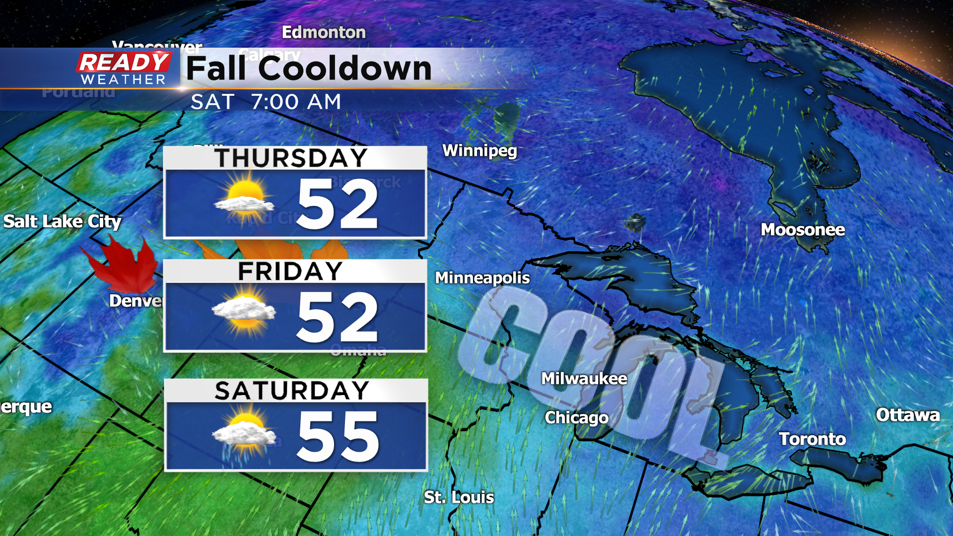
A second, stronger cold front will push through around/shortly after midnight, which will usher in a surge of cooler from Canada. This will drop highs into the 50s for the rest of the week and into the weekend.
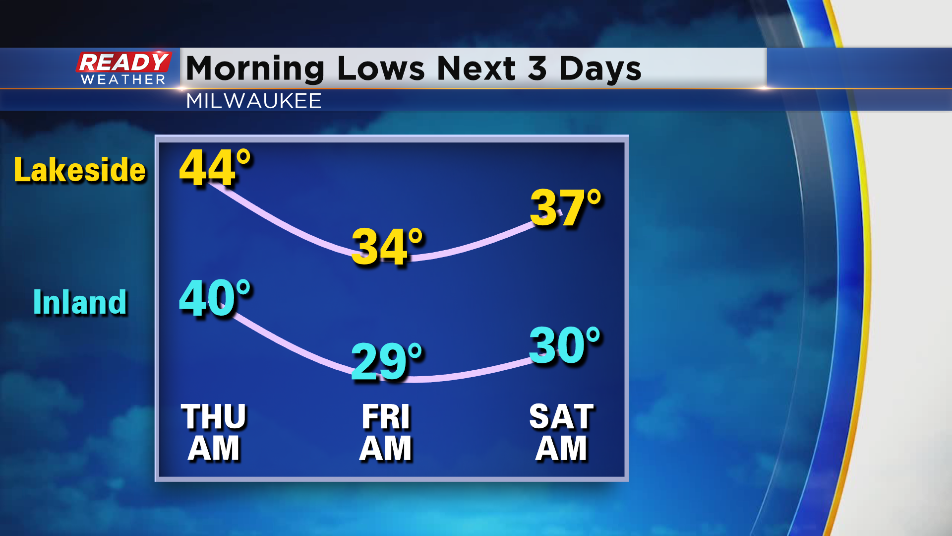
This cooler air mass will be more noticeable at night. Lingering clouds will keep temps in the 40s to start the day on Thursday, but clear skies and lighter winds will allow temps to plummet into the upper 20s to low 30s by Friday morning, leading to a widespread frost and possibly a widespread freeze. Another round of frost is possible Friday night into Saturday morning, especially away from the lake.
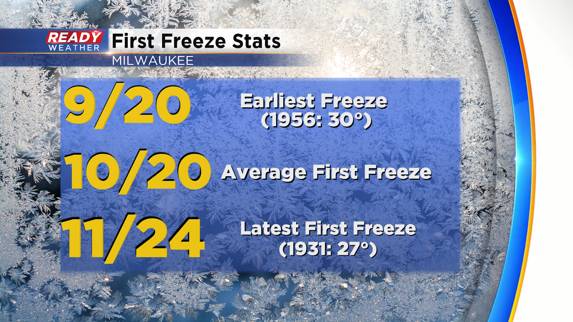
Inland spots have already dipped to and below the freezing mark a couple of times this fall, but Milwaukee's coldest temp so far this fall is 36°. Milwaukee usually experiences its first freeze around October 20th.
Download the CBS 58 Ready Weather App to see if this chilly air will lead to any mixed precipitation.
