1 AM Update: Strong storms with hail have developed
Updated: 1:08 a.m. May 14, 2018
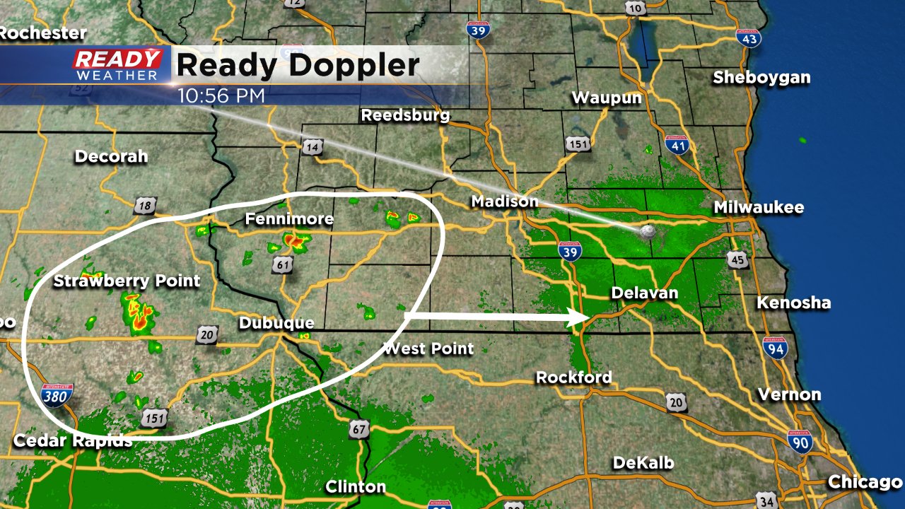
Strong storms have developed just to our west over Dane and Iowa Counties and are moving east. These storms are capable of hail and gusty wind to 40 mph. The storms will impact Waukesha around 1:45 a.m. and start hitting Milwaukee County near 2 a.m.

------
Updated: 11:08 p.m. May 13, 2018
Showers and storms have developed right on schedule in eastern Iowa and southwest Wisconsin. These storms are expected to move east over the next few hours and start impacting parts of southeast Wisconsin after 1 a.m.
The threat for some isolated strong to severe storms still exists.
------
Posted: 6:16 p.m. May 13, 2018
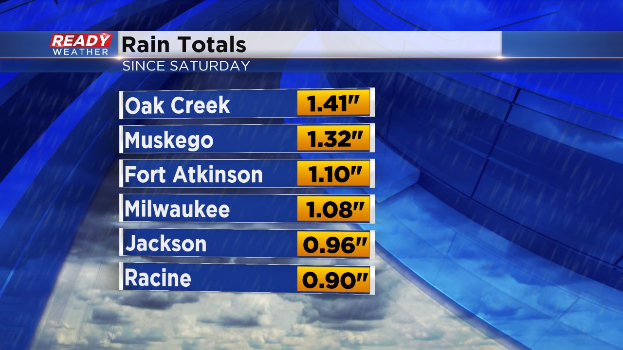
After a soggy Saturday night another round of rain and storms will arrive in southeast Wisconsin Sunday night. The majority of southeast Wisconsin has seen a plethora of rain over the past week. Mainly southern areas picked up the most Saturday night with some picking up over 1" of rain.
This May has been off to a very wet start and close to a record. Through the first 12 days of the month it is the 4th wettest May on record! Milwaukee has picked up 4.50" which is already above the average amount we see for the whole month of May, 3.40". The record wettest May happened in 1933 when Milwaukee saw 9.56" of rain. If we continue at the current trend, 2018 could rival that year. With still 18 days left in the month May, 2018 is already the 26th wettest May on record and that will happen even if we don't get any more rainfall.

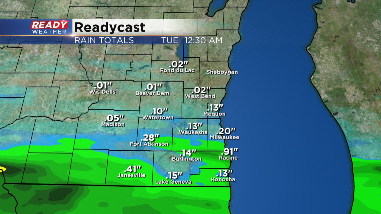
But, more rain is expected and some have the possibility to pick up another inch or two. Storms arrive after midnight Sunday night once again mainly in our southern half of counties. These storms will likely linger into the morning and could impact parts of the Monday morning commute.
Most of southeast Wisconsin will likely pick up less than a half inch of rain, but areas that see multiple thunderstorms could get as much as an inch or two.
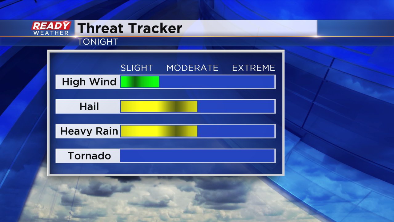
Strong storms will once again be possible with some of our southern counties in the "marginal" risk for severe weather both Sunday night and Monday. Hail looks to be the main threat along with heavy rain. Some gusty wind is likely as well.
Download the CBS 58 Ready Weather app to track the storms as they roll through and see updated blogs discussing the increasing rain we've received this month.
