Evening Update: Locally heavy rainfall possible


Updated: 7:45 p.m. June 3, 2024
All of the warnings have been dropped. There are strong storms moving across Walworth, Waukesha, and into Racine and Kenosha counties.

Gusty winds to 45 mph are possible along with some very heavy rainfall. Right now, we don't expect these storms to become severe.
______________________________________________________________________________________________________________
Updated: 6:45 p.m. June 3, 2024

A flash flood warning has been issued for parts of Jefferson county. Some areas have already picked 1" to 2".
Several flood advisories have been issued this evening. Locally heavy rainfall within those areas have created some localized flooding.

Stay away from flooded roadways. Additional rain and storms could create more flooding issues around Milwaukee, Waukesha, and Jefferson counties.
______________________________________________________________________________________________________________
Updated: 5:15 p.m. June 3, 2024
A flood watch has been issued for most of the area. Storms that have popped earlier produced some very heavy rainfall. Additional storms training over the same areas could also create some localized flooding.

We will expect scattered rain and storms to continue this evening. Stay away from flooded areas.
______________________________________________________________________________________________________________
Updated: 3:15 p.m. June 3, 2024
So far all of the storms have stayed well below severe limits this afternoon. The strongest storms have produced 40 mph winds, lightning, and some locally heavy rainfall.

There remains plenty of instability near the border of IL/WI. The strongest storms are sitting over Rock county.
______________________________________________________________________________________________________________
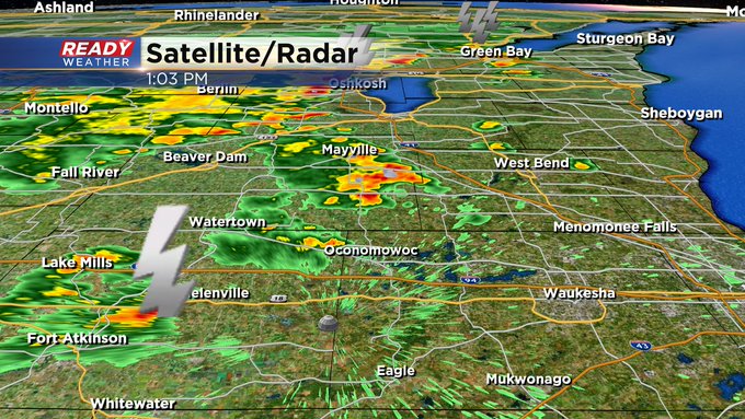
Updated: 1:08 p.m. June 3, 2024
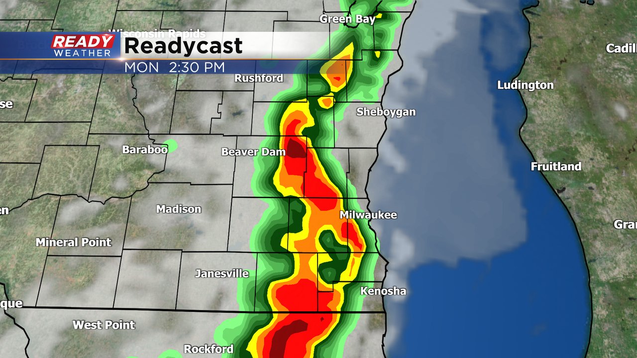
More storms have fired since the noon hour. Check it out:
Updated: 11:35 a.m. June 3, 2024
Forecast remains on track. Currently we have two areas of storms heading toward our western counties.
Updated: 9:35 a.m. June 3, 2024
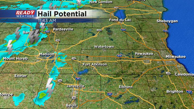
Most of southeast Wisconsin is still under some nice filtered sunshine as of the mid-morning hours on Monday. A few new storms are now starting to roll into southwest Wisconsin with a few more popping in NW Illinois. This will be the area to watch through the midday hours to see if the storms can really get going and then track them as they move into southeast Wisconsin for the rest of the afternoon and evening.
Here's is a radar image that will update with time:

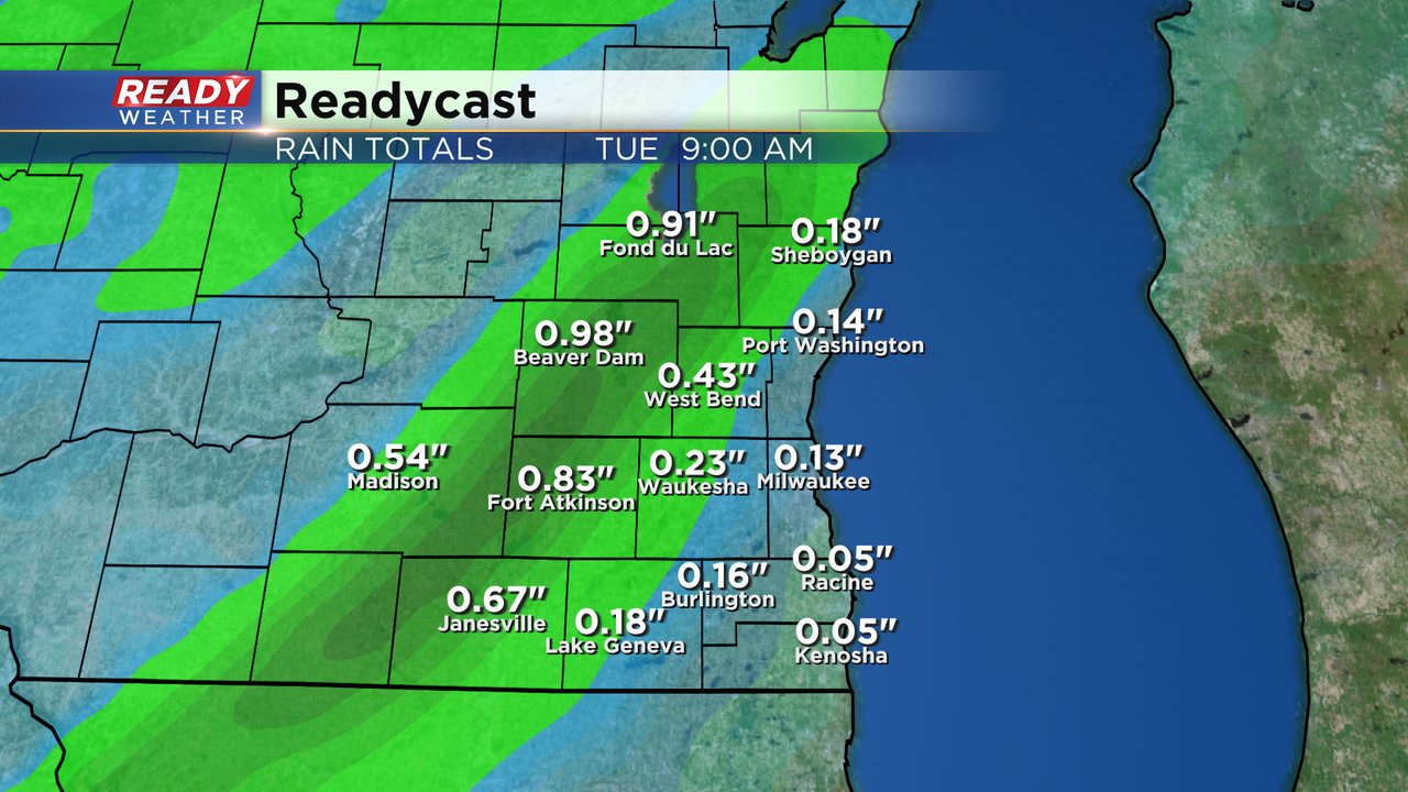
Rain totals on Monday will all depend on who sees the heaviest storms but most communities that do get storms could see a half to full inch of rain. If we get storms that go over the same area over and over, what we call "training", then rain totals could easily reach 2" or more leading to brief street flooding.
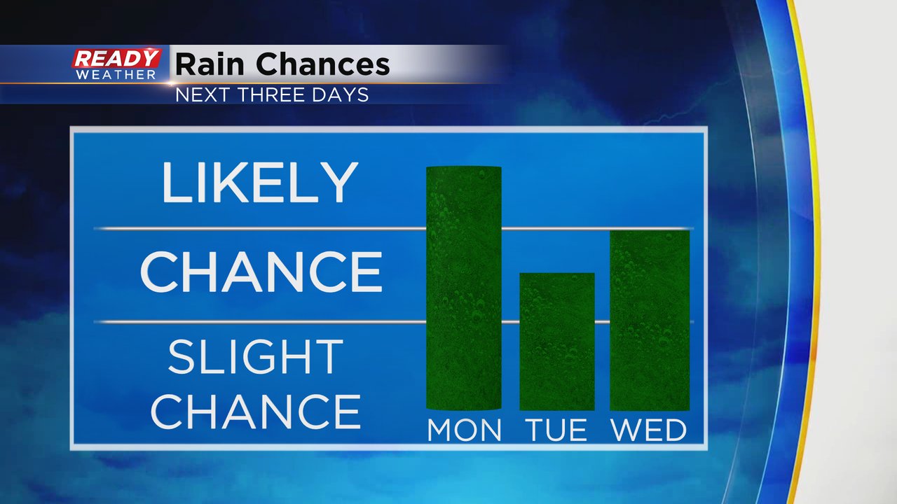
The storm chances don't stop on Monday. Tuesday has a chance for storms although the timing is a bit uncertain. Rain Tuesday looks possible both in the morning and again in the evening with more likely chances in the evening. Wednesday morning looks pretty wet as well but might dry out a bit in the afternoon.
The rest of the forecast and severe threats outlined below is still on track.
------
Posted: 5:51 a.m. June 3, 2024
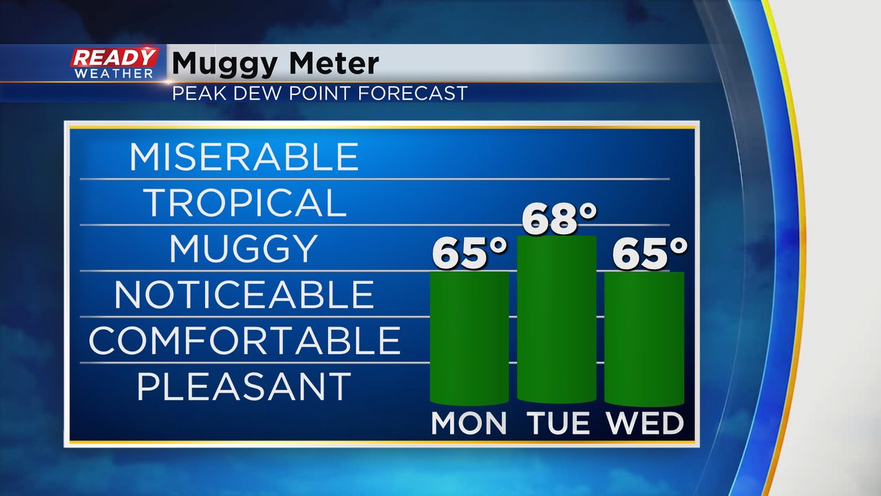
The temps and humidity levels will start to increase as we go into the new work week. High temperatures will range from the upper 70s to the low 80s with the warmest day on Tuesday. Dew points will also rise into the middle to upper 60s pushing humidity levels into the muggy category for some of the first prolonged humidity of the season.
After a dry start to the day Monday the storm chance increases around midday with storms likely during the afternoon and evening. There may be some dry time here and there but a rough timing for storms is from noon through midnight.
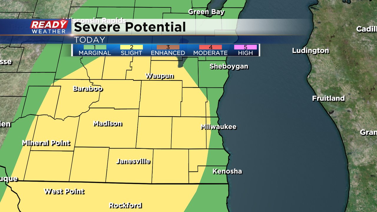
A good chunk of southeast Wisconsin us under a Level 2 Slight Risk for severe storms Monday afternoon and evening with a Level 1 Marginal Risk in our lakeside counties. Any storms that develop during the day on Monday could be strong to severe with some warnings possible.
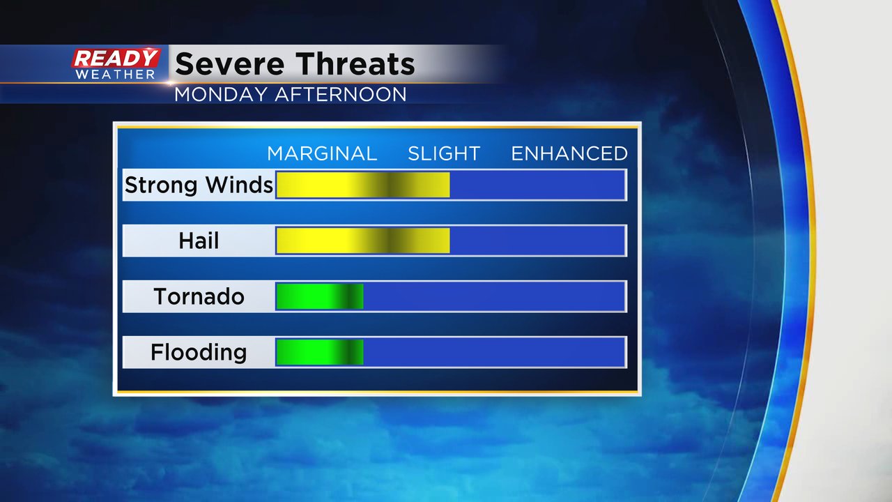
High wind and hail will be the main threats with any storms that develop Monday afternoon and evening but tornadoes are not out of the question and some flooding is also possible especially if storms go over the same area multiple times.
Download the CBS 58 Ready Weather app to track the storms Monday afternoon and evening.