Evening Update: Monitoring Storms Closer to 10 pm


It's been close to 90 this afternoon with plenty of heat and humidity. Other than a few showers earlier this afternoon, most of the strong to severe storm activity has stayed well to our northwest.
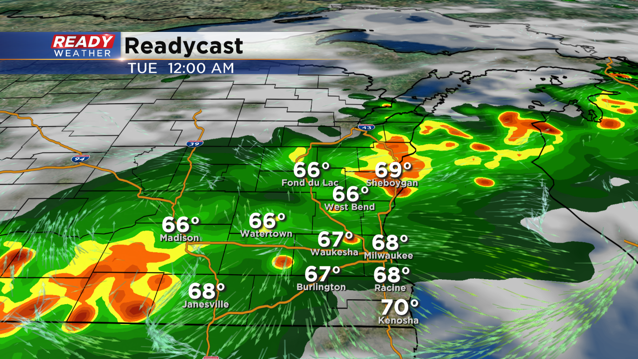
Storms are expected to move southeast in a fairly large line. While we are not under a watch at this time, it's possible southeastern Wisconsin will be added.
Storms are expected to move through between 9 pm and 1 am. Isolated strong to severe storms are possible with hail and gusty winds.
______________________________________________________________________________________________________________
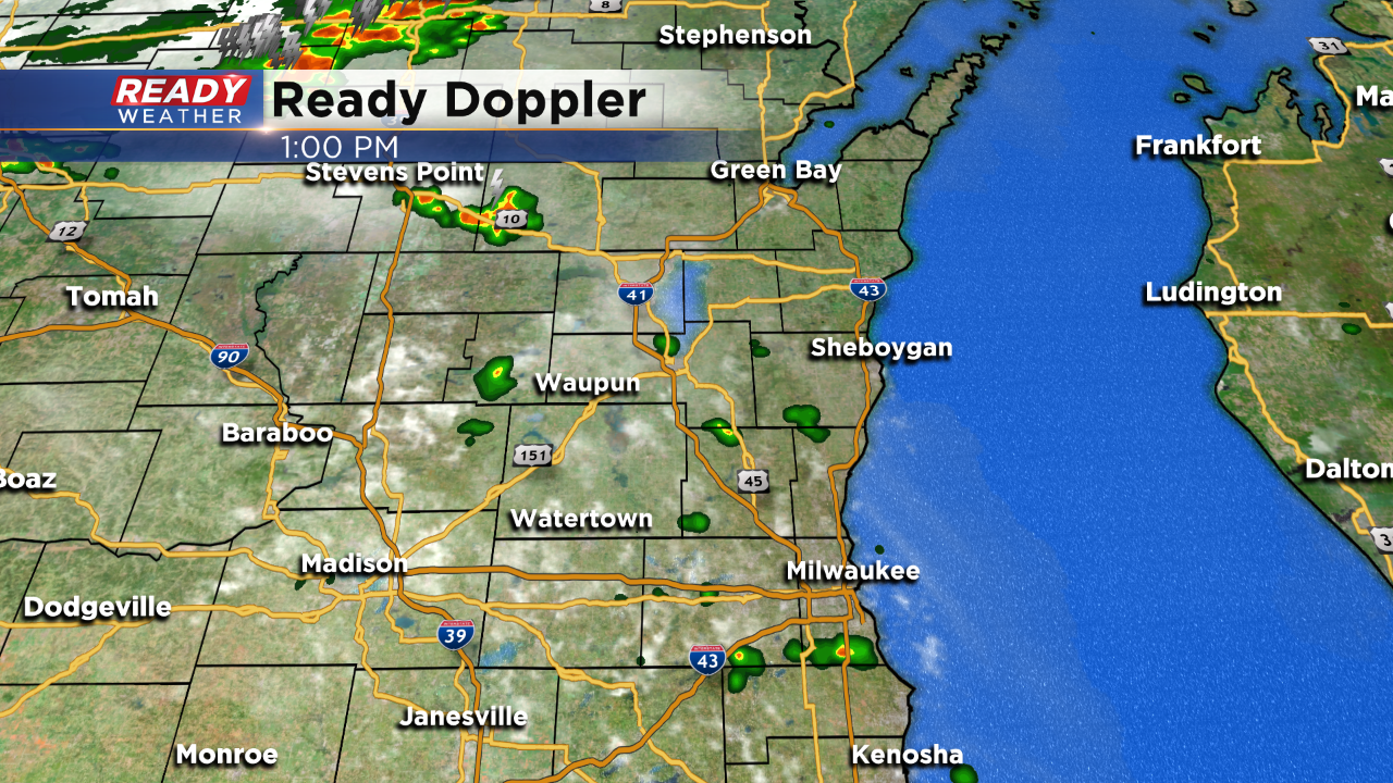
Updated: 1pm
The main line of storms is still well to our north, closer to a cold front. However, we are warming into the upper 80s with dew points in the middle 60s and that's enough for a few storms to pop here in our area. Take a look at our radar:
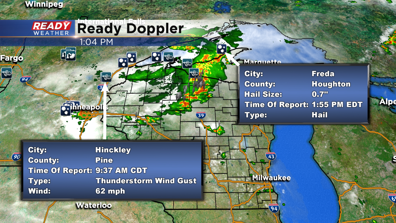
Updated: 8:38 p.m. August 5, 2019
The severe risk for Monday has been updated and the enhanced risk was pushed farther north into the Duluth/Superior area. It was also moved a little east, but still just west of our local area. Damaging wind remains the big threat along with heavy rain but some heavy rain and small hail is also possible.

------
Posted: 7:33 a.m. August 5, 2019
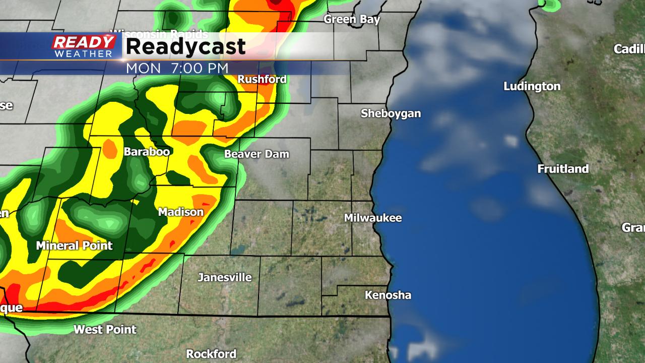
A few rounds of showers and storms rolled through over the weekend, but everything stayed below severe storm criteria. That could change on Monday as a line of rain and storms is expected to push across the state for most of the day.
A severe thunderstorm watch has already been issued for north west Wisconsin and parts of Minnesota. This is where the thunderstorms are expected to form and then move to the southeast.

Almost all of southeast Wisconsin is in the slight risk for severe weather with areas to our west in the enhanced risk. Most weather models show a weakening trend with the storms as they move into our area. Locally, the best chances to see some stronger storms will be our north and west communities like Sheboygan, Fond du lac, Jackson, Beaver Dam and Jefferson.

Damaging wind will be the main threat but these storms have a lot of moisture to work with so heavy downpours are likely along with some small hail. The tornado threat is low.
The timing for storms looks to be after 5 p.m. as the line pushes through and could last until midnight.
Download the CBS 58 Ready Weather app to track the storms as they move across the state.