It has been a very warm July thus far, however if you currently walk outside, there is a noticeable change in the temperatures. Temps in the city are 10 to 15 degrees cooler than they were just 24 hours ago.
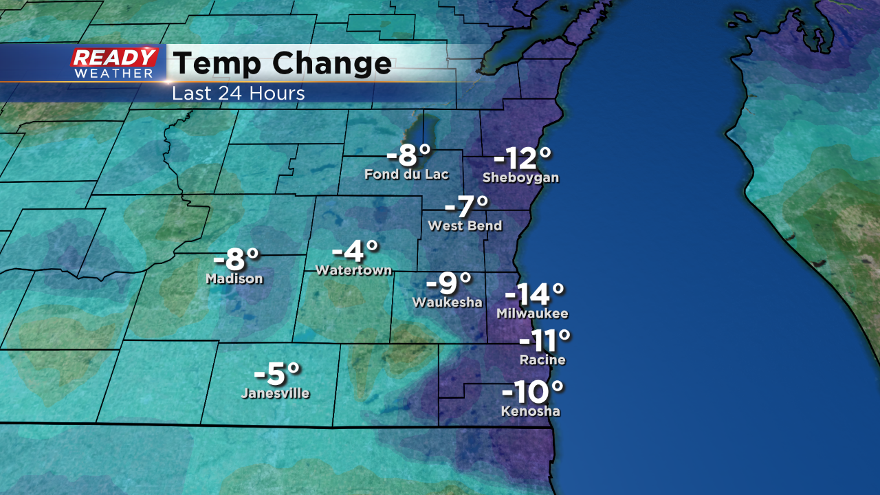
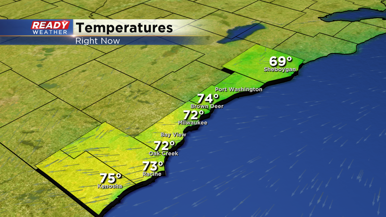
Our high for today will likely be 74 degrees, which we hit just after Midnight last night. However, our daytime high is currently at 72 degrees. Today has the potential to be the coldest day this July. On our previous coldest day, we saw a high of 73 degrees. The big cause of this temperature change is a wind coming directly from the Northeast, which correlates to a strong lake breeze that are keeping temperatures in the lower 70s.
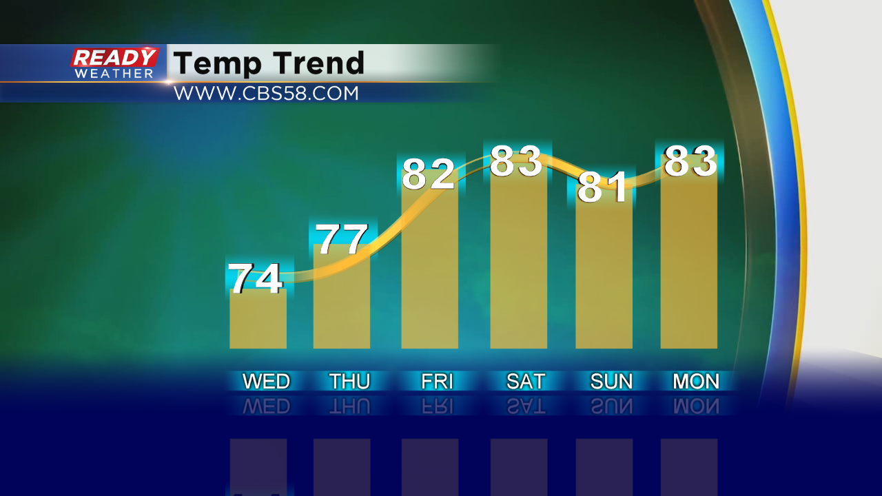
These cooler than average temperatures will stick around until at least Thursday and we may not see 80 degrees again until Friday, maybe even Saturday. It all depends on if the wind will be blowing towards or away from the lake.
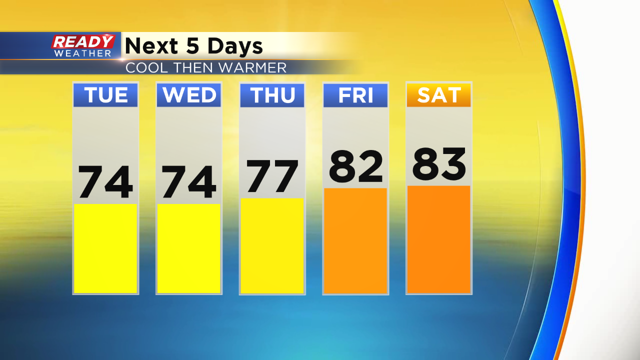
On top of the cold weather, we will be seeing nothing but sunshine for several days. Chances of rain for the next three days are minimal to zero. We will also see temperatures climb back up into the 80s consistently by the weekend.
Download the CBS 58 Ready Weather app to track the temperatures where you live.
Meteorologist Jacob Monte
