


The beginning of September has been overall gloomy and a little cool with five out of the first eight days seeing below-average temps. The gloominess will stick around through the upcoming week, but temperatures are trending much warmer.
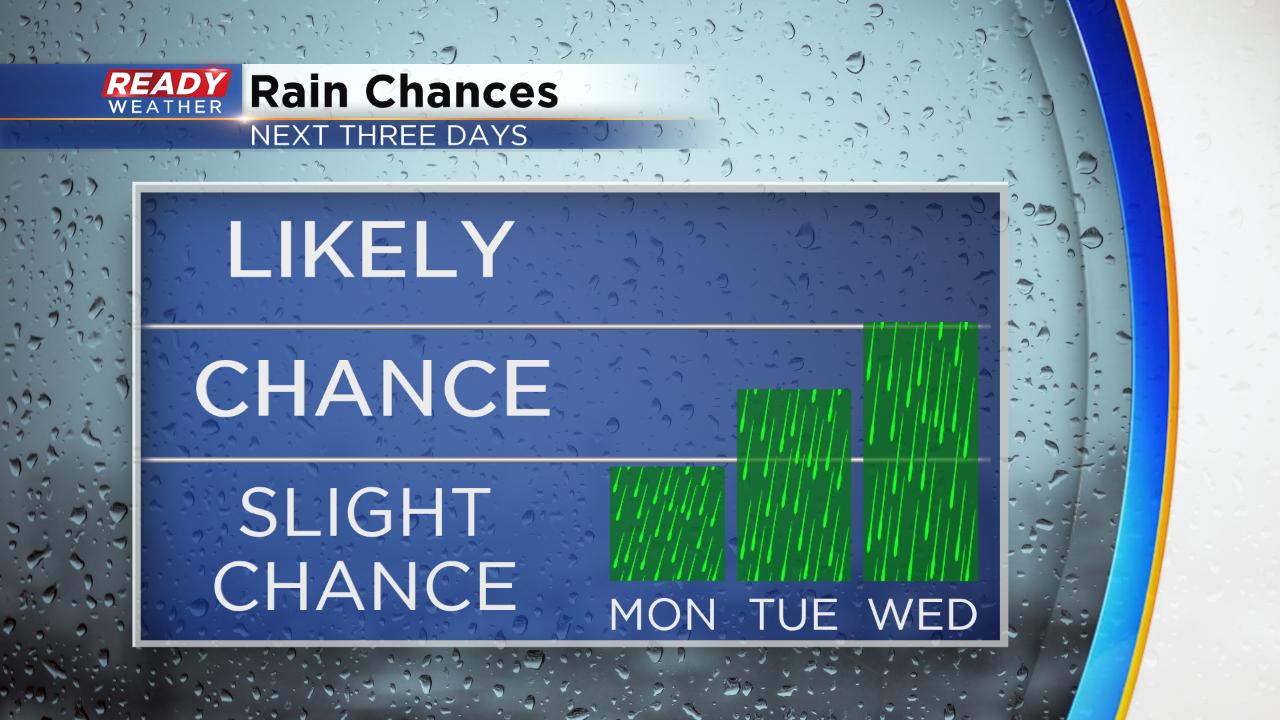
A few hit or miss showers or storms may be possible Monday and Tuesday. Wednesday and Thursday are our best chances for some soaking rain which could linger into Friday morning.
After one last cooler day on Monday with highs around 70° we warm up nearly 20° with some making a run at 90° for the middle of the week. The 80s last until the weekend when more average 70s return.
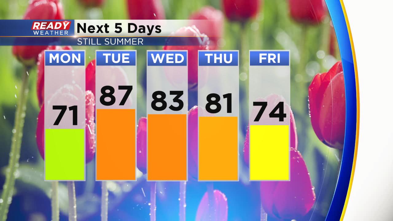
With the heat expect some humidity with dew points in the 60s to near 70° Tuesday and Wednesday so it feels pretty humid. With some of the heat and warmth along with storm chances there is a risk for stronger storms but it doesn't seem that great.

Summer looks to follow the calendar this year. We are two weeks away from the official start to Autumn and temperatures look to stay on the warmer side until then. The latest temperature trend for the middle of September gives Wisconsin a 60% chance for above-average temperatures. It's one of the rare times that all of the lower 48 states are expected to see warmer than normal temperatures.

Download the CBS 58 Ready Weather App to if any cooler air arrives in the 10-day.