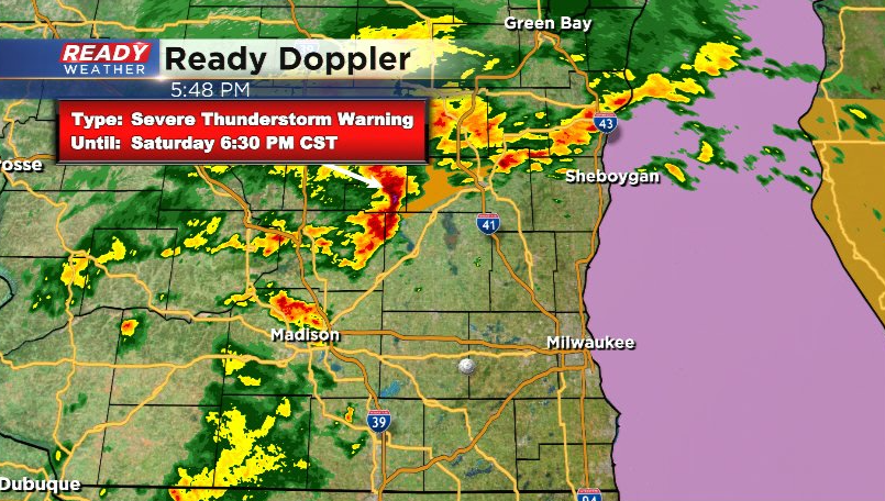
10:50 pm Update: Severe Thunderstorm Warning until 11:30 for all lakeshore counties


Updated: Saturday, March 5th 10:50 pm:
A line of severe storms with wind gusts of 60 mph is tracking through southeast Wisconsin. Severe Thunderstorm Warning runs for all lakeshore counties through 11:30 pm.
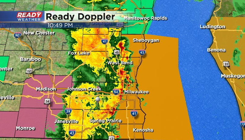
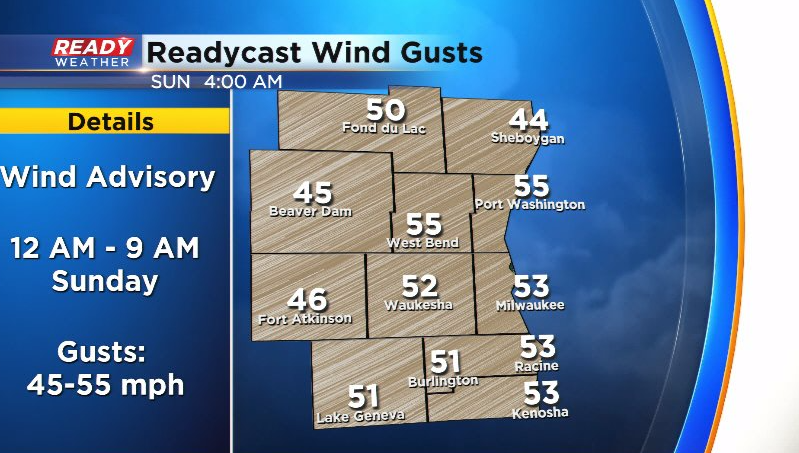
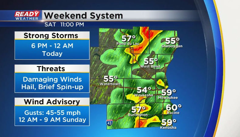
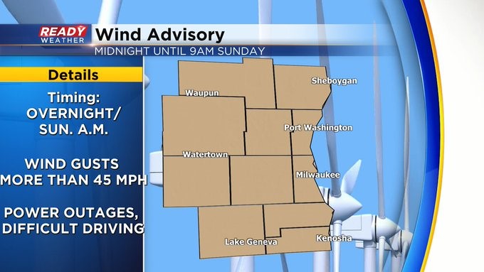
This line is racing to the east at 45 mph. The worst of the storms will push out over the lake before midnight. However, very strong, non-thunderstorm wind gusts will move in overnight behind this line. Wind gusts of 45-55 mph are expected from midnight - 9am. A Wind Advisory is in place for all of SE WI during this time.
-------------------------------------------
Updated: Saturday, March 5th 8:50 pm:
A Severe Thunderstorm Watch has been issued for parts of southern Wisconsin, including Jefferson and Walworth counties.
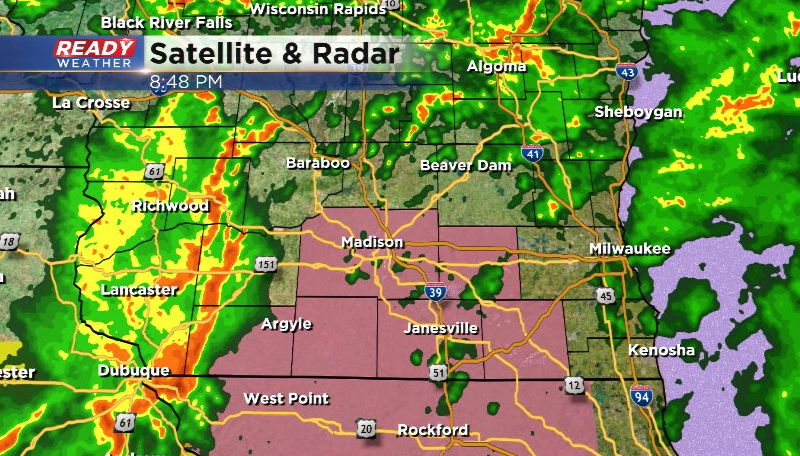
These areas have the best shot at damaging winds up to 70 mph along with embedded spin-ups within the lines of storms. The watch technically runs through 2am, but this line of storms will track across southeast Wisconsin between 9:30pm and 11:30pm and be over the lake by midnight.
----------------------------------------------------------------------------------
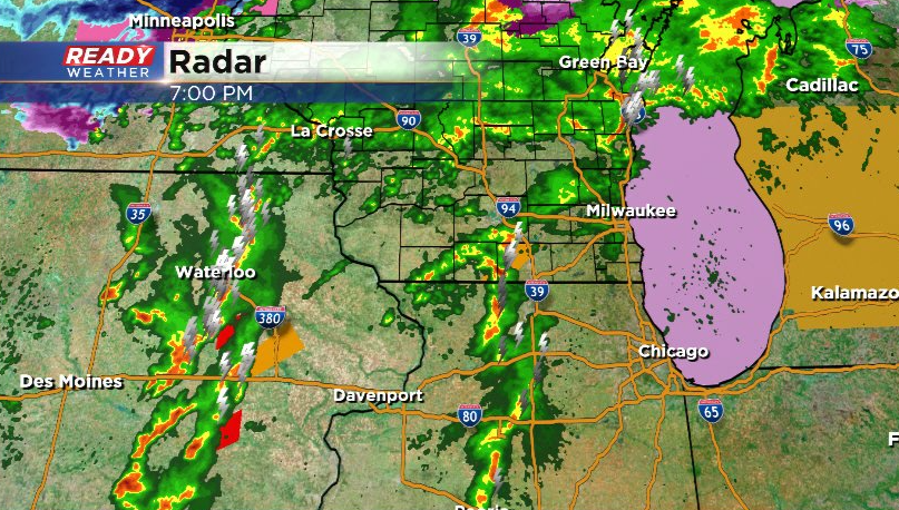
Updated: Saturday, March 5th 7:00 pm:
Scattered storms lifting northeast out of Illinois will mainly pose a large hail risk over the next two hours.
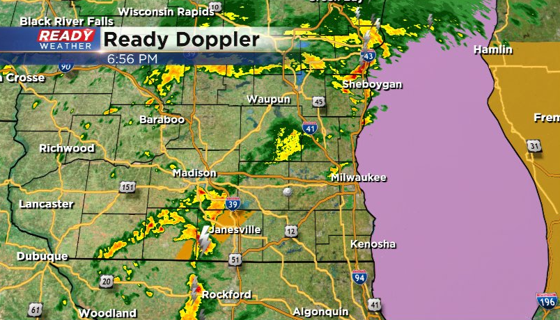
Our attention continues to be on the cluster of severe and tornadic storms in eastern Iowa. These storms are expected to pose a damaging wind threat as they track across southern Wisconsin between 9pm and midnight. An embedded spin-up can't be ruled out either.
Due to the increasing likelihood of severe winds with that round of storms, the Slight Risk (level 2 of 5) has been expanded across the rest of southeast Wisconsin (besides far north), while the level 3 of 5, Enhanced Risk, now reaching as far east as Rock county.
Download the CBS 58 Ready Weather app to get any watches and warnings sent to your phone.
----------------------------------------------------
Updated: Saturday, March 5th 5:45 pm:
A Severe Thunderstorm Warning has been issued for Fond du Lac county and far NW Dodge county through 6:30 pm. This storm has a history of producing quarter sized hail and the potential for wind gusts up to 60 mph.
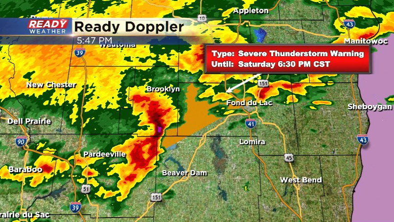
This storm is racing NE at 55 mph. Additional storms are popping up north of Madison, which would also track into Dodge county. We'll watch to see if storm strengthens. If it does, it could also produce quarter sized hail and strong winds.
------------------------------------------------------
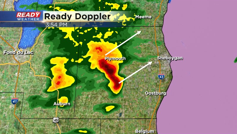
Updated: Saturday March 5th 4:00 pm:
While most of southeast Wisconsin is currently quiet, a strong thunderstorm is racing NE at 50 mph through Sheboygan county. This cell could produce some small hail but should move over the lake by 4:15 pm.
The main show looks to come through in two different lines this evening. The first line is getting its act together in eastern Iowa and looks to track through between 6-9pm.The second broken line of storms is currently southwest of Des Moines and will track through ahead of the cold front between 10pm-12am.
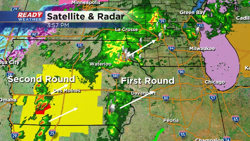
Both rounds of storms have the potential to produce damaging winds and hail, but the second round that moves through late this evening will have a small potential for brief, embedded spin-ups. The storm threat ends around midnight, with strong winds gusting 45-55 mph rolling in with the cold front overnight into early Sunday morning.
---------------------------------------------------------------------
Updated: Saturday, March 5th 1:10 pm:
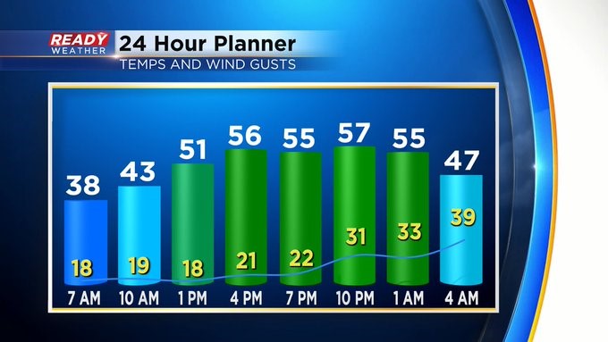
The warm front is slowly lifting into southeast Wisconsin early this afternoon with temps jumping between 5-10 degrees over the last hour alone.
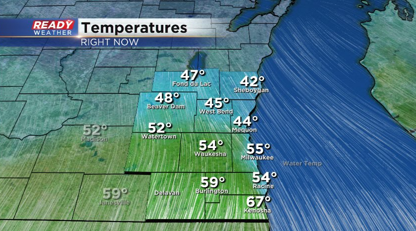
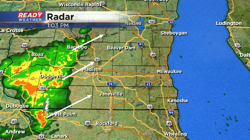
Temps will continue to rise into the 60s for most as we head through the rest of the day, but rain and storms could start impacting the area as early as mid afternoon. Another batch of rain and isolated storms is currently in southwest WI, tracking NE at 60 mph. This could move through at least the northern half of the viewing area between 2:30-3:30 pm.
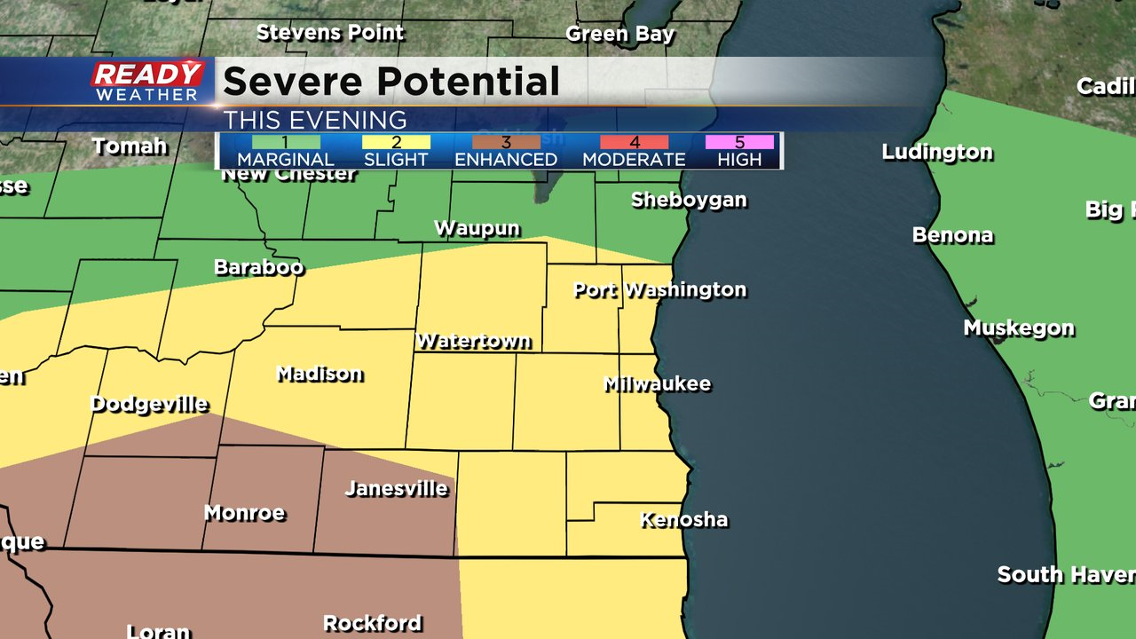
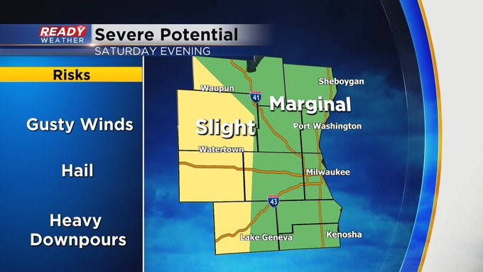
More widespread rain and storms are expected this evening, with a couple of rounds of storms between 7pm-Midnight. These storms could be strong to severe with damaging winds and hail being the primarily threat. While the tornado threat is low, it isn't zero. There could be a brief spin-up embedded in the storms this evening.
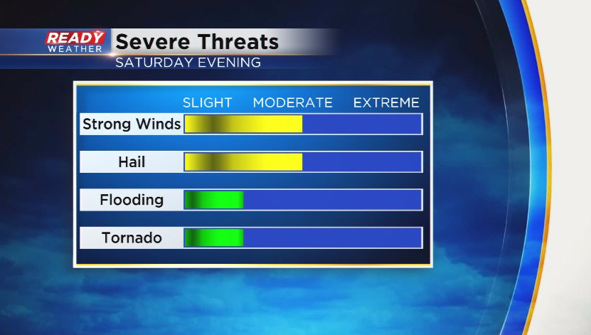
The best chance of that occurring will be west of Milwaukee where a level 2, Slight Risk, for severe storms is in place. Level 1, Marginal Risk, remains in place everywhere else.
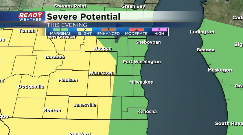
MILWAUKEE (CBS 58)--We'll have about three seasons in three days across the area. Starting with some sun today along with mild temps. Highs around 60. Then a strong cold front works in from the west, generating strong to severe weather this evening followed by windy conditions. The extreme western part of the viewing area is under a "Slight" risk for severe weather while a "Moderate" risk covers everyone else. Gusts from the southwest could be more than 45 mph overnight until mid morning hours of Sunday. This is when we have a Wind Advisory in place.
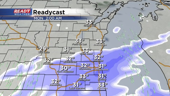
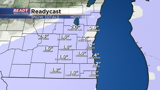
We take a break on Sunday and then we wait for more moisture. This time it'll be snow, mainly Monday morning. A few slushy inches of accumulation are not out of the question. The morning commute could be a bit slick too. Please take your time. And then another snowy system could impact us at the end of the week, mainly Friday morning. Stay tuned.